Windsor, Maine facts for kids
Quick facts for kids
Windsor, Maine
|
|
|---|---|

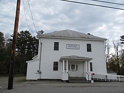
Town Hall
|
|

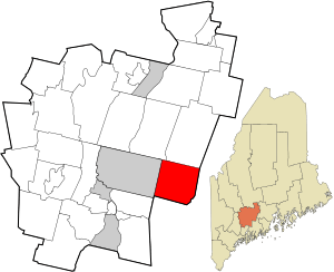
Location in Kennebec County and the state of Maine.
|
|
| Country | United States |
| State | Maine |
| County | Kennebec |
| Villages | Windsor Halls Corner North Windsor South Windsor West Windsor Windsor Station Windsorville |
| Area | |
| • Total | 35.52 sq mi (92.00 km2) |
| • Land | 34.65 sq mi (89.74 km2) |
| • Water | 0.87 sq mi (2.25 km2) |
| Elevation | 262 ft (80 m) |
| Population
(2020)
|
|
| • Total | 2,632 |
| • Density | 76/sq mi (29.3/km2) |
| Time zone | UTC-5 (Eastern (EST)) |
| • Summer (DST) | UTC-4 (EDT) |
| ZIP code |
04363
|
| Area code(s) | 207 |
| FIPS code | 23-86165 |
| GNIS feature ID | 0582818 |
Windsor is a small town located in Kennebec County, Maine, in the United States. In 2020, about 2,632 people lived there. Windsor is part of the larger Augusta area.
Contents
A Look Back: Windsor's History
The area that is now Windsor first became an official town on March 3, 1809. It was originally named "Malta." Soon after, a small conflict called the "Malta War" happened. This was a disagreement with the Massachusetts state government about who owned certain lands.
In 1820, the town was renamed "Gerry." This was done to honor Elbridge Gerry, who was a well-known statesman and a Vice President. Just two years later, in 1822, the town was renamed again to "Windsor," which is its name today.
Where is Windsor?
According to the United States Census Bureau, Windsor covers a total area of about 35.52 square miles (92.00 square kilometers). Most of this area, about 34.65 square miles (89.74 square kilometers), is land. The remaining 0.87 square miles (2.25 square kilometers) is water.
Who Lives in Windsor?
| Historical population | |||
|---|---|---|---|
| Census | Pop. | %± | |
| 1810 | 468 | — | |
| 1820 | 1,054 | 125.2% | |
| 1830 | 1,485 | 40.9% | |
| 1840 | 1,789 | 20.5% | |
| 1850 | 1,793 | 0.2% | |
| 1860 | 1,548 | −13.7% | |
| 1870 | 1,266 | −18.2% | |
| 1880 | 1,079 | −14.8% | |
| 1890 | 853 | −20.9% | |
| 1900 | 782 | −8.3% | |
| 1910 | 706 | −9.7% | |
| 1920 | 599 | −15.2% | |
| 1930 | 565 | −5.7% | |
| 1940 | 695 | 23.0% | |
| 1950 | 740 | 6.5% | |
| 1960 | 878 | 18.6% | |
| 1970 | 1,097 | 24.9% | |
| 1980 | 1,702 | 55.2% | |
| 1990 | 1,895 | 11.3% | |
| 2000 | 2,204 | 16.3% | |
| 2010 | 2,575 | 16.8% | |
| 2020 | 2,632 | 2.2% | |
| U.S. Decennial Census | |||
Population in 2010
In 2010, the town of Windsor had 2,575 people living there. These people lived in 1,039 households, and 721 of these were families. The town had about 74 people per square mile. There were 1,152 homes or housing units in total.
Most of the people in Windsor were White (97.0%). A smaller number were African American (0.4%), Native American (0.7%), or Asian (0.3%). Some people were from other races (0.2%) or had a mix of two or more races (1.4%). About 0.8% of the population identified as Hispanic or Latino.
About 32.2% of households had children under 18 living with them. More than half (52.9%) were married couples. About 10.3% of households had a female head without a husband, and 6.2% had a male head without a wife. Roughly 30.6% of households were not families.
The average age of people in Windsor was 42.1 years old. About 22.3% of residents were under 18. People aged 45 to 64 made up the largest group at 31.5%. The population was almost evenly split between males (49.5%) and females (50.5%).
Fun Places to Visit in Windsor
- Hussey's General Store
- Maine Fiber Frolic
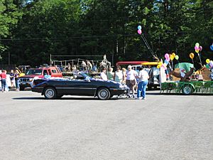
- Windsor Fair Grounds
See also
 In Spanish: Windsor (Maine) para niños
 | May Edward Chinn |
 | Rebecca Cole |
 | Alexa Canady |
 | Dorothy Lavinia Brown |


