
List of Austin neighborhoods facts for kids
Austin, Texas, is a big city with many different areas, called neighborhoods. Think of them like smaller towns or communities within the city. Austin is split in half by the Colorado River, which flows through the middle of the city. This river helps divide Austin into northern and southern parts.
Knowing about these neighborhoods helps you understand the different parts of Austin and what makes each one special!


.png)
Contents
Central Austin
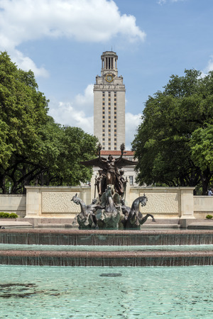
Central Austin is the heart of the city, including the busy Downtown area. It's located north of the Colorado River. You can find it between Interstate 35 on the east, around 51st Street to the north, and Mopac Expressway (also known as Loop 1) to the west. This area is home to many important buildings and the University of Texas at Austin.


Some of the neighborhoods in Central Austin include:
- Bryker Woods
- Clarksville Historic District
- Caswell Heights
- Downtown Austin
- Eastwoods
- Hancock
- Heritage
- Hyde Park Historic District
- Judge's Hill
- Lower Waller Creek
- North University
- Oakmont Heights
- Old Enfield
- Old Pecan Street
- Old West Austin
- Original Austin
- Original West University
- Pemberton Heights
- Rosedale
- Ridgelea
- Ridgetop
- Shoal Crest
- Shadow Lawn Historic District
- West Downtown
North Austin
North Austin includes all the neighborhoods located north of Central Austin. This area starts north of 51st Street, North Loop, and Hancock Drive. It's a large area with many different communities.
North Central
This part of North Austin is located north of 51st Street and Hancock Drive. It's a busy area with many homes and businesses.

Some neighborhoods here are:
- Allandale
- Balcones Woods
- Barrington Oaks
- Battle Bend Springs
- Brentwood
- Crestview
- Estates of Brentwood
- Hancock
- Highland
- North Burnet
- North Campus
- North Lamar
- North Loop
- North Shoal Creek
- Saint John
- Wooten
Northeast
Northeast Austin is found north of 51st Street and east of Interstate 35.
- Windsor Hills
- Windsor Park
Northwest
Northwest Austin is located north of Hancock Drive and west of the Mopac Expressway.
- Canyon Creek
- Great Hills/Arboretum
- Northwest Hills
Far North
The Far North area of Austin is located north of Parmer Lane.
- Copperfield
- Wells Branch
- Scofield Farms
East Austin
East Austin is the area located east of Interstate 35 and north of the Colorado River. This part of the city has a rich history and is known for its vibrant culture.

Some neighborhoods in East Austin include:
- Central East Austin
- East Cesar Chavez
- East Congress
- East End
- French Place
- Govalle
- Holly
- Mueller
West Austin
West Austin is a smaller area because of how the Colorado River bends. It's bordered by the Mopac Expressway to the east, the Colorado River to the south and west, and Northland Drive (RM 2222) to the north.

Neighborhoods in West Austin include:
- Far West
- Tarrytown
- West Congress
- West End
- West Line Historic District
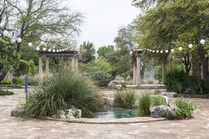
South Austin
South Austin generally includes all the areas located south of the Colorado River. This part of the city is known for its unique character and many popular spots.
.JPG)


South Central
South Central Austin is located between the Mopac Expressway to the west, the Colorado River to the north, Interstate 35 to the east, and Ben White Boulevard to the south.
- Barton Creek
- Barton Hills
- Bouldin Creek
- Dawson
- Galindo
- South Congress
- South Lamar
- South River City
- Spyglass-Barton's Bluffs
- Travis Heights
- Zilker
Southeast Central/Riverside
The area of Southeastern Austin between the Colorado River and Ben White Boulevard is often called the Riverside area.
- East Riverside-Oltorf
- Montopolis
- Pleasant Valley
Southeast
These neighborhoods are located east of Menchaca Road and south of Ben White Boulevard.
- Dove Springs
- Onion Creek
- South Manchaca
- Southeast Austin
- Southpark Meadows
Southwest
Southwest Austin includes neighborhoods west of Menchaca Road and south of Ben White Boulevard and Capital of Texas Highway.
- Cherry Creek
- Circle C Ranch
- Oak Hill
- Far South Austin/Slaughter-Manchaca
- Kincheonville
- The Ridge at Lantana
- Maple Run
- Sendera
- Shady Hollow
- Sunset Valley (an incorporated city)
- Tanglewood Forest
- Travis Country
- Westgate
- Woodstone Village
