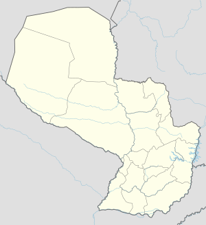
Yataity del Norte facts for kids
Quick facts for kids
Yataity del Norte
|
|
|---|---|
| Country | |
| Department | San Pedro |
| Area | |
| • Total | 263 km2 (102 sq mi) |
| Elevation | 227 m (745 ft) |
| Population
(2008)
|
|
| • Total | 14,373 |
| • Density | 23.68/km2 (61.3/sq mi) |
| Time zone | -4 |
| Postal code |
8190
|
Yataity del Norte is a town and district in the San Pedro area of Paraguay. You can reach this district using Route 8 "Dr. Blás Garay". The people here are very hard-working. They focus on trade and farming.
The town was started on December 22, 1965. It is about 263 kilometers from Asunción, the capital city.
Yataity del Norte is a good starting point to visit the nearby areas of Unión and December 25. Along the main road, you can find places selling fresh fruit. There are also cozy bars and restaurants. They offer tasty homemade meals, making them great spots to stop and rest.
The town is close to the Arroyo Peñatei stream. About 14,373 people live here. Most of them work in forestry, farming, and raising animals.
Contents
Exploring Yataity del Norte's Location
Yataity del Norte is located in a key spot in Paraguay. It shares borders with several other districts and departments.
Where is Yataity del Norte?
- To the north, it borders the District of San Estanislao.
- To the south, it is next to the Fifth Department of Caaguazú.
- To the east, it is separated from the Fifth Department of Caaguazú by the Tapiracuá i stream.
- To the west, it borders the District Union.
Rivers and Streams
The Yataity del Norte District has water from these streams:
- Arroyo Pañatei
- Arroyo Tapiracuái
Roads and Travel
You can get to Yataity del Norte using Route 8 "Dr. Blás Garay". Most other roads in the district are not paved.
Today, the district has public buses. These buses offer daily trips to other districts. They also go to big cities like Ciudad del Este, Pedro Juan Caballero, and even to Brazil, Argentina, and Chile. Most people here can use phones, and some have satellite communication systems.
Local Climate
The San Pedro department, where Yataity del Norte is, usually has a rainy and humid climate. The air is often moist, with humidity between 70% and 80%. The average temperature is 23 °C (73 °F). In summer, it can reach 35 °C (95 °F), and in winter, it can drop to 10 °C (50 °F).
Economy and Work in Yataity del Norte
The economy of Yataity del Norte, like much of the San Pedro department, mainly relies on farming. Raising cattle for beef is very important here. Farming has also grown a lot because the soil is very fertile.
Main Economic Activities
The town is a big center for raising different animals. This includes cattle, horses, pigs, and sheep.
In farming, people grow many crops. These include vegetables, oranges (both sweet and sour), bananas, sunflowers, and mandioca (cassava).
The San Pedro Department is working to improve living conditions for its people. There have been good changes in recent years.
Languages Spoken in Yataity del Norte
Most people in Yataity del Norte, like in the rest of the San Pedro department, speak Guaraní language. About 70% of the people speak both Spanish and Guaraní, often mixed together in a style called yopara. The remaining 30% mostly speak Spanish.
Education in Yataity del Norte
Yataity del Norte has primary schools and high schools. Children and young people attend these schools regularly. Some people cannot read or write, often because of difficult living conditions. This can make it hard for families to send their children to school. This problem affects both girls and boys.
People in the working population are learning new skills. This helps the area grow and develop.
Population of Yataity del Norte
According to a 2002 count, Yataity del Norte District had 12,477 people. About 1,328 lived in the town area. The other 11,153 people lived in the countryside. This means about 89% of the people lived in rural areas.
There were 2,492 homes in the district. Most of these, about 2,191, were in rural areas.
Population Changes Over Time
Here's how the population was expected to change:
- By 2008, the total population was 14,373 people. This included 7,633 men and 6,740 women.
- By 2009, the total population was 14,460 people. This included 6,682 men and 6,778 women.
Key Facts About the Population
Here are some interesting facts about the people in Yataity del Norte:
- About 40% of the population is younger than 15 years old.
- On average, women have about 3.2 children.
- About 7.4% of the people cannot read or write.
- About 76% of people work in farming or other primary jobs.
- About 5.5% work in manufacturing or other secondary jobs.
- About 18.3% work in services or other tertiary jobs.
- About 75.9% of people work in agriculture.
- About 77.9% of homes have electricity.
- About 13.5% of homes have running water.
See also
 In Spanish: Yataity del Norte para niños


