Đồng Hới facts for kids
Quick facts for kids
Đồng Hới
Thành phố Đồng Hới
|
|
|---|---|
| Đồng Hới City | |
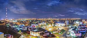
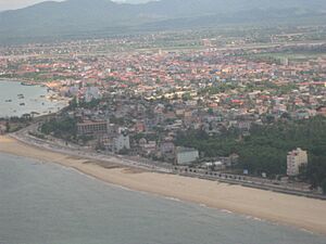
Aerial view of the city.
|
|
| Nickname(s):
City of Roses
|
|
| Country | |
| Province | Quảng Bình |
| Government | |
| • Type | City municipality |
| Area | |
| • City (Class-2) | 155.71 km2 (60.12 sq mi) |
| Population
(2019 census)
|
|
| • City (Class-2) | 133,672 |
| • Density | 858.468/km2 (2,223.42/sq mi) |
| • Urban | 91,601 (69%) |
| Time zone | UTC+7 (Vietnam) |
| Airport | Đồng Hới Airport (domestic) |
| Climate | Am |
| Website | [1] |
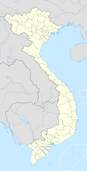
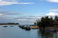
Đồng Hới is an important city in Vietnam. It is the capital of Quảng Bình Province, located on the north central coast. The city covers about 155.71 square kilometers. In 2019, its population was 133,672 people.
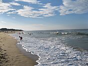
Đồng Hới is easy to reach by National Highway 1A. It also has a train station, the Đồng Hới Railway Station, and an airport. By road, Đồng Hới is about 486 kilometers south of Hanoi. It is also 160 kilometers north of Huế. The city has a beautiful 12-kilometer-long coastline with white sand beaches. It is also very close to Phong Nha-Kẻ Bàng National Park. This park is a UNESCO World Heritage Site.
Contents
History of Đồng Hới
Scientists have found signs that people lived in the Quảng Bình area a very long time ago. This was during the Stone Age. Many old items like ceramic pots and stone tools have been found.
In 1926, a French archaeologist named Madeleine Colani found many ancient tools. She found them in caves and grottoes in the western mountains of Quảng Bình. She believed that the Hòa Bình culture lived here. Tests showed these items were about 10,509 years old. Other caves also had similar tools and pottery. This shows that ancient people lived in these caves and hunted for food.
People have lived in the area of modern Đồng Hới for about 5,000 years. Many old items from the Stone Age were found near Bau Tro Lake. Around 2880 BC, this area was part of the Viet Thuong tribe. It was often a disputed land between the Champa kingdom and Đại Việt. In 1069, it officially became part of Đại Việt. This happened after Lý Thường Kiệt won a war against Champa.
Later, the land changed hands through a special marriage. A princess from the Trần dynasty, Huyền Trân, married the Champa king. As a wedding gift, Đại Việt received lands that are now Quảng Trị Province and Thừa Thiên–Huế Province.
During the Trịnh–Nguyễn War (1558–1775), Vietnam was split into two parts. The Gianh River was the border. Đồng Hới was a very important fort for the southern Nguyễn lords. The Đồng Hới Wall protected them from attacks by the northern Trịnh family.
During the First Indochina War in the 1950s, the French used the Đồng Hới airbase. They used it to attack forces in north-central Vietnam and Laos. Later, during the Vietnam War, Đồng Hới was heavily bombed. This was because it was close to the border between North Vietnam and South Vietnam.
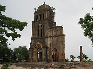
On February 11, 1965, much of the city was destroyed by bombs. The Tam Tòa Church, a Catholic building, was badly damaged. Today, its bell tower still stands as a monument.
On April 19, 1972, during a big attack by North Vietnam, US Navy ships were near the coast. They were attacked by three North Vietnamese MiG aircraft. The US ships were ready and defended themselves.
Đồng Hới is the narrowest part of Vietnam. It is only about 40 kilometers wide from east to west. After the war ended in 1975, Quảng Bình province was combined with two other provinces. But in 1990, it was separated again. Đồng Hới then became the capital of Quảng Bình province once more.
Geography
Location
Đồng Hới is located on National Route 1. It is also on the North–South Railway and the Ho Chi Minh Highway. The city is in the middle of Quảng Bình Province. It shares borders with Bố Trạch District to the north. To the south and west, it borders Quảng Ninh District. The South China Sea is to its east.
The city is 50 kilometers south of Phong Nha-Kẻ Bàng National Park. It is also 50 kilometers north of Bang Spa, a hot spring. Đồng Hới has a 12-kilometer coastline. The Nhật Lệ River flows through the city. Tro Lake provides fresh water. Nhật Lệ Beach is famous for its fine white sand.
Transportation
You can travel to Đồng Hới from Huế by local bus. Taxis are also available from the city center bus station. The bus trip takes about 3.5 hours.
Climate
Đồng Hới has four different seasons, like other parts of northern Vietnam. It has a tropical monsoon climate. This means it is generally warm and humid. The average yearly temperature is about 24.7 degrees Celsius. The city gets a lot of rain, especially in October.
In spring, Đồng Hới is warm, humid, and often foggy. Summers can be hot and dry. This is because of a dry wind from the Gulf of Thailand. This wind causes rain in Laos but dry weather in central Vietnam. In autumn, it is rainy and warm. Winters can be cooler, sometimes below 18 degrees Celsius. The coldest temperature recorded was 6.7 degrees Celsius in January 2016. The hottest was 43.2 degrees Celsius in April 2024.
| Climate data for Đồng Hới | |||||||||||||
|---|---|---|---|---|---|---|---|---|---|---|---|---|---|
| Month | Jan | Feb | Mar | Apr | May | Jun | Jul | Aug | Sep | Oct | Nov | Dec | Year |
| Record high °C (°F) | 34.7 (94.5) |
37.2 (99.0) |
39.8 (103.6) |
43.2 (109.8) |
42.2 (108.0) |
41.8 (107.2) |
40.9 (105.6) |
41.5 (106.7) |
40.9 (105.6) |
37.4 (99.3) |
35.0 (95.0) |
29.8 (85.6) |
43.2 (109.8) |
| Mean daily maximum °C (°F) | 21.7 (71.1) |
22.3 (72.1) |
24.9 (76.8) |
28.8 (83.8) |
32.4 (90.3) |
34.0 (93.2) |
33.9 (93.0) |
33.1 (91.6) |
30.9 (87.6) |
28.2 (82.8) |
25.5 (77.9) |
22.6 (72.7) |
28.2 (82.8) |
| Daily mean °C (°F) | 18.8 (65.8) |
19.5 (67.1) |
21.7 (71.1) |
24.9 (76.8) |
28.1 (82.6) |
29.8 (85.6) |
29.8 (85.6) |
29.0 (84.2) |
27.1 (80.8) |
25.1 (77.2) |
22.6 (72.7) |
19.8 (67.6) |
24.7 (76.5) |
| Mean daily minimum °C (°F) | 16.7 (62.1) |
17.6 (63.7) |
19.7 (67.5) |
22.4 (72.3) |
25.0 (77.0) |
26.8 (80.2) |
26.7 (80.1) |
26.0 (78.8) |
24.3 (75.7) |
22.5 (72.5) |
20.3 (68.5) |
17.6 (63.7) |
21.1 (70.0) |
| Record low °C (°F) | 6.7 (44.1) |
8.0 (46.4) |
8.0 (46.4) |
11.7 (53.1) |
15.1 (59.2) |
19.2 (66.6) |
20.5 (68.9) |
19.9 (67.8) |
17.8 (64.0) |
14.6 (58.3) |
12.0 (53.6) |
7.8 (46.0) |
6.7 (44.1) |
| Average rainfall mm (inches) | 59.4 (2.34) |
39.9 (1.57) |
43.2 (1.70) |
60.8 (2.39) |
115.6 (4.55) |
78.9 (3.11) |
75.5 (2.97) |
166.1 (6.54) |
472.5 (18.60) |
649.1 (25.56) |
318.7 (12.55) |
125.1 (4.93) |
2,189.7 (86.21) |
| Average rainy days | 11.8 | 11.2 | 11.3 | 9.2 | 10.1 | 7.3 | 7.2 | 11.0 | 15.8 | 19.3 | 17.4 | 14.2 | 145.2 |
| Average relative humidity (%) | 87.5 | 89.4 | 89.0 | 86.7 | 79.5 | 72.2 | 70.6 | 75.3 | 83.5 | 86.0 | 85.3 | 85.4 | 82.5 |
| Mean monthly sunshine hours | 89.9 | 74.5 | 106.3 | 159.1 | 232.8 | 224.3 | 234.6 | 198.1 | 168.1 | 129.2 | 95.6 | 73.3 | 1,783.9 |
| Source 1: Vietnam Institute for Building Science and Technology | |||||||||||||
| Source 2: The Yearbook of Indochina | |||||||||||||
Land and Landscape
Đồng Hới has many different types of land. These include hills, mountains, flat plains, and sandy coastal areas.
The western part of the city has hills. This area covers about 41.7% of the city. People here mostly work in farming and forestry. The soil is not very rich and can easily wash away.
Around the central plain, there are areas with gentle hills. This region makes up about 40.2% of the city. Many people here work in factories, crafts, and trading. While the soil isn't super fertile, there are many rivers and lakes. This makes it better for farming than the hillier areas.
The city's main business and government buildings are in the flat plain area. This part is small, only 0.2% of the city. The eastern side of the city has sandy coastal dunes. These dunes cover about 14.3% of the total area.
City Divisions
Đồng Hới is divided into 16 smaller areas. These include 10 urban wards (phường) and 6 rural communes (xã).
| No. | Name | Population 2009 | Area (km2) | |||
|---|---|---|---|---|---|---|
| Inner wards (Ward): | ||||||
| 1. | Bắc Lý | 18,158 | 10.19 | |||
| 2. | Bắc Nghĩa | 6,981 | 7.76 | |||
| 3. | Đồng Mỹ | 2,757 | 0.58 | |||
| 4. | Đồng Phú | 8,646 | 3.81 | |||
| 5. | Đồng Sơn | 9,127 | 19.65 | |||
| 6. | Đức Ninh Đông | 5,031 | 3.13 | |||
| 7. | Hải Đình | 3,878 | 8.822 | |||
| 8. | Hải Thành | 4,774 | 2.45 | |||
| 9. | Nam Lý | 16,412 | 3.9 | |||
| 10. | Phú Hải | 3,581 | 3.06 | |||
| Total inner wards | 10 Ward | 71,620 | 55.47 | |||
| Suburban communes (Commune): | ||||||
| 11. | Bảo Ninh | 8,906 | 16.3 | |||
| 12. | Đức Ninh | 7,526 | 5.21 | |||
| 13. | Lộc Ninh | 8,647 | 13.4 | |||
| 14. | Nghĩa Ninh | 4,642 | 16.22 | |||
| 15. | Quang Phú | 3,178 | 3.23 | |||
| 16. | Thuận Đức | 3,788 | 45.28 | |||
| Total suburban communes | 6 Commune | 36,906 | 100.24 | |||
| 10 phường, 6 Commune | 108,526 | 155.71 | ||||
Fun Things to Do in Đồng Hới
Đồng Hới has beautiful beaches like Nhật Lệ, with soft sand and clear water. Other popular beaches are Da Nhay and Ly Hoa, located about 60 kilometers north. If you like relaxing, you can visit the Bang Spa hot mineral spring.
The city is also close to the amazing Phong Nha-Kẻ Bàng National Park. This park is a World Heritage site. It's perfect for exploring huge caves and grottoes. Some famous ones are Phong Nha Cave, Thiên Đường Cave, and Sơn Đoòng Cave.
You can also take tours to old battlefields. These tours let you see areas along the Annamite Range and the Hồ Chí Minh trail.
It's easy to get to Đồng Hới. You can come by road using National Route 1 (Vietnam) or the Hồ Chí Minh Highway. You can also take a train to Đồng Hới Railway Station. Or, you can fly into Đồng Hới Airport.
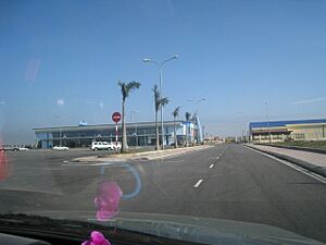
Đồng Hới Airport opened in 2008. The first flights were from Hanoi. Later, flights from Ho Chi Minh City also started.
The city has many hotels and guesthouses for visitors. You can find places from 1-star to 4-star resorts. There are also many delicious seafood restaurants. In 2005, almost 300,000 people visited Đồng Hới.
There is also a new project called FLC Dong Hoi Golf Links. It includes many golf courses, villas, and a large resort. This project is being built near the sea.
Economy
The Hòn La bay is a large bay, about 4 square kilometers. It is deep enough to become a major sea port. A new port is being built north of Đồng Hới. When finished, it will be able to handle very large ships. This port will help businesses in Quảng Bình grow.
Two industrial parks are also being built. These are the North-West Đồng Hới Industrial Park and Hòn La Industrial Park. They are designed to attract new businesses and investors. From 2010 to 2013, the city's economy grew by about 12.32% each year. In 2013, services made up the largest part of the economy (50.9%). Industry and construction were 35.5%, and farming and fishing were 13.6%. In 2015, the average income per person was about $3871.3.
Education
Đồng Hới is home to Quảng Bình University. This university offers many different subjects. There are also several high schools in the city. Some notable ones include Võ Nguyên Giáp Gifted High School, Phan Đình Phùng High School, Đồng Hới High School, and Đào Duy Từ High School.
See also
 In Spanish: Đồng Hới para niños
 | Shirley Ann Jackson |
 | Garett Morgan |
 | J. Ernest Wilkins Jr. |
 | Elijah McCoy |


