Quảng Bình Province facts for kids
Quick facts for kids
Quảng Bình Province
Tỉnh Quảng Bình
|
|
|---|---|
| Nickname(s):
Serenity
|
|
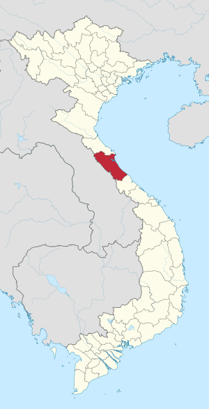
Location of Quảng Bình within Vietnam
|
|
| Country | |
| Region | North Central Coast |
| Capital | Đồng Hới |
| Area | |
| • Total | 8,065.8 km2 (3,114.2 sq mi) |
| Population
(2018)
|
|
| • Total | 936,607 |
| • Density | 116.1208/km2 (300.7514/sq mi) |
| Demographics | |
| • Ethnicities | Vietnamese, Bru–Vân Kiều, Chứt, Tày |
| Time zone | UTC+07:00 (ICT) |
| Area codes | 232 |
| ISO 3166 code | VN-24 |
Quảng Bình is a province located along Vietnam's north-central coast. It was once called Tiên Bình, but its name changed to Quảng Bình in 1604. The province covers an area of 8,065.8 square kilometers. In 2018, about 936,607 people lived there.
Quảng Bình borders Laos to the west and the Pacific Ocean to the east. Hà Tĩnh Province is to its north, and Quảng Trị Province is to its south. This area has a long history. It was once part of the ancient kingdom of Champa. Later, it became part of Đại Việt, which was an old name for Vietnam.
Quảng Bình was a key battleground between Champa and Đại Việt for many years. It became very important during the 17th century. At that time, Vietnam was split into two parts. Quảng Bình was a front line, protecting the southern part from attacks. During the Vietnam War, the province was heavily bombed. Today, it is famous for the Phong Nha-Kẻ Bàng National Park. This park is a World Heritage Site. Many famous Vietnamese people, like General Võ Nguyên Giáp, were born here.
Contents
Geography of Quảng Bình
Location and Landscape
Quảng Bình province is located between 16°55’ and 18°05’ North and 105°37’ and 107°00’ East. It shares a border with Hà Tĩnh Province in the north. The Annamite Range forms a natural border with Laos to the west. The province faces the South China Sea to the east.
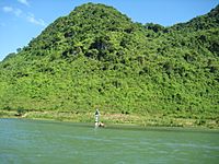
The land in Quảng Bình slopes from west to east. The western part has many hills and mountains. About 85% of the province is hilly or mountainous. The highest peak is Phi Co Pi, at 2,017 meters. Closer to the coast, there are lower hills and flat plains. The coastline is 116.04 kilometers long.
Rivers and the Sea
Quảng Bình has several important rivers. These include the Gianh River, Ron River, and Nhật Lệ River. Most rivers start in the Truong Son Range and flow into the South China Sea.
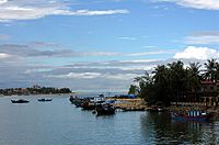
The province also has many natural and man-made lakes. These lakes hold a lot of fresh water. The sea area off Quảng Bình is large, covering about 20,000 square kilometers. There are several small islands, like Hòn La islet. Hòn La bay is a good place for a deep-water port.
Mountains and Caves
The Hoành Sơn Range runs through the northeastern part of the province. Many high mountain peaks are found in the Phong Nha-Kẻ Bàng National Park area. Some peaks are over 1,000 meters tall.
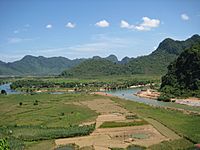
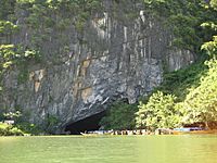
The park is famous for its karstic mountains. These are mountains made of limestone. They have many caves and grottoes inside them.
Climate and Seasons
Quảng Bình experiences four different seasons. Spring, from February to April, is warm and a bit rainy. Temperatures are usually between 18 and 25 degrees Celsius. Summer, from May to July, is hot and dry. Temperatures can reach up to 36 degrees Celsius.
Autumn is rainy and cool, with temperatures around 22 to 28 degrees Celsius. Winter is humid with light rain, and temperatures are about 12 to 16 degrees Celsius. The province gets a lot of rain each year, especially from September to November.
Amazing Nature and Animals
Plants and Trees
Quảng Bình province is rich in different kinds of plants. The forests, especially in Phong Nha-Kẻ Bàng National Park, have many unique species. Scientists have found 751 types of vascular plants here. Some of these plants are endangered.
Common trees include Hopea sp. and Chukrasia tabularis. These trees grow in the cracks and holes of the limestone mountains. The park also has a huge forest of Calocedrus macrolepis trees. Many of these trees are 500-600 years old. Rare orchid species, like Paphiopedilum malipoense, are also found here.
Animals and Wildlife
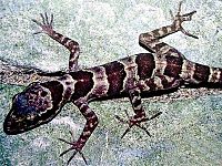
The forests of Quảng Bình are home to many animals. Over 381 species of vertebrates live here. Many of these animals are listed as endangered in Vietnam and around the world.
New species are still being discovered. For example, a new type of gecko was found here in 2005. The park has a large population of primates, including different types of macaques and gibbons. It is also known for its Hatinh and black langurs.
Many types of bats, reptiles, amphibians, and fish live in the park. There are also over 200 bird species, including rare ones like the chestnut-necklaced partridge. Scientists have also found 259 types of butterflies here.
How Quảng Bình is Governed
Quảng Bình is divided into 8 main areas. These include 6 districts, 1 district-level town called Ba Đồn, and 1 provincial city, Đồng Hới. Đồng Hới is the capital city of the province.
These areas are further divided into smaller towns and communes. Each area has a local government. The leader is usually the secretary of the local Communist Party. There is also a people's council that helps manage daily affairs.
History of Quảng Bình
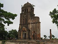
People have lived in what is now Quảng Bình province since the Stone Age. Archaeologists have found many old tools and pottery here. These findings show that ancient human communities lived in caves in the western mountains.
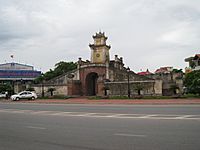
Quảng Bình became part of Đại Việt in 1306. This happened after a princess from the Trần Dynasty married a Champa king. The marriage helped Đại Việt gain more land to the south. During the Trinh-Nguyễn family war in the 17th century, the Gianh River in Quảng Bình became a border. It split Vietnam into two parts. Đồng Hới city was built as a fortress during this time.
In 1604, the province was officially named Quảng Bình. Later, under French rule, it was part of Annam. During the Vietnam War, Quảng Bình was in North Vietnam. It was very close to the dividing line between North and South Vietnam. Because of its location, it was heavily bombed. After the war, the province was merged with others. But in 1990, it became a separate province again.
Education and Culture
Quảng Bình is home to Quảng Bình University. This university offers courses in business, education, and computer science. There are also many high schools and primary schools. People in Quảng Bình value education highly. They see it as a way to improve their lives.
The province has a rich culture. Archaeological sites, like Bàu Tró, show ancient bronze drums from the Dong Son culture. While Quảng Bình is not as wealthy as some other provinces, it has a strong community spirit. Many young people move to bigger cities for work. However, the province continues to develop its education and healthcare.
Economy and Jobs
Quảng Bình's economy is growing. It mainly focuses on making construction materials like cement and bricks. This is because the province has a lot of limestone and clay. There are also industrial parks in Đồng Hới city and Hon La bay. Seafood processing and aluminum production are also important.
Most people in Quảng Bình work in agriculture. They grow crops and raise animals. The province has been working to improve its farming methods. Fishing is also a key part of the economy. Quảng Bình has many fishing boats and factories that process seafood for export.
In recent years, tourism has become very important. This is thanks to the famous Phong Nha-Ke Bang National Park and its beautiful beaches. The province also trades with Laos through the Cha Lo gate.
Places to Visit
Quảng Bình has many amazing places for tourists to visit.
- Phong Nha-Kẻ Bàng National Park: This park is a World Heritage Site. It has over 300 caves and grottoes. Some of the most famous caves are Phong Nha, Tien Son, and Thiên Đường. Phong Nha Cave has the longest underground river in the world. The park also protects a unique forest ecosystem.
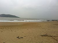
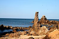
- Beautiful Beaches: Đá Nhảy, Ly Hoa Beach, and Nhật Lệ are known for their white sands and clear water. They are great places to relax.
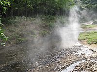
- Bang Spa: This is a hot spring area in Lệ Thủy District. You can enjoy health and resort services here. The water from the spring can be very hot, reaching up to 105 degrees Celsius.
- Ho Chi Minh trail: Many important historical sites from the Vietnam War are located along this trail.
The stunning landscapes of Quảng Bình were even featured in the movie Kong: Skull Island.
Getting Around
Quảng Bình has good transportation systems. It has an airport, a seaport, roads, railways, and riverways.
Đồng Hới Airport has flights to major cities in Vietnam. Soon, it will also have international flights. The province has two main national highways, National Route 1A and the Ho Chi Minh Highway. The North-South railway also runs through the province.
The Hon La deep-water seaport can handle large ships. National Road 12A connects the Hon La seaport to the Cha Lo Border Gate Economic Zone. This road links Vietnam to Laos, Thailand, and Myanmar. Because of its location, Quảng Bình is an important place for trade in the region.
People of Quảng Bình
In 2016, the population of Quảng Bình was about 882,500 people. Many different ethnic groups live here. The largest group is the Kinh people. Other groups include the Vân Kiều and Chứt people. Most of the minority ethnic groups live in the mountainous areas.
The population is not spread out evenly. Most people live in the flatter coastal areas. About 80% of the people live in rural areas, while 20% live in cities. Many people work in farming and forestry. Education is highly valued, and the province is working to train more skilled workers.
See also
 In Spanish: Provincia de Quảng Bình para niños
 | Delilah Pierce |
 | Gordon Parks |
 | Augusta Savage |
 | Charles Ethan Porter |


