Affoltern (district) facts for kids
Quick facts for kids
Affoltern District
Bezirk Affoltern
|
|
|---|---|
|
District
|
|
 |
|
| Country | |
| Canton | |
| Capital | Affoltern am Albis |
| Area | |
| • Total | 113.01 km2 (43.63 sq mi) |
| Population
(31 December 2020)
|
|
| • Total | 55,839 |
| • Density | 494.107/km2 (1,279.73/sq mi) |
| Time zone | UTC+1 (CET) |
| • Summer (DST) | UTC+2 (CEST) |
| Municipalities | 14 |
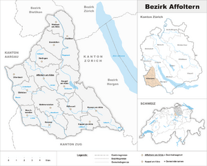
The Affoltern District (also known as Knonaueramt or Säuliamt) is one of the twelve main areas, or districts, in the German-speaking canton of Zürich, Switzerland. Its most important town, or capital, is Affoltern am Albis.
Towns and Villages
The Affoltern District is made up of 14 smaller areas called municipalities. Think of them like towns or villages, each with its own local government. These places work together to form the district.
| Municipality | Population (31 Dec 2005) |
Area, km² |
|---|---|---|
| Aeugst am Albis | 1606 | 7.87 |
| Affoltern am Albis | 10,133 | 10.56 |
| Bonstetten | 4468 | 7.42 |
| Hausen am Albis | 3203 | 13.64 |
| Hedingen | 3182 | 6.59 |
| Kappel am Albis | 846 | 7.87 |
| Knonau | 1509 | 6.48 |
| Maschwanden | 577 | 4.67 |
| Mettmenstetten | 3978 | 13.11 |
| Obfelden | 4355 | 7.54 |
| Ottenbach | 2227 | 4.98 |
| Rifferswil | 803 | 6.50 |
| Stallikon | 2788 | 12.01 |
| Wettswil am Albis | 4251 | 3.77 |
| Total | 43,926 | 113.01 |
See also
 In Spanish: Distrito de Affoltern para niños
Black History Month on Kiddle
Famous African-American Artists:
 | Delilah Pierce |
 | Gordon Parks |
 | Augusta Savage |
 | Charles Ethan Porter |

All content from Kiddle encyclopedia articles (including the article images and facts) can be freely used under Attribution-ShareAlike license, unless stated otherwise. Cite this article:
Affoltern (district) Facts for Kids. Kiddle Encyclopedia.
