Again River facts for kids
Quick facts for kids Again |
|
|---|---|

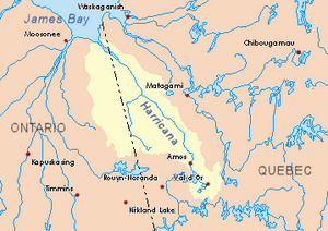
Harricana River basin in yellow
|
|
| Country | Canada |
| Provinces | |
| District | Cochrane (Ontario) |
| Region | Nord-du-Québec (Quebec) |
| Municipality | Eeyou Istchee Baie-James (Quebec) |
| Physical characteristics | |
| Main source | Lake Mine Cochrane District, Ontario 267 m (876 ft) 50°07′06″N 79°39′57″W / 50.11833°N 79.66583°W |
| River mouth | Harricana River District of Cochrane, Ontario 9 m (30 ft) 50°55′40″N 79°32′08″W / 50.92778°N 79.53556°W |
| Length | 119.9 km (74.5 mi) |
| Basin features | |
| Tributaries |
|
The Again River is a river in Canada. It flows into the Harricana River. The Again River passes through two different areas: the Cochrane District in Ontario and the Eeyou Istchee Baie-James municipality in Quebec.
During the colder months, the river's surface usually freezes. This happens from early November until mid-May. It's generally safe to walk or travel on the ice from mid-November to the end of April.
Contents
Where the Again River Flows
The Again River is part of a larger network of waterways. It has many rivers and lakes nearby that connect to it or are close by.
Neighboring Rivers
Here are some of the main rivers located near the Again River:
- To the north: The Harricana River.
- To the east: The Harricana River, Mannerelle River, Malouin River, Breynat River, and Despreux River.
- To the south: The Turgeon River and Detour River.
- To the west: The Lawagamau River (in Ontario), Corner River (in Ontario), and Seal River (Ontario).
Starting Point of the River
The Again River begins at a place called Lake Mine. This lake is about 3.4 kilometres (2.1 mi) long and sits at an elevation of 267 metres (876 ft) above sea level. Lake Mine is located in the eastern part of the Cochrane District in Ontario.
The source of the Again River is:
- About 10.4 kilometres (6.5 mi) east of the Ontario border.
- Around 92.5 kilometres (57.5 mi) south of where the Again River ends.
- About 37.6 kilometres (23.4 mi) east of Kesagami Lake in Ontario.
- Roughly 118.5 kilometres (73.6 mi) south of where the Harricana River meets another body of water in Ontario.
The River's Journey
From its starting point, the Again River travels for about 119.9 kilometres (74.5 mi). It generally flows in a direction that is similar to the Ontario border.
Here's how its journey unfolds:
- For the first 16.0 kilometres (9.9 mi), it flows north through three lakes. Then it goes northeast through two more lakes, including Lake Favell in Ontario. After that, it turns eastward until it reaches a smaller stream that drains the area between Quebec and Ontario.
- It continues for about 55.0 kilometres (34.2 mi) until it reaches the border between Quebec and Ontario.
- For the next 46.3 kilometres (28.8 mi), it flows north in Quebec, mostly along the border and through a marshy area. It continues until it crosses back into Ontario.
- Finally, it flows for about 2.6 kilometres (1.6 mi) to the northwest in the Cochrane District in Ontario, still in a marshy area, until it reaches its end.
Where the River Ends
The Again River flows into the southwestern part of the Harricana River. It joins the Harricana River near Low Shoal Island.
This meeting point is located:
- About 31.0 kilometres (19.3 mi) southeast of where the Harricana River ends.
- Around 2.6 kilometres (1.6 mi) west of the border between Quebec and Ontario.
- About 88.6 kilometres (55.1 mi) south of the center of the village of Moosonee in Ontario.
Naming the Again River
The name "rivière Again" (Again River) was officially recognized on December 5, 1968. This happened when the Commission de toponymie du Québec was first created. This commission is responsible for naming places in Quebec.
 | Ernest Everett Just |
 | Mary Jackson |
 | Emmett Chappelle |
 | Marie Maynard Daly |

