Mannerelle River facts for kids
Quick facts for kids Mannerelle |
|
|---|---|

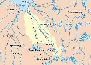
Harricana River basin in yellow
|
|
| Country | Canada |
| Province | Quebec |
| Region | Nord-du-Québec |
| Physical characteristics | |
| Main source | Manthet lake Eeyou Istchee Baie-James (municipality), Nord-du-Québec, Quebec 258 m (846 ft) 50°02′07″N 79°22′40″W / 50.03528°N 79.37778°W |
| River mouth | Malouin River Eeyou Istchee Baie-James (municipality), Nord-du-Québec, Quebec 91 m (299 ft) 50°35′27″N 79°19′01″W / 50.59083°N 79.31694°W |
| Length | 83.3 km (51.8 mi) |
The Mannerelle River is a river located in Quebec, Canada. It flows into another river called the Malouin River. The Mannerelle River runs through a large area known as Eeyou Istchee Baie-James (municipality) in the Nord-du-Québec region. Its path also crosses through areas called Massicotte and Manthet.
The surface of the Mannerelle River usually freezes over in early November. It stays frozen until mid-May. If you want to move safely on the ice, it's generally safe from mid-November to the end of April.
Where the River Flows
The Mannerelle River is part of a larger network of rivers and land. Here are some of the main rivers and areas nearby:
- North of the Mannerelle River: The Harricana River and the Malouin River.
- East of the Mannerelle River: The Harricana River, Malouin River, Breynat River, and Despreux River.
- South of the Mannerelle River: The Turgeon River (Eeyou Istchee James Bay) and the Detour River.
- West of the Mannerelle River: The Again River (in Ontario), Corner River (in Ontario), and Kattawagami River (in Ontario).
The River's Beginning
The Mannerelle River starts at a lake called Manthet Lake. This lake is about 2.6 kilometers (1.6 miles) long and sits at an elevation of 258 meters (846 feet) above sea level. Manthet Lake is located in the southern part of the Eeyou Istchee James Bay (Municipality).
The starting point of the Mannerelle River is:
- About 9.9 kilometers (6.2 miles) east of the border with Ontario.
- About 61.9 kilometers (38.5 miles) south of where the Mannerelle River ends.
- About 127.7 kilometers (79.3 miles) west of the town of Matagami.
- About 132.7 kilometers (82.5 miles) south-east of where the Harricana River ends.
The River's Journey
From Manthet Lake, the Mannerelle River flows for about 83.3 kilometers (51.8 miles). It generally flows in a direction that is more or less parallel to the Ontario border. Here's how its journey unfolds:
- For the first 24.2 kilometers (15.0 miles), it flows north. It continues until it meets water flowing from the south-east, coming from lakes Nicolas and Arquet.
- Then, for another 29.1 kilometers (18.1 miles), it keeps flowing north. This part of the river reaches a small stream coming from the southwest.
- Next, it flows north for 13.5 kilometers (8.4 miles) until it makes a bend.
- After that, it travels 6.0 kilometers (3.7 miles) northeast through a marshy area to another river bend.
- Finally, it flows north for 10.5 kilometers (6.5 miles) through a swampy area until it reaches its mouth, where it joins the Malouin River.
Naming the River
The name "Mannerelle River" was officially given on December 5, 1968. This happened when the Commission de toponymie du Québec (Quebec's place name commission) was first created.
 | Shirley Ann Jackson |
 | Garett Morgan |
 | J. Ernest Wilkins Jr. |
 | Elijah McCoy |

