Albion River facts for kids
Quick facts for kids Albion River |
|
|---|---|

Albion River
|
|
|
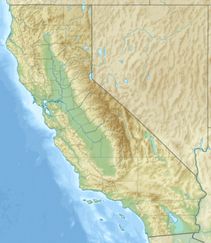
Location of the mouth in California
|
|
| Country | United States |
| State | California |
| Region | Mendocino County |
| Physical characteristics | |
| Main source | 12 mi (19 km) southwest of Willits 800 ft (240 m) 39°15′10″N 123°32′32″W / 39.25278°N 123.54222°W |
| River mouth | Pacific Ocean Albion, California 0 ft (0 m) 39°13′38″N 123°46′13″W / 39.22722°N 123.77028°W |
| Basin features | |
| Basin size | 43 sq mi (110 km2) |
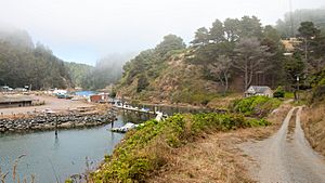
The Albion River is a river in Mendocino County, California. It's about 18 miles (29 km) long. This river flows into the Pacific Ocean near the town of Albion, California. The famous California State Route 1 highway crosses the river there on the Albion River Bridge. The river's water comes from an area of about 43 square miles (111 km²).
It generally flows from east to west, but it also twists and turns a lot. Smaller streams, called tributaries, flow into the Albion River. These include Railroad Gulch, Pleasant Valley Creek, and the North and South Forks of the Albion River. The river's highest point is about 1,570 feet (479 meters) above sea level.
Near the ocean, the river forms a large estuary. This is where fresh river water mixes with salty ocean water. Tidal waters can travel up to 5 miles (8 km) upstream from the mouth. In the past, the Albion River helped power a sawmill. Today, there are no big dams or reservoirs on the river. The river is important for fun activities like fishing. It also helps refill underground water supplies and provides homes for many animals, especially fish.
Contents
History of the Albion River
The Albion River gets its name from "Albion," an old name for Britain. This name was first used for a piece of land in 1844 by William A. Richardson. The river then took the name of this land.
In 1853, Captain Richardson built a sawmill near the river's mouth. This mill used the river's power to cut wood. It was updated in 1856 to use steam power, but it burned down in 1867. The mill was rebuilt to cut a lot of lumber each day.
The Albion River Railroad
To help move logs to the sawmill, construction of the Albion River Railroad began in 1885. This railway carried logs downstream. In 1891, the sawmill owners created the Albion Lumber Company. This company had its main office in San Francisco. They also built places there to dry and smooth lumber.
In 1892, a company from Michigan bought the Albion Lumber Company. They built a company town near the river's mouth in 1895. A second sawmill was built in 1903 at a place called Brett, about three miles (5 km) upstream. By 1905, the railway stretched far inland. It even went over Keen's Summit into the area of the Navarro River.
The railroad later became part of bigger railway companies. Trains used to carry lumber to the mouth of the Albion River. From there, the wood was loaded onto ships going to San Francisco. The last log was cut at the Albion sawmill on May 19, 1928. The railroad stopped running on January 16, 1930. Its tracks were taken apart for scrap metal in 1937.
Protecting the River
Even after the sawmills closed, logging (cutting down trees) continued in the river's watershed. This logging has caused a main problem for the river: too much sediment (dirt and sand) in the water. Most of the forests around the river are now younger, having been regrown after earlier logging.
In 2002, a plan was suggested to collect water from the Albion River. The idea was to put the water into large bags and tow it to San Diego for drinking. However, many local people did not like this plan. The state government then passed new laws. These laws required careful studies of how such a plan would affect fish and their homes. Because of this, the plan was stopped. Later, the governor signed a law that made the Albion River a recreational area. This helped protect the river from similar plans in the future.
Railway Mileposts
The Albion River Railroad had several important stops along its route:
- Milepost 0 - Albion wharf (where the lumber was loaded onto ships)
- Milepost 3.25 - Brett (where a second sawmill was built)
- Milepost 7.32 - Clearbrook Junction (where a branch line split off)
- Milepost 8.30 - Gunari
- Milepost 12.37 - Sunny Slope
- Milepost 13.05 - Skibo
- Milepost 14.65 - switchback (a zigzag part of the track to climb steep hills)
- Milepost 15.44 - Keene summit (the highest point, 611 feet or 186 meters high)
See Also
 | Aurelia Browder |
 | Nannie Helen Burroughs |
 | Michelle Alexander |


