
Alburgh (village), Vermont facts for kids
Quick facts for kids
Alburgh, Vermont
|
|
|---|---|
_highlighted.svg)
Location in Grand Isle County and the state of Vermont.
|
|
| Country | United States |
| State | Vermont |
| County | Grand Isle |
| Town | Alburgh |
| Incorporated | 1917 |
| Area | |
| • Total | 0.64 sq mi (1.65 km2) |
| • Land | 0.64 sq mi (1.65 km2) |
| • Water | 0.00 sq mi (0.00 km2) |
| Elevation | 108 ft (33 m) |
| Population
(2020)
|
|
| • Total | 571 |
| • Density | 892/sq mi (346.1/km2) |
| Time zone | UTC-5 (Eastern (EST)) |
| • Summer (DST) | UTC-4 (EDT) |
| ZIP codes |
05440
|
| Area code(s) | 802 |
| FIPS code | 50-00850 |
| GNIS feature ID | 2378298 |
Alburgh is a small village located in Grand Isle County, Vermont, United States. It is part of the larger town of Alburgh. In 2020, about 571 people lived here. The village was named after Ira Allen, who helped start the community.
Contents
History of Alburgh
The area where Alburgh village is located was first set up as a "town" in 1781. It was called "Alburgh" from the very beginning.
Name Changes Over Time
In 1891, the name of the town was changed to "Alburg." This change was suggested by a special board that deals with place names in the United States. When Alburgh village officially became its own separate village in 1917, it used this newer spelling, "Alburg."
However, in 2006, the people living in the village voted to change the name back. They wanted to use the original spelling, "Alburgh," again. The Vermont Department of Libraries, which keeps track of Vermont place names, approved this change.
How Alburgh is Governed
Because Alburgh is an "incorporated village," it has its own local government. This government is run by a group of people called a board of trustees. These trustees are chosen by the villagers in an election.
Where is Alburgh?
Alburgh village covers a small area of about 1.65 square kilometers (or 0.64 square miles). All of this area is land.
Location and Nearby Places
The village is found in the northwestern part of the larger town of Alburgh. It sits right on the eastern shore of Lake Champlain, a very large lake.
You can reach Alburgh using U.S. Route 2. This road goes north and then west across Lake Champlain to Rouses Point, New York, which is about 5 miles away. If you travel south on US 2 and then connect to Interstate 89, you can reach Burlington, Vermont, which is about 46 miles away. The Canada–United States border is also very close, just 2.5 miles north of Alburgh village on Vermont Route 225.
People of Alburgh
The number of people living in Alburgh has changed over the years. Here's a quick look at the population:
| Historical population | |||
|---|---|---|---|
| Census | Pop. | %± | |
| 1920 | 364 | — | |
| 1930 | 633 | 73.9% | |
| 1940 | 638 | 0.8% | |
| 1950 | 563 | −11.8% | |
| 1960 | 426 | −24.3% | |
| 1970 | 520 | 22.1% | |
| 1980 | 496 | −4.6% | |
| 1990 | 436 | −12.1% | |
| 2000 | 488 | 11.9% | |
| 2010 | 497 | 1.8% | |
| 2020 | 571 | 14.9% | |
| U.S. Decennial Census | |||
Population in 2000
In the year 2000, there were 488 people living in Alburgh village. Most of the people (about 95.9%) were White. A smaller number were Native American (2.46%) or Asian (0.20%). About 1.43% of the people were from two or more racial backgrounds.
There were 209 homes in the village. About 28.7% of these homes had children under 18 living in them. Many homes (49.8%) were married couples living together.
Age Groups
The people in Alburgh were spread out across different age groups:
- About 24.8% were under 18 years old.
- About 9.6% were between 18 and 24 years old.
- About 25.8% were between 25 and 44 years old.
- About 21.9% were between 45 and 64 years old.
- About 17.8% were 65 years old or older.
The average age of people in the village was 39 years.
Images for kids
-
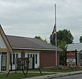
Post office
-
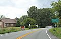
Sign on US2
-
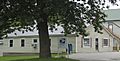
Village offices


