Allegheny County belt system facts for kids
| {{{shields}}}
{{{caption}}}
|
|
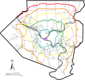
Static map of Allegheny County with the system
Red Belt
Orange Belt
Yellow Belt
Green Belt
Blue Belt
Purple Belt
(River)
|
|
Quick facts for kids System information |
|
|---|---|
| Length: | 280.5 mi (451.4 km) |
| Highway names | |
| Interstates: | Interstate nn (I-nn) |
| US Routes: | U.S. Route nn (US nn) |
The Allegheny County Belt System is a special network of roads in Allegheny County, Pennsylvania. It uses different colors to help drivers find their way around, especially near the city of Pittsburgh.
Unlike big highways that are built for fast travel, these belt roads are mostly for helping people navigate. They are not meant for high speeds. The system started in the early 1950s with five main routes: Red, Orange, Yellow, Green, and Blue. The Purple Belt was added later. All the roads in the system keep their original names.
Contents
History of the Belt System
The Allegheny County Belt System was created in the late 1940s by Joseph White. He was an engineer who wanted to help drivers avoid the busy downtown Pittsburgh area. He designed a system using existing roads, including federal, state, and local ones.
Signs for the belt routes were put up between late 1951 and early 1952. The Orange route was signed first, then Blue, Yellow, Red, and Green.
The main goal of these belts was to offer clear paths away from crowded main roads. They were not built as fast highways.
Later, new highways like the Interstate Highway System were built. At first, this made the belt routes less used. But as more people moved to the suburbs around Pittsburgh, the Belt System became helpful again. Many of the roads chosen for the belts are now important for Allegheny County's transportation plans.
In the mid-1990s, the City of Pittsburgh added the Purple Belt. This new belt was designed for the downtown area, following the idea of the county's system.
Even today, some people suggest using the belt system instead of building new highways around the city.
How the Belts are Made Up
The Belt System has six different beltways: Purple, Blue, Green, Yellow, Orange, and Red. They vary in length:
- Purple: 2 miles (3.2 km)
- Blue: 38 miles (61 km)
- Green: 39 miles (63 km)
- Yellow: 78 miles (126 km)
- Orange: 92 miles (148 km)
- Red: 34 miles (55 km)
The Purple, Blue, and Yellow belts are complete loops. This means they start and end at the same place. The Orange Belt used to be a full loop. But about 12 miles (19 km) of its southern part was removed in the 1970s. This was done to keep the belt system mostly within Allegheny County.
Allegheny County still creates maps that show the Belt System.
Descriptions of the Belts
Red Belt
| Location: | PA 65 in Leetsdale to 7th Avenue in Tarentum |
|---|---|
| Length: | 33.5 mi (53.9 km) |
The Red Belt is the farthest out of all the belts. It is different from the others because it does not form a full loop. Instead, it runs from east to west across the northern part of Allegheny County.
The Red Belt is about 33.5 miles (53.9 km) long. It goes through many rural areas. It starts in Leetsdale and ends in Tarentum. The Red Belt only crosses a few main highways. These include US 19, PA 8, and Interstate 79.
Older Red Belt Sections
Both ends of the Red Belt used to go outside Allegheny County. They were shortened in 1974. This means the Red Belt is the only one that does not cross any of Allegheny County's main rivers.
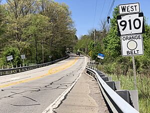
Orange Belt
| Location: | PA 88 in Bethel Park to PA 51 in Forward Township |
|---|---|
| Length: | 91.7 mi (147.6 km) |
The Orange Belt is the longest belt in the system, at 91.7 miles (147.6 km). For most of its path, it is the outermost belt, except where the Red Belt runs in the north. The Orange Belt used to be a full circle. But a 12-mile (19 km) section in the south was removed.
The Orange Belt goes through the northern, eastern, southern, and western parts of the county. It connects to four county parks and the Pittsburgh International Airport. It crosses or joins many Pennsylvania routes. These include PA 48, PA 50, and PA 51.
The Orange Belt crosses three of Allegheny County's four major rivers. These are the Ohio River, the Allegheny River, and the Youghiogheny River. For a short distance, the Orange Belt goes into Westmoreland County.
Removed Orange Belt Section
The original Orange Belt was a 121-mile (195 km) circle. It went into Washington County. But the southern part was removed by early 1973. This was done to keep the belt system mostly within Allegheny County.
Yellow Belt
| Location: | Pittsburgh |
|---|---|
| Length: | 77.6 mi (124.9 km) |
The Yellow Belt is one of two belts that make a complete loop around the city. It is about 77.6 miles (124.9 km) long. It travels through the northern, eastern, southern, and western parts of the county. In some southern areas, it is the outermost belt.
The Yellow Belt goes from South Park in the south. It then goes north and west towards Moon. From there, it heads north and east to Hampton. It continues east towards Penn Hills before returning to its start. It crosses or follows many state and U.S. routes. These include PA 50, PA 51, and US 19.
The Yellow Belt also runs along Interstate 79 for about four miles. This happens in Neville Township.
Curry Hollow Road is part of the Yellow Belt south of Pittsburgh. It connects with Lebanon Church Road near Pennsylvania Route 51 in Pleasant Hills, Pennsylvania. The Allegheny County Airport is located on Lebanon Church Road.
The Yellow Belt is special because it crosses all four major Allegheny County rivers. These are the Ohio River, Monongahela River, Youghiogheny River, and Allegheny River.
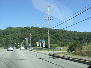
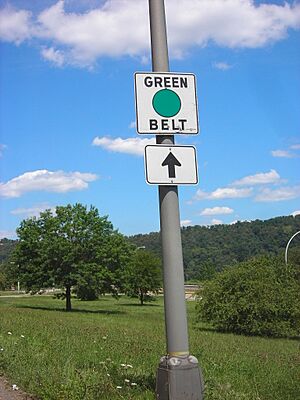
Green Belt
| Location: | PA 65 in Emsworth to PA 148 in McKeesport |
|---|---|
| Length: | 38.6 mi (62.1 km) |
The Green Belt forms a half-circle around the city. It is about 38.6 miles (62.1 km) long. It goes through suburban areas in the northern and eastern parts of the county. The gap in the circle is due to the land, not because it crosses into other counties.
The Green Belt starts in Emsworth and ends in McKeesport. It is the only belt that crosses the same river (the Monongahela) twice. It also ends at another belt route, the Yellow Belt. Along its way, it crosses or joins routes like PA 8 and PA 28.
The Green Belt crosses two of Allegheny County's four rivers three times. It crosses the Allegheny River via the Highland Park Bridge. It then crosses the Monongahela River twice, first via the Rankin Bridge and then via the McKeesport-Duquesne Bridge.
The Green Belt passes by well-known places. These include Kennywood Park and the Pittsburgh Zoo.
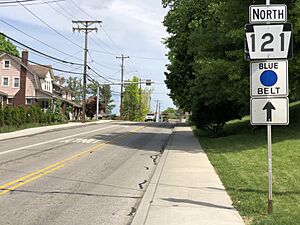
Blue Belt
| Location: | Pittsburgh |
|---|---|
| Length: | 38.1 mi (61.3 km) |
The Blue Belt is the innermost belt in the original system. It makes a complete circle around the city, about 38.1-mile (61.3 km) long.
The Blue Belt stays close to the edge of Pittsburgh. It also goes into nearby towns like Dormont and McKees Rocks. It mainly serves urban areas in the northern, southern, and eastern parts of the county. It crosses or joins routes like PA 8 and PA 28. Only a small part of the route is a fast highway.
The Blue Belt crosses three major rivers:
- The Ohio River via the McKees Rocks Bridge.
- The Allegheny River via the Highland Park Bridge.
- The Monongahela River via the Homestead Grays Bridge.
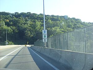
Blue and Green Belt Together
For one mile in northeastern Pittsburgh, the Blue and Green Belts run together. This is the only place in the system where two belts share the same road. They meet at the northern end of the Highland Park Bridge. From there, they cross the bridge together. Then they split up, with the Blue Belt going one way and the Green Belt another.
Purple Belt
| Location: | Downtown Pittsburgh |
|---|---|
| Length: | 2.03 mi (3.27 km) |
The Purple Belt is the innermost colored belt in the system. It runs through downtown Pittsburgh. It was created in 1995 to work with the Pittsburgh Wayfinder System. This system uses colors to help people find places downtown. The Purple Belt uses different signs than the other belts.
The Purple Belt's main purpose is to help people navigate downtown. It is not meant for getting around the whole city. It is also the only belt that stays completely within the city limits. The Allegheny County Department of Public Works takes care of the other belts. But the City of Pittsburgh takes care of the Purple Belt.
The Purple Belt forms a loop on four streets: Stanwix Street, Fort Duquesne Boulevard/11th Street, Grant Street, and Boulevard of the Allies. It stays within the area surrounded by the Allegheny River, Interstate 579, Interstate 376, and Interstate 279.
See Also
- List of beltways
 | Delilah Pierce |
 | Gordon Parks |
 | Augusta Savage |
 | Charles Ethan Porter |


