Aloomba, Queensland facts for kids
Quick facts for kids AloombaQueensland |
|||||||||||||||
|---|---|---|---|---|---|---|---|---|---|---|---|---|---|---|---|
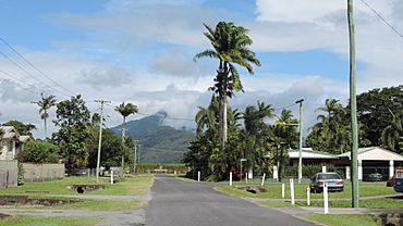
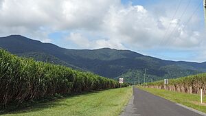
Looking south down Nielsen Street, Alloomba, 2018
|
|||||||||||||||
| Population | 576 (2021 census) | ||||||||||||||
| • Density | 5.199/km2 (13.47/sq mi) | ||||||||||||||
| Postcode(s) | 4871 | ||||||||||||||
| Area | 110.8 km2 (42.8 sq mi) | ||||||||||||||
| Time zone | AEST (UTC+10:00) | ||||||||||||||
| Location |
|
||||||||||||||
| LGA(s) | Cairns Region | ||||||||||||||
| State electorate(s) | Mulgrave | ||||||||||||||
| Federal Division(s) | Kennedy | ||||||||||||||
|
|||||||||||||||
Aloomba is a small town in the countryside, located in the Cairns Region of Queensland, Australia. In 2021, about 576 people lived there.
Contents
Exploring Aloomba's Location
Aloomba is a long, narrow area surrounded by mountains on its east and west sides. The Mulgrave River forms its northern border and also flows through the western part of the area.
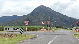
The main highway, the Bruce Highway, runs through the western side of Aloomba. The town itself is about 2 kilometers east of the highway. A railway line, the North Coast railway line, also passes through Aloomba. It enters from the south, goes through the town, and then heads back towards the highway.
Nature and Farming in Aloomba
The western, mountainous part of Aloomba is a protected area called the Malbon Thompson Forest Reserve. The rest of the land is mostly flat and used for farming. Farmers here mainly grow sugarcane.
To move the harvested sugarcane, there's a special network of small railways called cane tramways. These tramways take the sugarcane to the Mulgrave Sugar Mill in Gordonvale for processing.
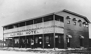
Aloomba's Past
The name "Aloomba" comes from an old local language, Yidinji. The word "Ngalumba" means a type of hard milkwood tree.
School Days in Aloomba
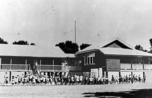
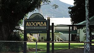
Aloomba Provisional School first opened its doors on May 15, 1899. It later became Aloomba State School on January 1, 1909.
The Cane Beetles March
On April 20, 1916, a special event called the Cane Beetles March started near Aloomba. This was during World War I, and its goal was to encourage men to join the Australian army. It was a "snowball march," meaning it started with a few people and grew bigger as it went along.
The march began with just 4 men in Mooliba (now Mirriwinni). It passed through several towns, including Aloomba, and ended in Cairns, about 60 kilometers away. By the end, 29 men had joined the army.
Education in Aloomba
Aloomba State School is a government primary school for students from Prep to Year 6. It's located on Nielsen Street. In 2018, the school had 91 students and 7 teachers.
There isn't a high school in Aloomba. Most students go to Gordonvale State High School in nearby Gordonvale.
Community Life
The Aloomba Community Hall is a place where people can gather. It's located on Anderson Road, next to Robert Rossi Park. The hall can hold up to 80 people and is managed by the Cairns Regional Council.
Famous People from Aloomba
- Bunny Adair attended Aloomba State School. He later became a Member of the Queensland Legislative Assembly for the Cook area, which means he was an elected representative in the Queensland government.
 | Jackie Robinson |
 | Jack Johnson |
 | Althea Gibson |
 | Arthur Ashe |
 | Muhammad Ali |


