Mulgrave River facts for kids
Quick facts for kids Mulgrave |
|
|---|---|

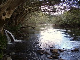
The Mulgrave River in the Goldsbrough Valley
|
|
|
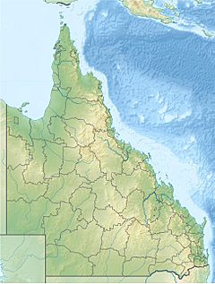
Location of Mulgrave River river mouth in Queensland
|
|
| Country | Australia |
| State | Queensland |
| Region | Far North Queensland |
| Physical characteristics | |
| Main source | Bellenden Ker Range |
| 2nd source | West Mulgrave River west of Babinda 376 m (1,234 ft) 17°21′16″S 145°46′52″E / 17.35444°S 145.78111°E |
| 3rd source | East Mulgrave River below South Peak 665 m (2,182 ft) 17°17′37″S 145°51′00″E / 17.29361°S 145.85000°E |
| River mouth | Coral Sea Mutchero Inlet 0 m (0 ft) 17°13′18″S 145°58′30″E / 17.22167°S 145.97500°E |
| Length | 70 km (43 mi) |
| Basin features | |
| Basin size | 1,315 km2 (508 sq mi) |
| Tributaries |
|
| National parks | Wooroonooran National Park; Russell River National Park |
The Mulgrave River is an important river system in Far North Queensland, Australia. It is made up of two main parts: the East Mulgrave River and the West Mulgrave River. This river flows for about 70 kilometres (43 mi) towards the Coral Sea. You can find it around 50 kilometres (31 mi) south of a city called Cairns.
Contents
Where is the Mulgrave River located?

The Mulgrave River gets its water from the Bellenden Ker Range of mountains. The East and West Mulgrave River branches start in different spots. The East branch begins below South Peak, and the West branch starts west of Babinda.
These two branches meet up inside the Wooroonooran National Park. This area is also part of the Wet Tropics World Heritage Area. When two rivers or branches meet, it's called a confluence.
How does the Mulgrave River flow?
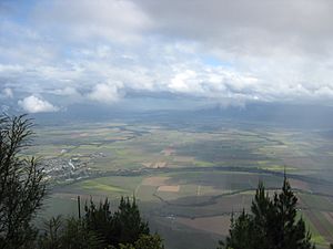
After the two branches join, the Mulgrave River flows generally north. It passes near Little Mulgrave and the edges of Gordonvale. The river also flows through a place called the Goldsborough Valley.
From Gordonvale, the river turns and flows towards the southeast and then south. Finally, the Mulgrave River empties into the Coral Sea. This happens about 30 kilometres (19 mi) south of Gordonvale. At its mouth, the Mulgrave River meets the Russell River.
Did the river change its path?
Scientists believe that the Trinity Inlet, near present-day Cairns, was once the mouth of the Mulgrave River. Long ago, volcanic activity caused Green Hill to rise in the Mulgrave Valley. This might have blocked the river from flowing into the sea near Cairns.
However, new research shows that river sediments are found above the old lava flows. This suggests that other things, like alluvial sediments (silt and sand carried by the river), might have changed the river's course. It's possible the river has flowed through both mouths at different times in history.
What is the river's size?
The Mulgrave River has a catchment area of 1,315 square kilometres (508 sq mi). This is the total area of land where all the rain and water eventually flow into the river. From where it starts to where it meets the sea, the river drops 665 metres (2,182 ft) in height. Its total course (length) is about 78 kilometres (48 mi).
How is the river used?
The Bruce Highway crosses the Mulgrave River south of Gordonvale. It uses a bridge called the Desmond Trannore Bridge.
In the 1870s, gold was found in the river. This discovery brought many changes to the Goldsborough Valley. Today, gravel is taken from the riverbed for building and other uses.
Animals in the Mulgrave River
You can find different animals living in the Mulgrave River. These include freshwater stonefish and crocodiles. It is important to be careful if you are swimming in the river because of these animals.
Sometimes, unwanted fish called tilapia are found in the river. These fish are not native to the area and can harm the local ecosystem. Efforts have been made to remove them from the river.
Flooding in the Mulgrave River
The Mulgrave River, along with the Russell River, has a long history of floods. People have recorded evidence of flooding in this area since the late 1800s.
Language of the Mulgrave River area
The Yidinji language is an Aboriginal language. It is also known as Yidinj, Yidiny, and Idindji. The traditional land where this language was spoken includes parts of the Cairns Region and Tablelands Region. This covers places like Cairns, Gordonvale, the Mulgrave River area, and the southern part of the Atherton Tableland.
 | Claudette Colvin |
 | Myrlie Evers-Williams |
 | Alberta Odell Jones |


