Altona, New York facts for kids
Quick facts for kids
Altona, New York
|
|
|---|---|

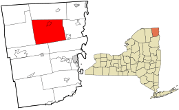
Location in Clinton County and the state of New York.
|
|

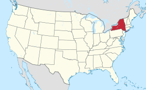
Location of New York in the United States
|
|
| Country | United States |
| State | New York |
| County | Clinton County |
| Incorporated | 1857 |
| Area | |
| • Total | 101.34 sq mi (262.46 km2) |
| • Land | 100.98 sq mi (261.54 km2) |
| • Water | 0.36 sq mi (0.92 km2) |
| Elevation | 915 ft (279 m) |
| Population
(2010)
|
|
| • Total | 2,887 |
| • Estimate
(2016)
|
2,890 |
| • Density | 28.62/sq mi (11.05/km2) |
| Time zone | UTC-5 (EST) |
| • Summer (DST) | UTC-4 (EDT) |
| ZIP code |
12910
|
| Area code(s) | 518 |
| FIPS code | 36-019-01583 |
Altona is a town in Clinton County, New York, United States. In 2010, about 2,887 people lived there. The town was named after a place called Altona in Germany. There is also a smaller area inside the town, called a hamlet, which is also named Altona.
The town is in the north-central part of Clinton County. Part of the western area is near the Adirondack Park boundary. Altona is located northwest of the city of Plattsburgh.
Contents
History of Altona
For thousands of years, different groups of Native Americans lived in this area. Around the year 1300, a group called the St. Lawrence Iroquoians built strong villages here. These villages were like the ones explorer Jacques Cartier saw in the 1500s. Later, the Mohawk people, part of the Iroquois Confederacy, are thought to have taken over this area.
The first European-American settlers arrived around 1800. This was after the American Revolutionary War, when many people moved to New York from New England. In 1857, Altona became its own town. It was formed from part of the Town of Chazy. In the early days, the town's economy depended on natural resources. People worked in mining, logging, and tanning (making leather).
Geography of Altona
Altona covers about 101.34 square miles (262.5 square kilometers). Most of this area is land, about 100.98 square miles (261.5 square kilometers). A small part, about 0.36 square miles (0.9 square kilometers), is water.
Most of the town's water flows into the Great Chazy River. The southeastern part is drained by the Little Chazy River and Corbeau Creek. All these rivers eventually flow into Lake Champlain.
New York State Route 190 (also known as Military Turnpike) is a main road that goes through the town. U.S. Route 11 also passes through the northwestern corner of Altona.
Population of Altona
| Historical population | |||
|---|---|---|---|
| Census | Pop. | %± | |
| 1860 | 1,665 | — | |
| 1870 | 2,759 | 65.7% | |
| 1880 | 3,570 | 29.4% | |
| 1890 | 2,368 | −33.7% | |
| 1900 | 2,465 | 4.1% | |
| 1910 | 2,383 | −3.3% | |
| 1920 | 1,911 | −19.8% | |
| 1930 | 1,834 | −4.0% | |
| 1940 | 2,026 | 10.5% | |
| 1950 | 1,711 | −15.5% | |
| 1960 | 1,750 | 2.3% | |
| 1970 | 1,852 | 5.8% | |
| 1980 | 2,077 | 12.1% | |
| 1990 | 2,775 | 33.6% | |
| 2000 | 3,164 | 14.0% | |
| 2010 | 2,887 | −8.8% | |
| 2016 (est.) | 2,890 | 0.1% | |
| U.S. Decennial Census | |||
In 2000, there were 3,160 people living in Altona. There were 888 households, and 653 families. The population density was about 31.3 people per square mile.
About 38.3% of households had children under 18 living with them. Most households (59.7%) were married couples living together. About 19.5% of households were single individuals. The average household had 2.73 people.
The median age in the town was 35 years old. About 21.9% of the population was under 18. About 7.9% of the population was 65 years or older.
The median income for a household in Altona was $37,500. For families, the median income was $41,442.
Communities and Locations in Altona
- Alder Bend – A small community in the western part of the town. It is inside the Adirondack Park area.
- Altona – This is the main hamlet (a small community) of Altona. It is in the northern part of the town.
- Altona Correctional Facility – This is a medium-security prison in New York. It was built in 1983 using a former high school building. It is located within the Altona hamlet.
- Crowley Corners – Another small community located on NY-190, southwest of the Altona hamlet.
- Dannemora Crossing – A hamlet found at the western edge of the town.
- Forest – A hamlet in the northwestern part of the town, west of Irona.
- Ganienkeh – This is a settlement for the Mohawk people. They got this land in an agreement with New York State in the 1970s.
- Irona – A hamlet near the northern town line, northwest of the Altona hamlet.
- Jericho – A hamlet located near the southern border of the town.
- Miner Lake – A lake found close to the center of the town, southwest of the Altona hamlet.
- Miner Lake State Park – A park that surrounds Miner Lake.
- Purdys Mills – A hamlet in the southern part of the town.
- Robinson – A hamlet located in the southeastern part of the town.
See also
 In Spanish: Altona (pueblo) para niños

