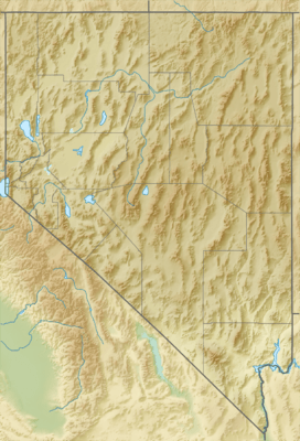
Antelope Valley (Lander County) facts for kids
Quick facts for kids Antelope Valley |
|
|---|---|
| Length | 25 mi (40 km) |
| Width | 8 mi (13 km) |
| Geography | |
| Country | United States |
| State | Nevada |
| Region | Humboldt River Basin |
| District | Lander County |
| Population center | Austin |
| Borders on |
List
|
The Antelope Valley in western Lander County, Nevada, is a small, mostly dry valley. It is about 25 miles (40 km) long. This valley is one of a few places in Nevada that share the name "Antelope Valley." It lies south of the Humboldt River. Antelope Creek, which flows into the Reese River, runs through part of it.
Another larger valley with the same name is found in Elko and White Pine Counties. A third valley called Antelope Valley is in Douglas County and even reaches into California.
What is Antelope Valley?
Antelope Valley got its name because antelope used to live and roam freely in this area. It is a short valley, stretching about 25 miles from north to south. The valley has a slight curve towards the northeast.
Antelope Creek flows north through the valley. This creek starts in the southern part of the valley. It begins where two mountain ranges meet: the New Pass Range to the southwest and Ravenswood Mountain to the southeast.
Water in the Valley
As Antelope Creek flows north, it eventually disappears into flatlands. This happens in the northern third of the valley, where the valley gets a bit wider. The Augusta Mountains form the western edge of the valley here.
Another creek, called Cain Creek, starts from these northern flatlands. It flows about 12 miles northeast towards the Reese River. Cottonwood Creek also flows into the headwaters of Cain Creek. Cottonwood Creek comes from the southern and central Fish Creek Mountains.
In the center-east part of the valley, you'll find Antelope Butte. This is a small, separate ridge located in the foothills of Ravenswood Mountain.
How to Get There
The easiest way to reach Antelope Valley is from the south. You can take Nevada Route 305 from Austin, Nevada. This route runs next to the Reese River.
The northern end of the valley is about 40 miles north of Austin. From there, you would travel about 10 miles west on unpaved roads. You can reach the southern part of the valley closer to Austin, about 10 miles north of the town. However, you would then need to go west of the foothills of the southern Ravenswood Mountain area. This path also requires using unpaved roads.
 | Ernest Everett Just |
 | Mary Jackson |
 | Emmett Chappelle |
 | Marie Maynard Daly |


