Shoshone Range facts for kids
Quick facts for kids Shoshone Range |
|
|---|---|

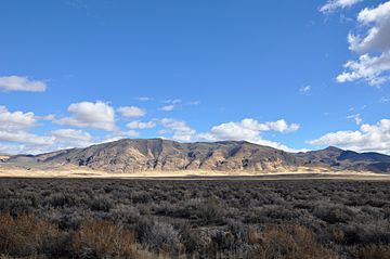
Looking east from Nevada State Route 305
|
|
| Highest point | |
| Peak | Mount Lewis |
| Elevation | 9,678 ft (2,950 m) |
| Geography | |
| Country | United States |
| State | Nevada |
| District | Lander County |
| Range coordinates | 40°21′1.701″N 116°53′4.343″W / 40.35047250°N 116.88453972°W |
| Topo map | USGS Goat Peak |
The Shoshone Range is a chain of mountains located in Lander County, Nevada. Part of the range also reaches into Eureka County. This happens near a spot called Shoshone Point, close to the Humboldt River.
About the Shoshone Range
The Shoshone Range is a notable mountain area in central Nevada. It stretches across a significant part of Lander County. These mountains are an important part of the landscape in this region.
Where is the Shoshone Range?
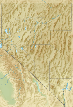
Most of the Shoshone Range is found in Lander County, Nevada. However, its northeastern tip extends into Eureka County. This area is near the Humboldt River, which is a major river in Nevada.
What's in a Name?
The name "Shoshone Range" comes from the Shoshoni language. In this language, "Shoshone" means "grass." This name likely refers to the types of plants and grasses that grow in or around the mountains.
Tallest Point
The highest point in the Shoshone Range is Mount Lewis. This peak stands at an elevation of 9,678 feet (2,950 meters). It is a prominent feature of the range.
 | Georgia Louise Harris Brown |
 | Julian Abele |
 | Norma Merrick Sklarek |
 | William Sidney Pittman |


