Antler Peak (Washington) facts for kids
Quick facts for kids Antler Peak |
|
|---|---|

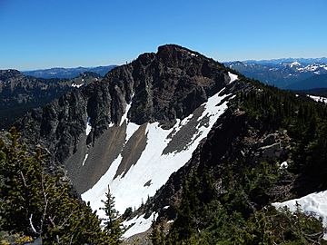
Antler Peak seen from the west
|
|
| Highest point | |
| Elevation | 7,017 ft (2,139 m) |
| Prominence | 377 ft (115 m) |
| Geography | |
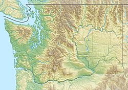
| Location | Mount Rainier National Park Pierce County, Washington, U.S. |
| Parent range | Cascades |
| Topo map | USGS Sunrise |
| Climbing | |
| Easiest route | Scrambling class 2 |
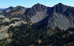
Antler Peak is a mountain peak that stands 7,017 feet (2,139 m) tall. It is located inside Mount Rainier National Park in Washington state, in an area called Pierce County.
This peak is part of the Sourdough Mountains, which are a smaller group of mountains within the larger Cascade Range. Antler Peak is found to the west of Dege Peak and northeast of the Sunrise Historic District. A hiking path called the Sourdough Ridge Trail goes along the south side of Antler Peak, connecting these two areas.
The closest taller mountain is Mount Fremont, which is about 1.55 mi (2.49 km) to the west. All the rain and melted snow that flows off Antler Peak eventually goes into the White River.
Weather at Antler Peak
Antler Peak is in a special weather area called a marine west coast climate zone. This means it's near the ocean, which affects its weather. Most of the weather systems come from the Pacific Ocean and move towards the Cascade Mountains.
When these weather systems reach the mountains, the air is forced to rise. As the air goes higher, it cools down and drops its moisture as rain or snow. This is why the western side of the Cascade Mountains gets a lot of rain and snow, especially in winter.
During the winter, it's often cloudy. But in the summer, high-pressure systems over the Pacific Ocean usually bring clear skies. Because the ocean makes the snow wet and heavy, there is a higher chance of avalanches, which are dangerous snow slides.
External Links
- National Park Service web site: Mount Rainier National Park

 | Claudette Colvin |
 | Myrlie Evers-Williams |
 | Alberta Odell Jones |


