Dege Peak facts for kids
Quick facts for kids Dege Peak |
|
|---|---|

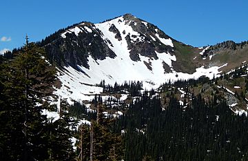
Dege Peak seen from the east at Sunrise Point
|
|
| Highest point | |
| Elevation | 7,006 ft (2,135 m) |
| Prominence | 286 ft (87 m) |
| Isolation | 1.02 mi (1.64 km) |
| Parent peak | Antler Peak (7,017 ft) |
| Geography | |
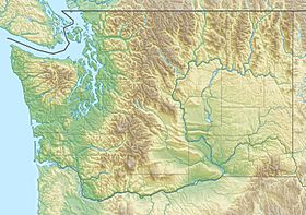
| Location | Mount Rainier National Park Pierce County, Washington, U.S. |
| Parent range | Cascades |
| Topo map | USGS White River Park |
| Climbing | |
| Easiest route | class 1 Trail |
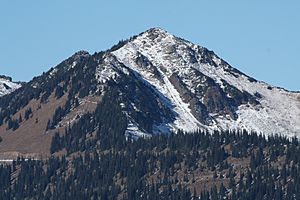
Dege Peak is a cool mountain in Washington state. It stands tall at 7,006 feet (2,135 meters) above sea level. You can find it in Pierce County, right inside the amazing Mount Rainier National Park. This peak is part of the Sourdough Mountains. It got its name in 1932 from James Henry Dege, who was a well-known businessman from Tacoma. His mother was even related to an old U.S. President, Zachary Taylor!
Hiking Adventures at Dege Peak
Dege Peak is a super popular spot for hiking. Why? Because the trail goes above the tree line. This means you get incredible views in every direction! You can see huge glaciers like the Emmons Glacier and Winthrop Glacier. You can also spot Little Tahoma Peak from here. The hiking trail starts at the Sunrise Historic District.
But there's a catch! You can only get to Dege Peak when the snow has melted enough for the Sunrise Road to open. This usually happens in July, August, and September. So, if you want to visit, plan your trip for those summer months!
Dege Peak's Neighbors
Dege Peak has a taller neighbor called Antler Peak. It's about 1.03 miles (1.66 km) to the west. All the rain and snow that melts from Dege Peak flows into the White River.
Weather and Climate
Dege Peak is located in a special climate zone called the marine west coast climate. This means it gets a lot of moisture from the Pacific Ocean. Most weather systems come from the Pacific and move towards the Cascade Mountains. When these weather systems hit the tall mountains, they are forced to rise. This causes them to drop their moisture as rain or snow onto the Cascades.
Because of this, the west side of the Cascades gets a lot of rain and snow, especially in winter. The snow here tends to be wet and heavy. This can sometimes lead to a high danger of avalanches. During winter, it's often cloudy. But in summer, high pressure systems over the Pacific Ocean usually bring clear skies. The best time to visit Dege Peak for clear views is from July through September.
 | William M. Jackson |
 | Juan E. Gilbert |
 | Neil deGrasse Tyson |


