Applethorpe, Queensland facts for kids
Quick facts for kids ApplethorpeQueensland |
|||||||||||||||
|---|---|---|---|---|---|---|---|---|---|---|---|---|---|---|---|

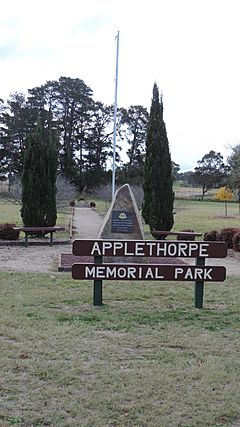
The Applethorpe Memorial Park
|
|||||||||||||||
| Population | 571 (2021 census) | ||||||||||||||
| • Density | 12.227/km2 (31.67/sq mi) | ||||||||||||||
| Postcode(s) | 4378 | ||||||||||||||
| Elevation | 872 m (2,861 ft) | ||||||||||||||
| Area | 46.7 km2 (18.0 sq mi) | ||||||||||||||
| Time zone | AEST (UTC+10:00) | ||||||||||||||
| Location |
|
||||||||||||||
| LGA(s) | Southern Downs Region | ||||||||||||||
| State electorate(s) | Southern Downs | ||||||||||||||
| Federal Division(s) | Maranoa | ||||||||||||||
|
|||||||||||||||
Applethorpe is a small town in Queensland, Australia. It is located in the Southern Downs Region, close to the border with New South Wales. This town is famous for growing lots of apples. It is also known for having some of the coldest temperatures in Queensland.
In 2021, about 571 people lived in Applethorpe.
Contents
Exploring Applethorpe's Location
Applethorpe is found in the Granite Belt area. It sits on the New England Highway, just north of Stanthorpe. The town is quite high up, about 872 meters above sea level.
The Southern railway line goes through Applethorpe. There used to be a train station called Applethorpe railway station, but it is not used anymore.
A Look at Applethorpe's Past
The area was first called Roessler. This name came from an early German settler. But in 1915, the name was changed to Applethorpe. This happened during World War I, when many German names were changed to English ones. The new name, Applethorpe, showed that many apple orchards were in the area.
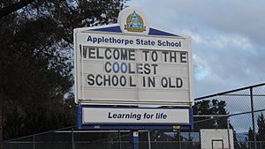
The local school also had its name changed. It opened in 1911 as Four Mile Stanthorpe School. Then it was called Roesseller State School for a few years. In 1917, it became Applethorpe State School, just like the town.
The Applethorpe Post Office opened around 1919. It helped people send letters and packages for many years. It closed down in 1991.
In 2006, Applethorpe had 748 people. About 20% of them worked in farming or related industries.
Weather in Applethorpe
Applethorpe often gets very cold. In 2007, the temperature dropped to a very chilly -7.7 degrees Celsius. However, in July 2010, the lowest temperature recorded was 13.6 degrees Celsius. This was the warmest minimum temperature ever for that month.
Getting Around Applethorpe
You can reach Applethorpe by driving on the New England Highway. Crisps Coaches also offers bus services to Applethorpe. These buses come from Brisbane, Toowoomba, and other nearby cities.
The Stanthorpe Airport is actually located in Applethorpe. It is a public airport managed by the Southern Downs Regional Council. However, there are no regular flights scheduled here.
Learning in Applethorpe
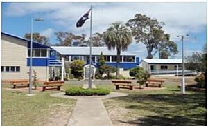
Applethorpe State School is a primary school for kids from Prep to Year 6. It is a government school for both boys and girls. In 2017, the school had 38 students and 4 teachers.
There are no high schools in Applethorpe itself. The closest high school is Stanthorpe State High School. It is located in the nearby town of Stanthorpe.
Fun Things to Do in Applethorpe
- Applethorpe Memorial Park: This park is on Ann Street. It remembers people who served in Australia's defense.
- Granite Mountain Disc Golf: This is a private frisbee golf course. It has hosted big championships for the sport.
- Summit Fruit Run: This is a 12-kilometer tourist drive. It goes from Applethorpe to Dalveen. Along the way, you can see fruit farms and buy fresh fruit.
 | Frances Mary Albrier |
 | Whitney Young |
 | Muhammad Ali |


