Argentine Peak facts for kids
Quick facts for kids Argentine Peak |
|
|---|---|

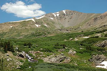
Argentine Peak, July 2006
|
|
| Highest point | |
| Elevation | 13,743 ft (4,189 m) |
| Prominence | 638 ft (194 m) |
| Isolation | 1.49 mi (2.40 km) |
| Geography | |
| Location | Continental Divide between Clear Creek and Summit counties, Colorado, United States |
| Parent range | Front Range |
| Topo map | USGS 7.5' topographic map Montezuma, Colorado |
| Climbing | |
| Easiest route | Hike |
Argentine Peak is a very tall mountain summit in the Front Range of the Rocky Mountains of North America. It stands at 13,743 feet (4,189 meters) high. Mountains over 13,000 feet are sometimes called "thirteeners."
This peak is located in Arapaho National Forest in Colorado, United States. It's about 8.5 miles (13.6 kilometers) southwest of Georgetown. The summit sits on the Continental Divide. This is a special line that separates which way water flows across the continent.
Where is Argentine Peak?
Argentine Peak is found between Clear Creek and Summit counties. It is part of the Front Range mountain group. This range is a major part of the Rocky Mountains.
The peak is also about 1 mile (1.6 kilometers) south of Argentine Pass. A pass is a lower point between mountains. It often makes it easier to travel through a mountain range.
What's in a Name?
The name "Argentine Peak" comes from the "Argentine District." This area was Colorado's first big silver mining district.
The word Argentum is Latin for silver. So, the peak and the pass were named after the valuable silver ore found there. This shows how important mining was in the history of this region.
 | Audre Lorde |
 | John Berry Meachum |
 | Ferdinand Lee Barnett |


