
Armavir Province facts for kids
Quick facts for kids
Armavir
Արմավիր
|
|
|---|---|

Location of Armavir within Armenia
|
|
| Country | Armenia |
| Capital | Armavir |
| Area | |
| • Total | 1,242 km2 (480 sq mi) |
| Area rank | 10th |
| Population | |
| • Total | 282,600 |
| • Rank | 3rd |
| • Density | 227.54/km2 (589.3/sq mi) |
| Time zone | UTC+04 |
| • Summer (DST) | UTC+05 |
| Postal code |
0901-1149
|
| ISO 3166 code | AM.AV |
| FIPS 10-4 | AM03 |
| Website | official website: http://armavir.gov.am/ |
Armavir is a province in Armenia. It's like a region or state within the country. The main city, or capital, of this province is also called Armavir.
This province is located in the western part of Armenia. It sits between two famous mountains: Mount Ararat and Mount Aragats. Armavir also shares a 45-mile border with Turkey to its south and west.
One of the most important places in Armavir is the Holy City of Echmiadzin. This city is the main center of the Armenian Apostolic Church. It is also where the Catholicos of Armenia and of All Armenians lives. He is the spiritual leader of the Armenian Church.
Another historic spot in this region is the city of Sardarapat. This city was the site of a very important battle in 1918, known as the Battle of Sardarapat.
Armavir is the smallest province in Armenia. It has 3 urban communities, which are like towns or cities. It also has 94 rural communities, which are smaller villages.
Images for kids
-
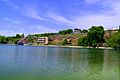
Lake Ayger, Aknalich
-
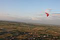
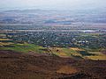
Aerial view of Ararat plain in the Armavir region
-
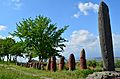
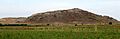
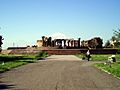
Standing stones at the ruins of Metsamor Castle dating back to the 5th millennium BC
-
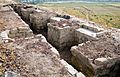
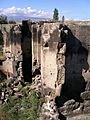
Reconstructed walls of ancient Argishtikhinili
-
The site of ancient Armavir
-
The ruins of Targmanchats monastery of Aygeshat, 6th-7th centuries
-
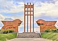
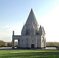
The memorial dedicated to the Armenian victory at the battle of Sardarabad near Araks
-
The village of Yervandashat. The heights in the background are the site of ancient Yervandashat
-
Saint Gregory of Narek Cathedral
-
The Yazidi Temple of Aknalich
-
Quba Mere Diwane temple
-
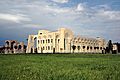
Vatche and Tamar Manoukian Manuscript Depository
-
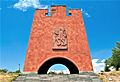
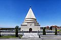
Musa Dagh resistance memorial
-
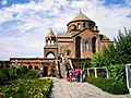
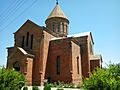
Saint Hripsimé Church of 618, a UNESCO World heritage site
-
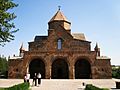
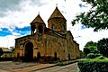
Saint Gayane Church of 630, a UNESCO World heritage site
-
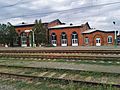
Armavir railway station
-

A greenhouse in Gai, Armavir
-
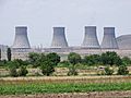
Metsamor Nuclear Power Plant
-
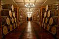
Wine cellars at MAP winery
-
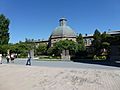
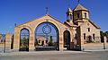
Etchmiadzin Cathedral, 303 AD, a UNESCO World Heritage Site
-
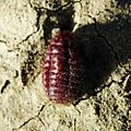
The Armenian cochineal found in the Vordan Karmir Sanctuary
-
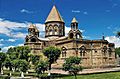
Gevorkian Theological Seminary
-
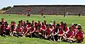
The Jubilee Stadium in July 2014, during the FIFA "Live Your Goals" program
-
Zvartnots Cathedral of the 7th century, a UNESCO World heritage site
-
Shoghakat Church of 1694
-
The church of Bambakashat, 1901
-
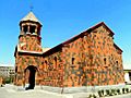
The church of Shahumyan village
-
Lake of Aknalich
.JPG)


.jpg)


.JPG)
See also
 In Spanish: Provincia de Armavir para niños
