Bahawalnagar facts for kids
Quick facts for kids
Bahawalnagar
بہاول نگر
|
||
|---|---|---|
|
City
|
||
 |
||
|
||
|
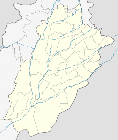
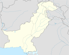
Location in Punjab, Pakistan
|
||
| Country | ||
| Province | ||
| Division | Bahawalpur | |
| District | Bahawalnagar | |
| Union councils | 118 | |
| Government | ||
| • Type | Municipal Committee | |
| Elevation | 163 m (535 ft) | |
| Population
(2023)
|
||
| • City | 241,873 | |
| • Rank | 39th, Pakistan | |
| Time zone | UTC+5 (PST) | |
| • Summer (DST) | +6 | |
| Website | Municipal Committee Bahawalnagar | |
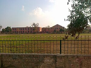
Bahawalnagar is an important city in the Punjab province of Pakistan. It is the capital city of the Bahawalnagar District. The city is also the main center for its district and a smaller area called tehsil.
In 2023, Bahawalnagar was the 39th largest city in Pakistan by population. Its old name was Rojanwali or Ubbha. The city was renamed Bahawalnagar in 1904. This new name honored Bahawal Khan V, who was the ruler of the Bahawalpur state. That state included the areas of Bahawalpur, Bahawalnagar, and Rahim Yar Khan today.
Bahawalnagar is about 262 kilometers (163 miles) south of Lahore. It is also about 175 kilometers (109 miles) east of Bahawalpur. The Sutlej River flows about 6 miles north of the city.
Contents
History of Bahawalnagar
How Bahawalnagar Started
Bahawalnagar began as a small village called Rojhanwali. It had only a few huts and simple homes. This original village is still there, about 1.5 miles north of the current railway station. Bahawalnagar is located on the old Delhi–Multan road. This road was built by the Indian Muslim Emperor Sher Shah Suri. The area around Bahawalnagar was once part of the Multan province during the Mughal Empire.
The Railway Station and Growth
In 1895, a railway station was built in Rojhanwali. It was an important connection point between Bahawalnagar and Bhatinda. Before the country was divided, it was a very busy railway hub. Trains traveled from Karachi to Delhi, passing through Bahawalnagar. Passenger trains also ran to other nearby cities.
In 1904, Nawab Mohammad Bahawal Khan Abbasi IV visited Rojhanwali. The people asked if they could rename the city after him. The Nawab agreed, and so the city became Bahawalnagar. With the railway, about 40 to 50 shops and 100 homes grew up near the railway station.
Canals and Development
At first, the area was not ideal for growth because the land was not good and the drinking water was unhealthy. But then, a system of canals was built. The most important was the Fordwah Canal. This canal brought water to almost the entire district, making the land fertile. The town then grew into a planned settlement south of the railway station.
In the early 1900s, the first police station was set up (1900–1901). The first primary school opened in 1902–1903. In 1906, a local committee was formed to help manage the town. In 1914, Bahawalnagar became a "Tehsil," which is a smaller administrative area. A full municipal committee was created in 1922 to help run the city.
Education in Bahawalnagar
The number of people who can read and write in Bahawalnagar is less than 25%. The government is working to improve this through its schools and colleges. A branch of the Islamia University is also located in Bahawalnagar.
Sports in Bahawalnagar
Haider Stadium is the largest sports stadium in Bahawalnagar City and the entire Bahawalnagar District. It is a key place for sports events.
Population of Bahawalnagar
The population of Bahawalnagar city has grown over the years. Here's how many people lived there during different census years:
| Census Year | Population |
| 1972 | 50,991 |
| 1981 | 74,533 |
| 1998 | 111,313 |
| 2017 | 160,883 |
| 2023 | 241,873 |
City Administration
Bahawalnagar is the main administrative center for the Bahawalnagar District. It is one of five "tehsils" (subdivisions) within the district. This tehsil is further divided into 31 smaller areas called Union Councils.
Climate in Bahawalnagar
Bahawalnagar has a semi-arid climate. This means it has very hot summers and mild winters. Most of the rain falls during the monsoon season, from June to September. Some rain also happens from February to April.
Over the years, global climate change has affected Bahawalnagar. The monsoon rains can sometimes be very heavy and cause floods.
| Climate data for Bahawalnagar, Pakistan | |||||||||||||
|---|---|---|---|---|---|---|---|---|---|---|---|---|---|
| Month | Jan | Feb | Mar | Apr | May | Jun | Jul | Aug | Sep | Oct | Nov | Dec | Year |
| Mean daily maximum °C (°F) | 20 (68) |
23 (73) |
29 (84) |
36 (96) |
40 (104) |
41 (105) |
38 (100) |
37 (98) |
36 (96) |
34 (93) |
28 (82) |
22 (71) |
32 (89) |
| Mean daily minimum °C (°F) | 4 (39) |
7 (44) |
11 (55) |
17 (66) |
22 (73) |
26.9 (82) |
27 (80) |
27 (80) |
24 (75) |
17 (62) |
11 (51) |
6 (42) |
17 (62) |
| Average precipitation mm (inches) | 18 (0.7) |
18 (0.3) |
21 (0.8) |
3 (0.1) |
28 (0.3) |
79 (0.8) |
162 (3.6) |
145 (2.9) |
59 (1.4) |
25 (1.0) |
5 (0.2) |
1 (0.0) |
505 (14.1) |
| Source: Weatherbase 2015 | |||||||||||||
| Climate data for Bahawalnagar | |||||||||||||
|---|---|---|---|---|---|---|---|---|---|---|---|---|---|
| Month | Jan | Feb | Mar | Apr | May | Jun | Jul | Aug | Sep | Oct | Nov | Dec | Year |
| Record high °C (°F) | 29.3 (84.7) |
35.6 (96.1) |
41.5 (106.7) |
45.6 (114.1) |
48.0 (118.4) |
50.1 (122.2) |
46.0 (114.8) |
42.4 (108.3) |
42.0 (107.6) |
40.0 (104.0) |
37.0 (98.6) |
29.6 (85.3) |
50.1 (122.2) |
| Mean daily maximum °C (°F) | 18.6 (65.5) |
19.76 (67.57) |
26.3 (79.3) |
33.9 (93.0) |
39.8 (103.6) |
41.7 (107.1) |
36.3 (97.3) |
34.4 (93.9) |
34.5 (94.1) |
33.2 (91.8) |
25.6 (78.1) |
20.5 (68.9) |
30.38 (86.68) |
| Daily mean °C (°F) | 13.3 (55.9) |
15.7 (60.3) |
21.0 (69.8) |
28.0 (82.4) |
32.8 (91.0) |
35.1 (95.2) |
33.1 (91.6) |
32.4 (90.3) |
30.6 (87.1) |
26.4 (79.5) |
20.6 (69.1) |
15.0 (59.0) |
25.3 (77.6) |
| Mean daily minimum °C (°F) | 4.8 (40.6) |
7.4 (45.3) |
12.5 (54.5) |
18.5 (65.3) |
23.7 (74.7) |
26.2 (79.2) |
27.7 (81.9) |
26.4 (79.5) |
24.7 (76.5) |
17.5 (63.5) |
10.6 (51.1) |
6.6 (43.9) |
17.2 (63.0) |
| Record low °C (°F) | 0.0 (32.0) |
−1.0 (30.2) |
3.9 (39.0) |
12.6 (54.7) |
14.4 (57.9) |
18.3 (64.9) |
16.1 (61.0) |
21.4 (70.5) |
13.1 (55.6) |
11.0 (51.8) |
4.0 (39.2) |
1.7 (35.1) |
−1.0 (30.2) |
| Average precipitation mm (inches) | 12.5 (0.49) |
26.5 (1.04) |
30.2 (1.19) |
25.2 (0.99) |
24.8 (0.98) |
65.3 (2.57) |
160.2 (6.31) |
130.9 (5.15) |
59.5 (2.34) |
11.0 (0.43) |
4.3 (0.17) |
9.0 (0.35) |
559.4 (22.01) |
| Mean monthly sunshine hours | 222.4 | 218.9 | 250.8 | 274.3 | 269.1 | 213.9 | 218.3 | 256.6 | 279.3 | 284.0 | 260.8 | 223.5 | 2,971.9 |
| Source: NOAA (1971–1990) | |||||||||||||
See also
 In Spanish: Bahawalnagar para niños
 | John T. Biggers |
 | Thomas Blackshear |
 | Mark Bradford |
 | Beverly Buchanan |


