Balliet Run facts for kids
Quick facts for kids Balliet Run |
|
|---|---|

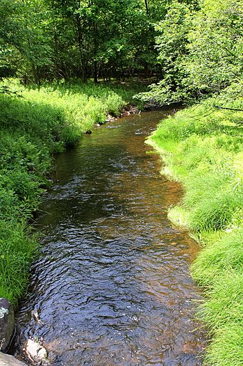
Balliet Run near its mouth
|
|
| Physical characteristics | |
| Main source | base of Nescopeck Mountain, not far from Nescopeck Pass in Dorrance Township, Luzerne County, Pennsylvania between 1,360 and 1,380 feet (410 and 420 m) |
| River mouth | Big Wapwallopen Creek in Hollenback Township, Luzerne County, Pennsylvania 801 ft (244 m) 41°03′30″N 76°04′10″W / 41.0582°N 76.0694°W |
| Length | 7.3 mi (11.7 km) |
| Basin features | |
| Progression | Big Wapwallopen Creek → Susquehanna River → Chesapeake Bay |
| Basin size | 7.23 sq mi (18.7 km2) |
| Tributaries |
|
Balliet Run (also known as Balliet's Run) is a small stream in Luzerne County, Pennsylvania. It flows into Big Wapwallopen Creek. This stream is about 7.3 miles (11.7 km) long. It passes through Dorrance, Hollenback, and Butler Townships.
The area of land that drains into Balliet Run is 7.23 square miles (18.7 km2). The stream has two smaller streams, called tributaries, that flow into it. Balliet Run is special because it is known for its wild trout. Both brook trout and brown trout live in its clear waters.
Contents
The Path of Balliet Run
Balliet Run starts at the bottom of Nescopeck Mountain in Dorrance Township. It begins near a place called Nescopeck Pass. The stream first flows west for a short distance, even going under Interstate 81.
Then, it turns southwest and flows along the northern side of Nescopeck Mountain for a few miles. It passes by a small community called Springtown. After that, the stream turns northwest, moving away from the mountain.
It receives an unnamed tributary from its right side. Then, it flows southwest for about a mile and leaves Dorrance Township. Balliet Run then enters Hollenback Township. It turns south, getting closer to Nescopeck Mountain again. Here, it gets another unnamed tributary from its left side.
The stream briefly enters Butler Township before returning to Hollenback Township. Finally, it flows west-northwest, then southwest, and then west. It eventually joins Big Wapwallopen Creek. Balliet Run meets Big Wapwallopen Creek about 5.18 miles (8.34 km) before the creek reaches its own mouth.
Stream Helpers: Tributaries
Balliet Run does not have any named tributaries. However, it does have two smaller streams that flow into it. These are unnamed. One of these helper streams is about 0.8 miles (1.3 km) long. The other is about 1.5 miles (2.4 km) long.
Water Flow and Quality
The amount of water flowing in Balliet Run can change. The highest amount of water it usually carries in a year is about 780 cubic feet per second. There is a 10 percent chance of this happening.
The water in Balliet Run has a certain level of alkalinity, which is a measure of how well it can neutralize acids. This level is 11 milligrams per liter.
A local facility called YRC Wilkes Barre Terminal has permission to release treated water into Balliet Run.
Land and Rocks Around the Stream
The land around Balliet Run is interesting. The stream's mouth is about 801 feet (244 m) above sea level. Where the stream begins, its source, the elevation is higher, between 1,360 and 1,380 feet (410 and 420 m) above sea level.
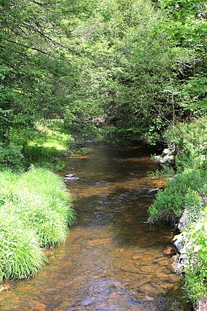
Balliet Run is a small stream. Many people say it feels like a mountain stream. It gets its water from natural springs. An article in the Times Leader newspaper once said that the stream's "cool, clear water" feels very special.
Most of the upper parts of Balliet Run are on a type of soil called Wisconsinan Till. This soil was left behind by glaciers. Some areas also have fill (material used to raise land). The bedrock under the stream includes sandstone, conglomerate, and shale.
The Stream's Drainage Area
The watershed of Balliet Run covers an area of 7.23 square miles (18.7 km2). This is the total land area that drains water into the stream. The mouth of the stream is located in the Sybertsville area. However, its source is in the Freeland area.
Balliet Run flows entirely through private land. This means that public access to the stream is not allowed. There are about 10.73 miles (17.27 km) of streams within its watershed. There is also a small wetland area where the stream begins.
A Look Back: History of Balliet Run
Balliet Run was officially added to the Geographic Names Information System on August 2, 1979. This system helps keep track of names for places like streams.
In the 1980s, a club for skeet shooting (a sport where people shoot at clay targets) owned land near Balliet Run. This club was called Ashley Skeet Club.
Balliet Run was first stocked with fish in 1957. This means fish were added to the stream by people. However, in 2007, it was named "Class A Wild Trout Waters." This special title means it has a healthy population of naturally reproducing trout. In 2013, a large piece of land (100 acres) along the stream was set aside for conservation. This was done to protect the local bat and trout populations.
There were once concerns that a nearby quarry (a place where stone is dug out) might affect Balliet Run. However, the quarry's president stated that they would take steps to prevent any negative impact on the stream or wetlands.
Wildlife in Balliet Run
Balliet Run is home to brown trout. The amount of brown trout living in the stream is very high. This is why it qualifies as "Class A Wild Trout Waters." This special designation means the stream has a very healthy population of wild trout. Native brook trout also live in the stream.
The Pennsylvania Fish and Boat Commission considers Balliet Run to be excellent habitat for brown trout. This applies from where the stream starts all the way to where it joins Big Wapwallopen Creek. The stream is important for both coldwater fish and fish that travel long distances.
 | William Lucy |
 | Charles Hayes |
 | Cleveland Robinson |


