Big Wapwallopen Creek facts for kids
Quick facts for kids Big Wapwallopen Creek |
|
|---|---|
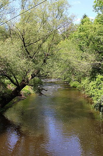
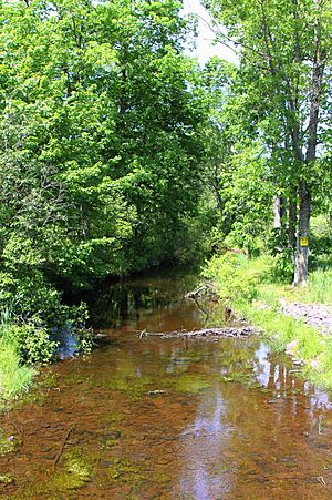
Big Wapwallopen Creek in Hollenback Township in June 2015
|
|
| Other name(s) | Wapwallopen Creek, Big Wap |
| Physical characteristics | |
| Main source | Crystal Lake in Bear Creek Township, Luzerne County, Pennsylvania between 1,920 and 1,940 feet (590 and 590 m) |
| River mouth | Susquehanna River on the border between Conyngham Township, Luzerne County, Pennsylvania and Nescopeck Township, Luzerne County, Pennsylvania 495 ft (151 m) 41°04′22″N 76°08′06″W / 41.07277°N 76.13506°W |
| Length | 23 mi (37 km) |
| Basin features | |
| Progression | Susquehanna River → Chesapeake Bay |
| Basin size | 53.2 sq mi (138 km2) |
| Tributaries |
|
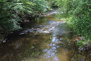
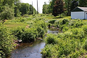
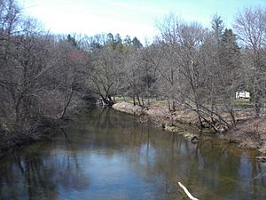
Big Wapwallopen Creek (also called Wapwallopen Creek or Big Wap) is a stream in Luzerne County, Pennsylvania, in the United States. It flows into the Susquehanna River. The creek is about 23 miles (37 km) long. It flows through several townships, including Bear Creek, Fairview, Rice, Wright, Dorrance, Hollenback, Nescopeck, and Conyngham.
The area drained by the creek is 53.2 square miles (138 km2). Big Wapwallopen Creek has three main streams that flow into it: Balliet Run, Watering Run, and Bow Creek. This creek is a special place for fish, known as a Coldwater Fishery and a Migratory Fishery. It's also a "Class A Wild Trout Waters" in some parts, meaning wild trout live and reproduce there.
The creek has three big waterfalls, each over 25 feet (7.6 m) tall. In its lower parts, the creek flows through a deep valley called the Wapwallopen Gorge. Here, the water drops 210 feet (64 m)! The creek mostly flows over sandstone and shale rocks. Big Wapwallopen Creek has been around for millions of years, but the part that goes through the Wapwallopen Gorge is much younger, less than 20,000 years old.
Most of the land around the creek is rural and covered in forests. The creek can cause flooding in six different townships. The name "Wapwallopen Creek" comes from a Native American village that used to be nearby. The Delaware and Shawnee tribes lived in this area long ago. Many mills were built along the creek in the 1700s and 1800s, including two powder mills in the Wapwallopen Gorge. One of these, built in 1859, was one of the biggest powder mills in the United States at the time. It operated until 1912. Many bridges were also built over the creek in the 1900s. The Wapwallopen Gorge is a special natural area in Luzerne County. You can even canoe on about 10.3 miles (16.6 km) of the creek, but some spots are too difficult to pass.
Contents
Where the Creek Flows
Big Wapwallopen Creek starts in Crystal Lake in Bear Creek Township. It flows west, then southwest, crossing roads like Pennsylvania Route 437 and Pennsylvania Route 309. It goes through areas like Pole Bridge Swamp and Hickory Swale.
As it continues, the creek flows along the border of Rice Township and Wright Township. It then enters Dorrance Township, crossing Interstate 81. The creek winds its way through Feys Grove and then into Hollenback Township.
Near the end of its journey, the creek enters a deep valley called a gorge. It flows through this gorge, crossing the border between Hollenback Township and Nescopeck Township several times. Finally, it leaves the gorge, crosses Pennsylvania Route 239, and meets the Susquehanna River near Wapwallopen.
Big Wapwallopen Creek joins the Susquehanna River about 166.64 miles (268.18 km) upstream from where the Susquehanna River flows into the ocean.
Creek's Branches
Big Wapwallopen Creek has three main branches, or tributaries, that flow into it: Balliet Run, Watering Run, and Bow Creek. There are also many smaller, unnamed branches.
- Balliet Run joins the creek about 5.18 miles (8.34 km) before its mouth.
- Watering Run joins about 8.46 miles (13.62 km) before the mouth.
- Bow Creek joins about 11.90 miles (19.15 km) before the mouth.
Water Quality and Flow
A part of Big Wapwallopen Creek was found to have some water quality issues in 2004. This was due to too much organic material or not enough dissolved oxygen in the water.
The creek has a special measuring station near Wapwallopen that tracks its water flow. The average amount of water flowing in the creek in 2013 was 52.3 cubic feet per second (1.48 m3/s). The amount of water in the creek changes a lot throughout the year and from year to year. For example, in some years like 2001, the average flow was very high, while in other years like 1965, it was much lower.
When there are big storms, the creek can have very high flows, which can cause flooding. For instance, there's a 10% chance that the water flow near the creek's mouth could reach 3350 cubic feet per second during a flood.
Creek's Landscape and Features
The creek starts high up, between 1,920 and 1,940 feet (590 and 590 m) above sea level. It then flows down to an elevation of 495 feet (151 m) where it meets the Susquehanna River. The land around the creek has rolling hills, some swamps, and lakes.
Big Wapwallopen Creek is located in a region known for its ridges and valleys. Closer to its mouth, you'll find three large waterfalls. All of them are over 25 feet (7.6 m) tall, with the highest one being 45 feet (14 m). These falls are called the Upper, Middle, and Lower Falls. The creek also has many rapids formed by rocks and boulders.
The creek flows through a special valley called the Wapwallopen Gorge, also known as the Powder Hole. In this gorge, the creek drops a total of 210 feet (64 m). The gorge was formed millions of years ago, but the creek changed its path about 20,000 years ago during the last Ice Age. Instead of following its old path, it carved a new one through solid rock.
The creek's path is winding and goes through rock layers made of sandstone and shale. In the Wapwallopen Gorge, it cuts through older rocks, some dating back 380 million years!
Weather and Water Temperature
The area around Big Wapwallopen Creek gets about 35 to 45 inches (89 to 114 cm) of rain each year. The water temperature of the creek changes with the seasons. It can be as cold as 0.0 °C (32.0 °F) in January and as warm as 26.0 °C (78.8 °F) in August.
Creek's Surroundings
The entire area that drains into Big Wapwallopen Creek is 53.2 square miles (138 km2). Most of this area, about 84%, is covered by forests. The creek's mouth is about 17 miles (27 km) southwest of the city of Wilkes-Barre. The town of Mountain Top is located near where the creek begins.
The creek flows through a rural valley with steep slopes. The first 4.7 miles (7.6 km) of the creek are on private land. There's a dammed lake called Crystal Lake at the creek's source. This lake is used to supply public drinking water.
Big Wapwallopen Creek is a main cause of flooding in several townships, including Rice, Wright, Conyngham, Dorrance, Fairview, Hollenback, and Nescopeck. However, in Conyngham Township, a large flood would only affect a small, undeveloped area.
The land around the creek is important for aquatic life, meaning it's a good place for water plants and animals to live.
Creek's History
Big Wapwallopen Creek was officially added to the Geographic Names Information System in 1979. It's also known by its shorter names, Wapwallopen Creek or Big Wap.
The creek gets its name from a Native American village that was once located near the Susquehanna River, close to the creek. The Delaware and Shawnee tribes had camps and homes along the creek, hunting and fishing there as early as 1675.
In the late 1700s and 1800s, many mills were built along Big Wapwallopen Creek. Nathan Beach built a mill in the Wapwallopen Gorge in 1795. Later, in 1856, William Silver built a powder mill in the gorge. This mill was damaged by an explosion and a flood. Then, in 1859, the Du Pont company bought the site and built the Wapwallopen Mills, which became one of the largest powder mills in the United States. These mills made black powder until 1912. Today, only ruins of these mills remain.
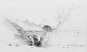
In 1852, an artist named Thomas Addison Richards made a drawing of Big Wapwallopen Creek. The Crystal Spring Water Company, started in 1861, got its water from the upper parts of the creek's watershed. In the 1800s, there was also a tannery (a place that makes leather) on a branch of the creek. By 1865, the community of Dorrance had several mills and a tavern on the creek.
In the early 1900s, agriculture was the main industry in the creek's watershed. The creek and Crystal Lake were used for water supply. There was also a small hydroelectric plant and other mills that used the creek's water for power. Towns like Wapwallopen, Hobbie, and Briggsville were the main communities in the area. Several railroads also passed through the creek's watershed.
Big Wapwallopen Creek has flooded several times. In March 1936, it flooded in Rice Township. Larger floods happened in August 1955 and June 1972, causing water to rise on roads and flood homes.
Many bridges have been built over the creek over the years, especially in the 1900s. These include metal truss bridges, masonry arch bridges, and concrete bridges. Some of these bridges carry major roads like Interstate 81 and Pennsylvania Route 239.
Today, there's a group called the Big Wapwallopen Creek Watershed Association that works to protect the creek.
Creek's Wildlife
The Pennsylvania Department of Environmental Protection has named Big Wapwallopen Creek a Coldwater Fishery and a Migratory Fishery. This means it's a great place for fish that prefer cold water and for fish that travel to different waters. Wild trout naturally live and reproduce in the creek and all its named branches. A 4.7-mile (7.6 km) part of the creek is even called "Class A Wild Trout Waters" for both brook trout and brown trout.
The creek is also stocked with trout, meaning fish are added to it for fishing. In 2014, rainbow trout were added before fishing season. Other fish like minnows and suckers have also been seen in the creek.
In 1967, a serious incident occurred when a tank of a harmful substance spilled into the creek. This caused a major fish kill, affecting about 4000 fish, including minnows, suckers, and trout.
Along the creek, you can find hemlock trees that create a shady canopy in some spots. The Wapwallopen Gorge is recognized as an important natural area. You'll see hemlock and yellow birch trees at the top of the gorge, and river birch and sycamore trees further down. The land along the creek also has forests and wet areas like vernal pools and marshes. These wet areas are important places for reptiles, amphibians, fish, and other small water creatures to live and breed.
Fun Activities
You can go canoeing on about 10.3 miles (16.6 km) of Big Wapwallopen Creek, especially after snow melts or a heavy rain. The difficulty for canoeing is usually easy to medium, but there's at least one waterfall in the Wapwallopen Gorge that you cannot canoe over. People who have canoed here describe the scenery as "good to excellent" and call the creek "short and scenic" and a "clear brook." There are also places to go hiking along the lower parts of the creek.
The creek has three popular swimming holes, known together as the Powder Hole. While these spots are enjoyed by many, it's important to be careful as they have had a high rate of injuries in the past.
A Jewish camp called Camp Davidowitz used to be located along Big Wapwallopen Creek.
The creek is a popular spot for trout fishing. In 2016, the trout fishing season opened on April 16.
|
 | Calvin Brent |
 | Walter T. Bailey |
 | Martha Cassell Thompson |
 | Alberta Jeannette Cassell |


