Bandera Mountain facts for kids
Quick facts for kids Bandera Mountain |
|
|---|---|

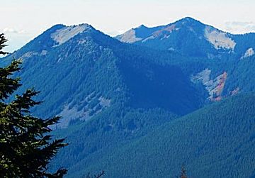
Bandera Mountain (left) and Mount Defiance (right)
|
|
| Highest point | |
| Elevation | 5,245 ft (1,599 m) NAVD 88 |
| Prominence | 961 ft (293 m) |
| Geography | |
| Topo map | USGS Bandera |
| Climbing | |
| Easiest route | Trail and Scrambling |
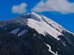
Bandera Mountain is a cool mountain located near Snoqualmie Pass in Washington. It's part of the beautiful Alpine Lakes Wilderness. This mountain is a popular spot for hikers and adventurers!
You can reach Bandera Mountain using the Mason Lake Trail. This trail is also known as the Ira Springs Memorial Trail. To get there, you'll take Exit 45 off I-90 and then follow Forest Road 9031. It's a great place to explore the outdoors!
Weather at Bandera Mountain
Bandera Mountain is in a special weather zone called the marine west coast climate. This means it gets a lot of moisture from the Pacific Ocean.
How Mountains Affect Weather
Most of the weather systems start over the Pacific Ocean. They travel northeast towards the Cascade Mountains. When these weather systems hit the tall peaks of the Cascade Range, they are forced to rise. As the air goes up, it cools down. This causes the moisture in the air to turn into rain or snow. This process is called Orographic lift.
Because of this, the western side of the Cascades gets a lot of rain and snow. This is especially true during the winter months. So, expect snowy winters if you visit Bandera Mountain!
Summer vs. Winter Weather
In winter, the weather is often cloudy and wet. But in summer, things change! High pressure systems over the Pacific Ocean become stronger. This often brings clear skies and lots of sunshine to the mountain.
All the water that falls on Bandera Mountain eventually flows into the Snoqualmie River. It's all part of the natural water cycle!
 | Sharif Bey |
 | Hale Woodruff |
 | Richmond Barthé |
 | Purvis Young |


