Barellan Point, Queensland facts for kids
Quick facts for kids Barellan PointIpswich, Queensland |
|||||||||||||||
|---|---|---|---|---|---|---|---|---|---|---|---|---|---|---|---|
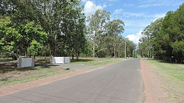
Junction Road looking east from the intersection with Fifth Avenue, 2021
|
|||||||||||||||
| Population | 1,173 (2021 census) | ||||||||||||||
| • Density | 326/km2 (840/sq mi) | ||||||||||||||
| Postcode(s) | 4306 | ||||||||||||||
| Area | 3.6 km2 (1.4 sq mi) | ||||||||||||||
| Time zone | AEST (UTC+10:00) | ||||||||||||||
| Location | |||||||||||||||
| LGA(s) | City of Ipswich | ||||||||||||||
| State electorate(s) | Ipswich West | ||||||||||||||
| Federal Division(s) | Blair | ||||||||||||||
|
|||||||||||||||
Barellan Point is a quiet, mostly residential area in Ipswich, Queensland, Australia. It's a place where people live in homes with bigger yards, often surrounded by nature. In 2021, about 1,173 people called Barellan Point home. It's known for its peaceful setting near two important rivers.
Contents
Exploring Barellan Point's Location
Barellan Point is located where two major rivers meet. The Brisbane River forms its eastern border. The Bremer River runs along its southern edge. This makes it a very scenic spot.
Islands Near Barellan Point
The area also includes two small islands in the Brisbane River.
- Bedwell Island is about 3.2 hectares in size.
- Finlay Island is slightly larger, at 3.27 hectares. It is now connected to the mainland of Barellan Point. These islands are not inhabited by people.
A Glimpse into Barellan Point's Past
Barellan Point has an interesting history, especially linked to its rivers and a time of war.
Joseph Brady's River Work
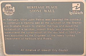
In 1864, an engineer named Joseph Brady was hired. His job was to improve the Brisbane and Bremer Rivers. This was to make it easier for boats to travel between Brisbane and Ipswich.
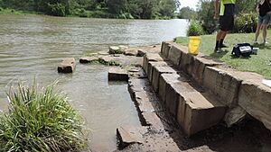
One of his projects was building a special wall at Barellan Point. This wall helped control the river's flow. It stopped sand from building up, which kept the river channel clear for ships.
Barellan Point's World War II Airfield
During World War II, a secret airfield was built here. It was called the Barellan Point Landing Ground. It was also known as the Bremer River or Riverview Landing Ground.
This airfield was created by RAAF Base Amberley. It was mainly for planes needing to make emergency landings. However, it was also used by RAAF No 23 Squadron for training flights. The landing strip was very long, about 3,000 feet. It stretched from Dampier Street to Fifth Avenue.
After the war ended, the land went back to being farmland.
Remembering the Airfield
Today, a special memorial stands at the corner of Fifth Avenue and Junction Road. It remembers the Barellan Point Landing Ground. The memorial was officially opened in 2015. The Queensland Governor, Paul de Jersey, was there for the ceremony.
Joseph Brady Park: A Community Space
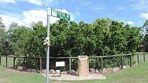
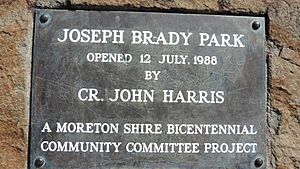
In 1988, a park was opened to honor Joseph Brady. It's called Joseph Brady Park. This park celebrates his important engineering work in the area. It was part of Australia's 200th birthday celebrations.
Barellan Point's Population
The number of people living in Barellan Point has stayed quite steady over the years.
- In 2006, there were 1,178 residents.
- In 2016, the population was 1,159 people.
- By 2021, it had slightly increased to 1,173 people.
Local Parks and Fun Spots
Barellan Point has several parks where people can relax and enjoy nature.
- Faulkner Crescent Reserve
- Findlay Park
- Hallett Park
- Joseph Brady Park: This park is located right where the two rivers meet. It's a great spot for fishing.
- Mitchell Street Reserve
- Riverside Avenue Reserve (1260a)
- Springdale Park
- Third Avenue Reserve
 | Ernest Everett Just |
 | Mary Jackson |
 | Emmett Chappelle |
 | Marie Maynard Daly |


