Barron River (Queensland) facts for kids
Quick facts for kids Barron |
|
|---|---|

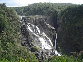
The Barron Falls near Kuranda
|
|
|
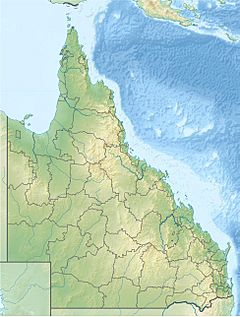
Location of Barron River river mouth in Queensland
|
|
| Native name | Bibhoora |
| Country | Australia |
| State | Queensland |
| Region | Far North Queensland |
| Physical characteristics | |
| Main source | Atherton Tablelands below Mount Hypipamee 1,200 m (3,900 ft) 17°25′48″S 145°30′48″E / 17.43000°S 145.51333°E |
| River mouth | Coral Sea Machans Beach/Aeroglen 0 m (0 ft) 16°51′41″S 145°46′15″E / 16.86139°S 145.77083°E |
| Length | 165 km (103 mi) |
| Basin features | |
| Basin size | 2,138 km2 (825 sq mi) |
| Tributaries |
|
| Waterfalls | Barron Falls; Dinner Falls |
| National parks | Mount Hypipamee National Park; Barron Gorge National Park |
The Barron River is a major river in northern Queensland, Australia. Its original Indigenous name is Bibhoora. The river starts high up in the Atherton Tablelands, near Mount Hypipamee. It flows for about 165 kilometers (103 miles). The Barron River collects water from a large area of about 2,138 square kilometers (825 square miles). It flows through Lake Tinaroo and eventually reaches the Coral Sea near Smithfield.
Contents
Where is the Barron River Located?
The Barron River begins in the Mount Hypipamee National Park. This area is about 1,200 meters (3,937 feet) above sea level. The river flows north for about 65 kilometers (40 miles) across the Atherton Tablelands. After passing Mareeba, it turns east towards Kuranda.
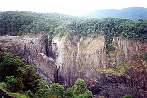
The river then goes under the Kuranda Range Highway bridge. It flows through Kuranda itself. A major feature is the Barron Falls, where the river drops about 260 meters (853 feet). Another waterfall, the Dinner Falls, is found along the upper part of the river. After the falls, the river reaches the Cairns floodplains near Smithfield.
How the River Changed Over Time
Long ago, some of the water that used to flow into the Mitchell River was naturally redirected into the Barron River. This extra water helped create the deep and narrow Barron Gorge. Today, much of the water that once flowed over the Barron Falls is used to make electricity. This happens at the Barron Gorge Hydroelectric Power Station.
What Feeds the River?
The Barron River's catchment area includes many smaller streams and creeks. These include Kauri, Mazlin, McLean, Maroobi, Peterson, and Severin Creeks, which flow into Lake Tinaroo. Other important creeks are Emerald Creek, Granite Creek, and the Clohesy River. Stoney Creek also adds water to the Barron.
Before the Barron River flows into the Coral Sea, it splits into three main channels. These are the main river channel, Thomatis/Richters Creek, and Redden Creek. When there are floods, two more channels, Barr Creek and Half Moon Creek, also become active.
The river is important for the beaches north of Cairns. It provides the sand for these beaches.
History of the Barron River
The original Aboriginal name for the river is Bibhoora. The name "Barron River" was given in 1875. Two police officers, Robert Arthur Johnstone and Alexander Douglas-Douglas, named it after Thomas Henry Bowman Barron. He was a chief clerk of police in Brisbane. The first European to discover the river was James Venture Mulligan in 1874. The river also gives its name to the electoral district of Barron River, a local government area created in 1971.
Flooding in the River
The lower parts of the Barron River have often experienced floods. These floods have been recorded since the early 1900s. Even though the Tinaroo Falls Dam exists, it does not stop all floods. Both farming areas and homes can be affected by high water. Since 1995, a system of rainfall and river height stations has been set up. This helps the Cairns City Council warn people about floods.
In 1939, a strong cyclone caused a lot of flooding on the Barron River. The river even changed its path. The mouth of the Barron River moved about 2 kilometers (1.2 miles) north. One of the worst floods happened in 1950. This was because a major tropical cyclone stayed along the Queensland coast for over a week.
Animals in the River
The Barron River is home to many kinds of fish. However, some non-native fish have been introduced. This has caused a decrease in the number and variety of native fish species.
About 63 different types of fish have been found in the river. Some of these include the glassfish, barred grunter, Snub-nosed Garfish, Fly-specked hardyhead, and Mouth almighty. You might also find Bigeye Trevally, Gobys, Jungle Perch, and eastern rainbowfish. Other fish include the Bony bream, Spotted scat, Giant gudgeon, Freshwater Longtom, and Seven-spot Archerfish.
See also
 In Spanish: Río Barron (Queensland) para niños
 | Lonnie Johnson |
 | Granville Woods |
 | Lewis Howard Latimer |
 | James West |


