Aeroglen facts for kids
Quick facts for kids AeroglenCairns, Queensland |
|||||||||||||||
|---|---|---|---|---|---|---|---|---|---|---|---|---|---|---|---|

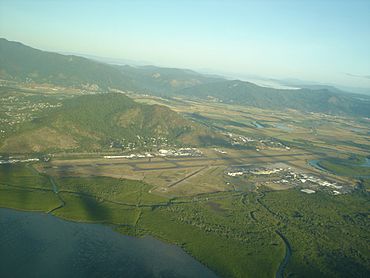
Aeroglen and Cairns Airport with Mount Whitfield directly behind it, as seen from the Coral Sea
|
|||||||||||||||
| Population | 405 (2021 census) | ||||||||||||||
| • Density | 29.35/km2 (76.0/sq mi) | ||||||||||||||
| Postcode(s) | 4870 | ||||||||||||||
| Area | 13.8 km2 (5.3 sq mi) | ||||||||||||||
| Time zone | AEST (UTC+10:00) | ||||||||||||||
| Location | |||||||||||||||
| LGA(s) | Cairns Region | ||||||||||||||
| State electorate(s) | Cairns | ||||||||||||||
| Federal Division(s) | Leichhardt | ||||||||||||||
|
|||||||||||||||
Aeroglen is a small coastal suburb located in Cairns, Queensland, Australia. It's about 5 kilometers (3 miles) north of the main city center. In 2021, about 405 people lived in Aeroglen.
Contents
Discovering Aeroglen's Location
Aeroglen is surrounded by natural features. To the north, you'll find the Barron River. The Coral Sea borders it to the east. Lily Creek is to the south. The Captain Cook Highway runs through the area, with most homes on its east side.
This suburb sits at the bottom of Mount Whitfield Conservation Park. This means it has a bit of a slope.
The Captain Cook Highway enters Aeroglen from the south. It then heads north-west towards Barron and Machans Beach.
The Tablelands railway line also comes into Aeroglen from the south. It runs just west of the highway. This railway line then goes west towards Stratford. There used to be a train station called Aeroglen railway station here, but it's not used anymore.
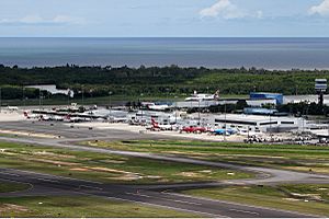
A very large part of Aeroglen is taken up by the Cairns International Airport. This airport is located between the highway and the Coral Sea.
A Glimpse into Aeroglen's Past
Aeroglen is on the traditional lands of the Yidinji Aboriginal people. They have lived here for a very long time.
The name "Aeroglen" was first used before 1939. It got its name because it's so close to the old aerodrome (an early airport). The Australian Government bought this aerodrome in 1937. Before it was called Aeroglen, the area was known as Quarry Siding.
Who Lives in Aeroglen?
In 2011, Aeroglen had 403 residents. The population stayed the same in 2016, with 403 people. In 2021, the population grew slightly to 405 people.
In 2016, most people (77.6%) living in Aeroglen were born in Australia. Also, most people (86.8%) spoke only English at home. When asked about religion, the most common answer was "No Religion," given by 38.2% of the people.
Learning in Aeroglen
There are no schools directly in Aeroglen itself. However, there are several schools nearby.
- The closest government primary schools are:
* Edge Hill State School in Edge Hill (to the south-west) * Freshwater State School in Freshwater (to the west) * Machans Beach State School in Machans Beach (to the north)
- The closest secondary school (high school) is Cairns State High School. It's located in Cairns North, which is just south of Aeroglen.
 | Jessica Watkins |
 | Robert Henry Lawrence Jr. |
 | Mae Jemison |
 | Sian Proctor |
 | Guion Bluford |


