Whitfield, Queensland facts for kids
Quick facts for kids WhitfieldCairns, Queensland |
|||||||||||||||
|---|---|---|---|---|---|---|---|---|---|---|---|---|---|---|---|

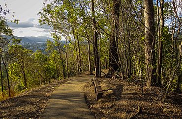
Red Arrow walk on Mount Whitfield
|
|||||||||||||||
| Population | 4,262 (2021 census) | ||||||||||||||
| • Density | 710/km2 (1,800/sq mi) | ||||||||||||||
| Postcode(s) | 4870 | ||||||||||||||
| Area | 6.0 km2 (2.3 sq mi) | ||||||||||||||
| Time zone | AEST (UTC+10:00) | ||||||||||||||
| Location |
|
||||||||||||||
| LGA(s) | Cairns Region | ||||||||||||||
| State electorate(s) | Cairns | ||||||||||||||
| Federal Division(s) | Leichhardt | ||||||||||||||
|
|||||||||||||||
Whitfield is a lovely suburb located in Cairns, a city in Queensland, Australia. It's part of the wider Cairns Region. In 2021, about 4,262 people called Whitfield home.
Contents
Exploring Whitfield's Geography
Whitfield is known for its beautiful natural features. It has two main mountains that stand tall:
- Lumley Hill, which is about 325 meters high.
- Mount Whitfield, which reaches about 365 meters.
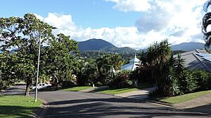
The southern part of Whitfield is where most people live. It's a residential area that starts near sea level and goes up to about 50 meters high on the slopes of Mount Whitfield.
The northern part of the suburb is mostly untouched bushland. This area is part of the Mount Whitfield Conservation Park. This park covers the higher parts of Mount Whitfield, which goes up to 350 meters. It's a great place for nature lovers!
A Glimpse into Whitfield's Past
Whitfield is located on the traditional lands of the Yidinji Aboriginal people. They have lived in this area for a very long time.
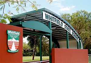
A key part of the suburb's history is the opening of Whitfield State School. It welcomed its first students on January 23, 1989.
Who Lives in Whitfield?
The number of people living in Whitfield has changed a little over the years.
- In 2011, there were 4,176 people.
- By 2016, the population grew slightly to 4,275 people.
- In the most recent count in 2021, Whitfield had 4,262 residents.
Special Places in Whitfield
Whitfield has some buildings and places that are important to its history. These are called heritage listings. One such special place is:
- The Oribin Studio at 16 Heavey Crescent.
Learning and Education in Whitfield
Whitfield is home to a great primary school called Whitfield State School.
- It's a government school for students from Prep (the first year of school) up to Year 6.
- Both boys and girls attend this school, which is located at 42-74 McManus Street.
- In 2018, the school had 831 students. It also has a special education program to help students with different learning needs.
While Whitfield doesn't have its own high schools, students can easily go to nearby secondary schools. The closest government high schools are:
- Trinity Bay State High School in Manunda.
- Cairns State High School in Cairns North.
Fun and Recreation in Whitfield
Whitfield has several parks where people can relax and enjoy the outdoors. These green spaces are perfect for playing, walking, or just spending time with friends and family.
- Colin Penridge Park
- Murchison Street Park
- Ross Allen Park
 | Delilah Pierce |
 | Gordon Parks |
 | Augusta Savage |
 | Charles Ethan Porter |


