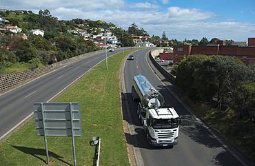
Bass Highway, Tasmania facts for kids
Quick facts for kids Bass HighwayTasmania |
|
|---|---|
 |
|
| The Bass Highway in Burnie | |
| General information | |
| Type | Highway |
| Length | 273 km (170 mi) |
| Route number(s) |
|
| Former route number |
|
| Major junctions | |
| East end | Prospect, Launceston, Tasmania |
|
|
| West end | Marrawah, Tasmania |
| Location(s) | |
| Region | Tasmania |
| Major settlements | Deloraine, Devonport, Ulverstone, Burnie, Wynyard, Smithton |
| Highway system | |
| Highways in Australia National Highway • Freeways in Australia Highways in Tasmania |
|
The Bass Highway is a really important road in Tasmania, Australia. It connects three big cities in the north of Tasmania: Launceston, Devonport, and Burnie. This highway is named after the Bass Strait, which is the sea between Tasmania and mainland Australia. It's also part of Australia's main road network, called the National Highway. In Tasmania, it's known as National Highway 1 for part of its length.
Contents
Where Does the Bass Highway Go?
The Bass Highway travels through many towns and areas. It starts near Launceston and passes through its suburbs.
- Launceston
- Hadspen
- Carrick
- Hagley
- Westbury
- Deloraine
- Elizabeth Town
- Latrobe
- Devonport
- Ulverstone
- Penguin
- Burnie
After Burnie, the highway changes its number to A2, but it's still called the Bass Highway. It continues west through more towns:
How the Highway Has Improved
The name "Bass Highway" has been used since 1938. Since the mid-1970s, this highway has been greatly improved. Many sections have been updated to make driving safer and faster.
Bypasses and New Sections
One major improvement was building bypasses. A bypass is a road that goes around a town instead of through its center. This helps reduce traffic in towns and makes journeys quicker.
- In 1977, a new section opened in Burnie. This helped connect the highway to the town's port.
- Also in 1977, a bypass for Devonport was finished. This new road helped traffic flow better around the city.
- The Ulverstone bypass was completed in 1980, making travel smoother through that area.
- In the 1980s, parts of the highway near Burnie and between Devonport and Ulverstone were made wider, with more lanes. This is called duplication.
- A new road was built in 1988 to connect the Bass Highway directly to the Launceston Southern Outlet. This new part is known as the Prospect bypass.
- Bypasses were also opened for Smithton in 1988 and Deloraine in 1990. The Deloraine bypass cost about A$19 million and took five years to build.
- Later, in the late 1980s and early 2000s, more bypasses were completed for Carrick, Hadspen, Hagley, and Westbury.
Old Highway Sections
Some parts of the "old" highway, like the section between Deloraine and Hadspen, are now called Meander Valley Road. This old route is now promoted as a scenic road for tourists to enjoy.
Who Was George Bass?
The Bass Highway, just like the Bass Strait, is named after an explorer called George Bass. He was a British naval surgeon and explorer who made important discoveries in Australia in the late 1700s.

