
Beara Peninsula facts for kids

The Beara Peninsula (also known as Beara) is a beautiful piece of land on the southwest coast of Ireland. It stretches out into the Atlantic Ocean, with Kenmare Bay to its north and Bantry Bay to its south. Imagine it like a finger pointing out from the land!
In the middle of the peninsula, you'll find two mountain ranges: the Caha Mountains and the Slieve Miskish Mountains. Part of Beara, from Kenmare to near Ardgroom, is in County Kerry. The rest of it is in County Cork.
The amazing landscape of Beara was shaped a very long time ago, about 12,000 years ago, during a period called the Quaternary period. People have lived here for a long time too, with signs of human activity from at least 3000 BC. Over the centuries, Vikings visited, and in the 1600s, it became an important place for the English army to defend against French attacks. Before the Great Famine, about 39,000 people lived here. Today, fewer than 6,000 people call Beara home.
Beara is famous for its long and varied coastline, its mountains, and its scenic passes. It's also part of the famous Wild Atlantic Way, a popular route for exploring Ireland's west coast.
Contents
Discovering Beara's Past
_(14593817400).jpg)
Beara's landscape was carved by huge sheets of ice during the Quaternary period. You can still see signs of this, like scratches on rocks near Hungry Hill and large rocks left behind by glaciers near Glengarriff.
Early Human Life in Beara
The first people arrived in Beara around 3000 BC. They left behind traces of their homes from the Early Bronze Age. The area is full of ancient stone structures, like over 70 standing stones, 22 stone rows, and 38 dolmens (which are like stone tables). You can also find wedge tombs and stone circles.
Later, Vikings settled here, and some place names, like Longhart, still show their influence. During the Early Medieval period, many ringforts (circular forts), cashels (stone forts), cairns (stone mounds), and fulacht fiadh (ancient cooking sites) were built, showing a lot of activity in the area.
Beara in Later History
In more recent times, Beara was the home of the O'Sullivan Beare family. It was one of the last places where native Irish people resisted after the 1601 Battle of Kinsale.
The town of Allihies, at the very tip of Beara, became a major copper mining area. This mining history was even featured in a famous book called 'Hungry Hill' by Daphne du Maurier.
Around 1796, the French navy threatened Bantry Bay. To protect the area, the English built defenses on Bere Island, including Martello towers and watch towers.
How Beara Got Its Name
The Beara Historical Society shares a story about how the peninsula got its name:
- Long ago, a king named Owen Mór was badly hurt in a battle.
- His followers took him to Bere Island to recover.
- A fairy named Eadaoin helped him get well in her special bower, now called Greenane.
- Owen then sailed to Spain, where he married a princess named Beara.
- Later, Owen, Beara, and an army returned to Greenane.
- Owen took his wife to the highest hill on the island. Looking out, he named the island and the whole peninsula 'Beara' to honor her.
- Local stories say Princess Beara died and was buried in Ballard Commons.
However, a scholar named Nollaig Ó Muraíle thinks the name might come from a local word, béarach, which means "rocks on the seashore where the sea crashes with great force."
Exploring Beara Today

Beara is a fantastic place for visitors!
Popular Tourist Spots
Some of the top places to visit include:
- The old ruins of Dunboy Castle and Puxley Mansion.
- The Copper Mines Museum in Allihies, where you can learn about the area's mining past.
- Garnish Island near Glengarriff, which has beautiful gardens.
- Derreen Garden, a privately owned garden that is open to the public.
Driving the Ring of Beara
The "Ring of Beara" is a scenic drive that goes around the peninsula for about 148 kilometers (92 miles). It starts in Kenmare, crosses the famous Healy Pass through Adrigole, and passes through towns like Castletownbere and Allihies. You can also take detours to Dursey Island, Eyeries, and Ardgroom, before finishing in Glengarriff.
Beara has always had a strong connection to the sea. Castletownbere is one of Ireland's biggest fishing ports, especially for white fish. It's also a great spot for diving, sailing, and boating.
Walking the Beara Way
The Beara Way is a long walking path that circles the peninsula. Along the way, you'll discover many historical and archaeological sites. The main towns on the route are Castletownbere, Kenmare, and Glengarriff. There are also smaller villages like Allihies, Ardgroom, Adrigole, and Eyeries.
You can easily visit Bere Island by a short ferry trip, and Dursey Island by a unique cable car! The Beara Way is part of a longer route called the Beara-Breifne Way, which follows the historic march of O'Sullivan Beare from 1603. Close to Eyeries, you can see the Ballycrovane Ogham Stone, which is the tallest Ogham stone in all of Europe!
Images for kids
-

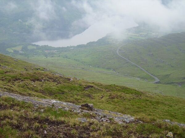
Glanmore Lake
-
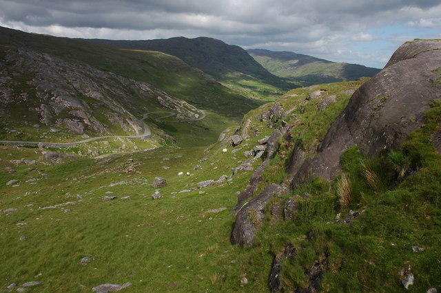
Healy Pass - distance
-
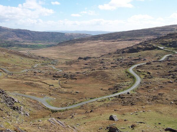
Healy Pass - road
-
Coolcreen


See also
 In Spanish: Península de Beara para niños
