Beara Way facts for kids
Quick facts for kids Beara Way |
|
|---|---|
 |
|
| Length | 206 kilometres (128 miles) |
| Location | Counties Cork & Kerry, Ireland |
| Designation | National Waymarked Trail |
| Trailheads | Glengarriff |
| Use | Hiking |
| Elevation change | 5,300 m (17,400 ft) |
| Difficulty | Strenuous |
| Season | Any |
| Website | http://www.bearatourism.com |
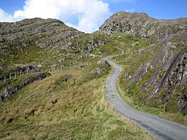
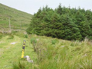
The Beara Way (Irish: Slí Bhéara) is a long walking trail in the southwest of Ireland. It is a circular path that goes all the way around the Beara Peninsula. The trail is 206-kilometre (128-mile) long. It starts and ends in Glengarriff, County Cork. It also goes through parts of County Kerry. Most people take about nine days to finish the whole trail. The Beara Way is known as a National Waymarked Trail. This means it is a special, well-marked path for walkers.
Contents
The Beara Way: A Great Irish Adventure
How the Trail Began
Work on the Beara Way started in 1991. The Beara Tourism and Development Association planned the trail. They got money from different groups like the West Cork County Development Team. The Irish Sports Council and Bord Fáilte also helped. Workers from a program called FÁS built the trail. The Beara Way officially opened in June 1996.
Upgrades and Popularity
The trail got a big update in 2009. Workers built 20 new bridges and 200 stiles. Stiles are steps that help you cross fences. They also added 15 information boards and 30 plaques. In 2010, a study looked at all the National Waymarked Trails. It found that the Beara Way was one of the most used trails. Because it was so popular, experts suggested it should be made even better. They wanted it to become a "National Long Distance Trail." This new standard would make it one of the best trails in the world.
Exploring the Beara Way Route
The Beara Way starts in Glengarriff. First, you walk into the Glengarriff Woods Nature Reserve. Then, the path climbs up into the Caha Mountains. You will reach a height of 500 metres (1,600 feet) here. The trail goes over a mountain pass. After that, it goes down to the village of Adrigole.
From Adrigole, the trail follows the sides of Hungry Hill. It also goes along the Slieve Mish Mountains. This part of the path leads to Castletownbere. There is a side path you can take here. It goes around Bere Island. You can get to the island by taking a ferry from Castletownbere.
The path from Castletownbere to Allihies used to be an old cattle path. For many years, people mined copper in Allihies. You can still see old mine buildings in the area. Another side path starts from Allihies. This path takes you to the very end of the Beara Peninsula. From there, you can take a cable car to Dursey Island.
From Allihies, the trail follows an old miners' track. It climbs up the rocky hills above the village. Then it crosses another mountain pass to reach Eyeries. A path along the coast connects Eyeries with Ardgroom.
The trail then crosses into County Kerry. It goes through Lauragh to reach Tuosist. From Tuosist, the Way crosses the northern slopes of Knockagarrane. It then passes between two lakes, Clonee Lough and Lough Inchiquin. After that, it crosses a mountain pass.
At this point, the path splits. You can go north to Kenmare or south to Bonane. The last part of the trail goes back to Glengarriff. It passes through Bonane Heritage Park and Esk mountain. There is also another side path. This one connects Glengarriff with Kealkill, Gougane Barra, and Ballingeary.
Connecting to Other Trails
The Beara Way is part of a bigger project called the Beara-Breifne Way. This is a walking and cycling route. It is being built to go all the way from the Beara Peninsula to the Breifne area. This area is in County Leitrim and County Cavan. The route follows the path of Donal Cam O'Sullivan Beare's march. He marched after the Battle of Kinsale in 1602.
The Mealagh Valley Walking Route is another trail. It is 20-kilometre (12-mile) long. This trail connects the Beara Way with the Sheep's Head Way.
The Beara Way is also the start (or end) of the European walking route E8. This very long route goes from Dursey Island all the way to Istanbul, Turkey! The E8 connects to the Kerry Way using a link path. This link path follows roads between Bonane and Kenmare.
 | Valerie Thomas |
 | Frederick McKinley Jones |
 | George Edward Alcorn Jr. |
 | Thomas Mensah |


