Beaver, Arkansas facts for kids
Quick facts for kids
Beaver, Arkansas
|
|
|---|---|

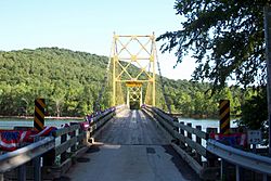
The "Little Golden Gate Bridge"
|
|

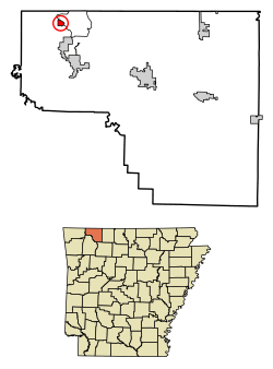
Location of Beaver in Carroll County, Arkansas.
|
|
| Country | United States |
| State | Arkansas |
| County | Carroll |
| Area | |
| • Total | 0.50 sq mi (1.29 km2) |
| • Land | 0.32 sq mi (0.82 km2) |
| • Water | 0.18 sq mi (0.48 km2) |
| Elevation | 1,004 ft (306 m) |
| Population
(2020)
|
|
| • Total | 67 |
| • Density | 212.70/sq mi (82.14/km2) |
| Time zone | UTC-6 (Central (CST)) |
| • Summer (DST) | UTC-5 (CDT) |
| ZIP code |
72613
|
| Area code(s) | 479 |
| FIPS code | 05-04540 |
| GNIS feature ID | 2405224 |
Beaver is a small town in Carroll County, Arkansas, United States. In 2020, about 67 people lived there. The town sits by the White River. It is also at the edge of Table Rock Lake. Beaver is deep in the beautiful Ozark Mountains.
This little town is north of Eureka Springs. It has even been shown in movies because of its pretty views. Beaver is famous for the Beaver Bridge. This bridge is a special two-panel suspension bridge over the White River. It is listed on the National Register of Historic Places.
Exploring Beaver's Location
Beaver is found in the northwest part of Carroll County. The town covers a total area of about 0.5 square miles (1.29 square kilometers). Most of this area is land, but some is water.
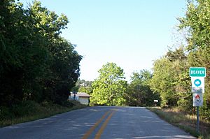
Highway 187 is the main road that goes through Beaver. This road leads west to US Highway 62. From there, you can go to Eureka Springs or Rogers. Another road nearby is Arkansas Highway 23. This road is also called the Pig Trail Scenic Byway. It is a popular route for tourists and people who ride motorcycles.
Who Lives in Beaver?
| Historical population | |||
|---|---|---|---|
| Census | Pop. | %± | |
| 1960 | 24 | — | |
| 1990 | 57 | — | |
| 2000 | 95 | 66.7% | |
| 2010 | 100 | 5.3% | |
| 2020 | 67 | −33.0% | |
| U.S. Decennial Census | |||
In the year 2000, there were 95 people living in Beaver. These people lived in 37 households. Most households were families. About 27% of households had children under 18. Many households were married couples living together. Some people lived alone.
The average age of people in Beaver was 42 years old. About 27% of the people were under 18. About 15% were 65 years old or older.
Beaver's Weather
The weather in Beaver is usually warm. It gets rain throughout the year. This type of weather is called a "Humid Subtropical Climate."
| Climate data for Beaver, Arkansas | |||||||||||||
|---|---|---|---|---|---|---|---|---|---|---|---|---|---|
| Month | Jan | Feb | Mar | Apr | May | Jun | Jul | Aug | Sep | Oct | Nov | Dec | Year |
| Mean daily maximum °C (°F) | 8 (46) |
11 (51) |
16 (61) |
22 (72) |
26 (78) |
29 (85) |
33 (91) |
32 (90) |
27 (81) |
22 (72) |
15 (59) |
9 (49) |
21 (70) |
| Mean daily minimum °C (°F) | −4 (25) |
−2 (29) |
3 (38) |
9 (48) |
13 (55) |
17 (63) |
19 (67) |
18 (65) |
15 (59) |
9 (49) |
4 (39) |
−2 (29) |
8 (47) |
| Average precipitation cm (inches) | 5.1 (2) |
7.1 (2.8) |
10 (4.1) |
11 (4.2) |
12 (4.9) |
11 (4.4) |
8.4 (3.3) |
9.7 (3.8) |
10 (4.1) |
9.4 (3.7) |
9.7 (3.8) |
8.6 (3.4) |
113 (44.4) |
| Source: Weatherbase | |||||||||||||
See also
 In Spanish: Beaver (Arkansas) para niños


