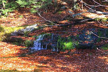
Beth Run facts for kids
Quick facts for kids Beth Run |
|
|---|---|

Mouth of Beth Run
|
|
| Physical characteristics | |
| Main source | head of a valley in Ross Township, Luzerne County, Pennsylvania between 1,980 and 2,000 feet (604 and 610 m) |
| River mouth | Bowman Creek near Mountain Springs in Lake Township, Luzerne County, Pennsylvania 1,598 ft (487 m) 41°21′38″N 76°09′49″W / 41.36065°N 76.16370°W |
| Length | 1.9 mi (3.1 km) |
| Basin features | |
| Progression | Bowman Creek → Susquehanna River → Chesapeake Bay |
| Basin size | 2.34 sq mi (6.1 km2) |
| Tributaries |
|
Beth Run is a small stream, also called a tributary, located in Luzerne County, Pennsylvania. It flows into a larger stream called Bowman Creek. Beth Run is about 1.9 miles (3.1 km) long.
This stream flows through two areas: Ross Township and Lake Township. The area of land that drains water into Beth Run, known as its watershed, covers about 2.34 square miles (6.1 km2). Beth Run is known for its clean, cold water, making it a great home for fish, especially trout. It's even called "Class A Wild Trout Waters" because wild trout naturally live and reproduce there!
Contents
Where Beth Run Flows
Beth Run starts at the top of a valley in Ross Township. It flows generally east and then northeast for a while. As it continues, it enters Lake Township.
In Lake Township, another small, unnamed stream joins Beth Run from the right side. The valley around the stream then gets much wider. Finally, Beth Run reaches the end of its journey and flows into Bowman Creek. It joins Bowman Creek about 21.97 miles (35.36 km) upstream from where Bowman Creek itself ends.
The Land Around Beth Run
The land around Beth Run has interesting geology, which is the study of the rocks and soil on the surface. Most of the area along Beth Run is covered by a type of till called Wisconsinan Till. This till was left behind by glaciers during the last Ice Age.
Near the stream's beginning, you can also find alluvium, which is sand, silt, and clay deposited by flowing water. Some of the Wisconsinan Till here is even on top of clays that formed in ancient glacial lakes. At the very start of the stream, there's a special kind of till called Wisconsinan Bouldery Till, which has lots of large boulders. The sides of the valley where Beth Run flows are made of bedrock, which includes sandstone and shale.
The elevation near where Beth Run meets Bowman Creek is about 1,598 feet (487 m) above sea level. The stream's source (where it begins) is much higher, between 1,980 and 2,000 feet (600 and 610 m) above sea level.
Beth Run's Watershed
The entire watershed of Beth Run covers an area of 2.34 square miles (6.1 km2). This means all the rain and snow that falls in this area eventually flows into Beth Run. The stream is located entirely within a specific map area called the Sweet Valley quadrangle, as mapped by the United States Geological Survey.
A great thing about Beth Run is that its entire length is on public land. This means people can visit and enjoy the stream and its surroundings.
History of Beth Run
Beth Run was officially added to the Geographic Names Information System on August 2, 1979. This system keeps track of names and locations of places in the United States. Its special identification number there is 1169332.
In the 1970s, the Pennsylvania Game Commission was interested in buying a large piece of land, about 3,200-acre (1,300 ha), near Beth Run. They wanted to add this land to Pennsylvania State Game Lands Number 57. The Game Commission also once asked for permission to build a special bridge, called an aluminum box culvert bridge, over the stream. This bridge would have helped them access the southern parts of State Game Lands Number 57 for cutting trees that needed to be removed.
Wildlife in Beth Run
The area that drains into Beth Run is very important for fish. It is officially called a "High-Quality Coldwater Fishery" and a "Migratory Fishery." This means the water is clean and cold, which is perfect for fish that prefer cooler temperatures, and it's also a place where fish can travel.
Wild trout naturally live and reproduce in Beth Run, from where it starts all the way to where it meets Bowman Creek. The Pennsylvania Fish and Boat Commission has classified Beth Run as "Class A Wild Trout Waters" specifically for brook trout. This is a special designation showing how healthy and important the stream is for these native fish.
 | Roy Wilkins |
 | John Lewis |
 | Linda Carol Brown |

