Bethel (CDP), Connecticut facts for kids
Quick facts for kids
Bethel, Connecticut
|
|
|---|---|

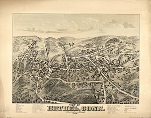
1879 sketch of Bethel
|
|
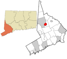
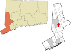
 Fairfield County and Connecticut Fairfield County and Connecticut Western Connecticut Planning Region and Connecticut Western Connecticut Planning Region and Connecticut |
|
| State | Connecticut |
| County | Fairfield |
| Town | Bethel |
| Area | |
| • Total | 4.09 sq mi (10.59 km2) |
| • Land | 4.09 sq mi (10.59 km2) |
| • Water | 0 sq mi (0.0 km2) |
| Elevation | 384 ft (117 m) |
| Population
(2010)
|
|
| • Total | 9,549 |
| • Density | 2,335/sq mi (901.4/km2) |
| ZIP Code |
06801
|
| FIPS code | 09-04790 |
| GNIS feature ID | 2378335 |
Bethel is a special kind of community in Fairfield County, Connecticut, United States. It's called a census-designated place (CDP). This means it's an area that the government counts for population, but it's not an officially separate city or town.
Bethel CDP includes the main village and homes around it. It is part of the larger town of Bethel. In 2010, about 9,549 people lived in the CDP. The whole town of Bethel had 18,584 people.
Contents
Exploring Bethel's Location
The Bethel CDP is located in the western part of the town of Bethel. It shares a border with the city of Danbury to the west. To the north, the CDP reaches East Swamp Brook. Wolf Pit Brook forms its eastern border.
The southern border of Bethel CDP is a bit winding. It follows several roads and even a small brook. Some of these roads include Putnam Park Road and Chestnut Ridge Road.
Roads and Travel
Several important roads pass through Bethel. Connecticut Route 53 goes through the west side of the community. This road can take you north into downtown Danbury. If you go south, it leads about 13 miles to Weston.
Connecticut Route 302 crosses the middle of Bethel. It follows Greenwood Avenue and part of Milwaukee Avenue. This route goes east for about 6 miles to Newtown.
Connecticut Route 58 starts in the eastern part of Bethel CDP. It connects with Route 302 there. Route 58 heads southeast about 18 miles to Fairfield. Fairfield is near the city of Bridgeport.
Land and Water
The Bethel CDP covers an area of about 10.6 square kilometers. All of this area is land. There are no large bodies of water within the CDP itself.
Small streams, called brooks, flow through the community. These brooks flow north towards the Still River in Danbury. The Still River then flows into the Housatonic River.
People of Bethel
In 2010, there were 9,549 people living in the Bethel CDP. These people lived in 3,903 households. About 2,451 of these households were families.
The population density was about 901 people per square kilometer. There were 4,168 housing units in total. Most of these homes were occupied.
Who Lives Here?
People from many different backgrounds live in Bethel CDP. About 84.8% of the people were White. About 5.8% were Asian, and 2.6% were African American. Some people were from two or more racial backgrounds. About 10.4% of the population was Hispanic or Latino.
Households and Families
Of the households in Bethel, about 32.9% had children under 18 living with them. Many households, about 46.4%, were married couples living together. About 11.9% of households were led by a female without a husband present.
About 31.1% of all households were single individuals. About 11.2% of these individuals were 65 years old or older. On average, each household had about 2.44 people. Families, on average, had about 3.09 people.
Age Groups
The population of Bethel CDP includes people of all ages. About 22.4% of the people were under 18 years old. About 7.8% were between 18 and 24 years old. The largest group, about 28.9%, was between 25 and 44 years old.
People aged 45 to 64 made up about 29.5% of the population. Finally, about 11.7% of the people were 65 years old or older. The average age in Bethel CDP was about 39.5 years.
See also

- In Spanish: Bethel (condado de Fairfield) para niños
 | Chris Smalls |
 | Fred Hampton |
 | Ralph Abernathy |

