Big Bend Peak facts for kids
Quick facts for kids Big Bend Peak |
|
|---|---|

Big Bend Peak
|
|
| Highest point | |
| Elevation | 2,804 m (9,199 ft) |
| Prominence | 224 m (735 ft) |
| Parent peak | Mount Saskatchewan (3342 m) |
| Listing | Mountains of Alberta |
| Geography | |
| Location | Banff National Park Alberta, Canada |
| Parent range | Canadian Rockies |
| Topo map | NTS 83C/03 |
| Type of rock | Sedimentary |
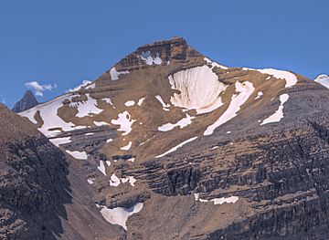
Big Bend Peak is a tall mountain in Banff National Park, Alberta, Canada. It stands about 2,804 meters (9,199 feet) high. This impressive peak is part of the Canadian Rockies.
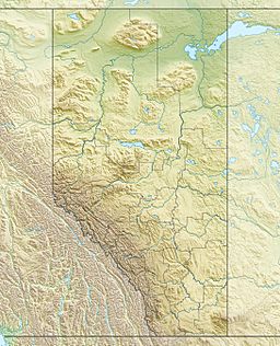
You can find Big Bend Peak in the upper North Saskatchewan River valley. It is located on the west side of the famous Icefields Parkway. The mountain gets its name because it's only about four kilometers southwest of a big curve, or "big bend," in that road. The closest taller mountain is Mount Saskatchewan, which is about 5.5 kilometers (3.4 miles) to the south.
How Big Bend Peak Formed
Like many mountains in Banff National Park, Big Bend Peak is made of a type of rock called sedimentary rock. This rock formed over millions of years, from the Precambrian to the Jurassic periods.
Imagine ancient shallow seas covering this area. Layers of sand, mud, and tiny sea creatures settled at the bottom. Over time, these layers hardened into sedimentary rock. Later, huge forces from inside the Earth pushed these rocks eastward. This event, called the Laramide orogeny, lifted the rocks and created the mountains we see today.
What's the Weather Like?
Big Bend Peak is in a subarctic climate zone. This means it has very cold and snowy winters. Summers are usually mild.
During winter, temperatures can drop below -20 °C (-4 °F). With the wind chill, it can feel even colder, sometimes below -30 °C (-22 °F). The snow and ice that melt from Big Bend Peak flow into the North Saskatchewan River.


