Binna Burra, Queensland facts for kids
Quick facts for kids Binna BurraQueensland |
|||||||||||||||
|---|---|---|---|---|---|---|---|---|---|---|---|---|---|---|---|

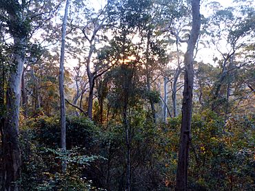
Binna Burra rainforest at sunset, 2014
|
|||||||||||||||
| Population | 0 (2021 census) | ||||||||||||||
| • Density | 0/km2 (0/sq mi) | ||||||||||||||
| Postcode(s) | 4211 | ||||||||||||||
| Area | 24.4 km2 (9.4 sq mi) | ||||||||||||||
| Time zone | AEST (UTC+10:00) | ||||||||||||||
| Location |
|
||||||||||||||
| LGA(s) | Scenic Rim Region | ||||||||||||||
| State electorate(s) | Scenic Rim | ||||||||||||||
| Federal Division(s) | Wright | ||||||||||||||
|
|||||||||||||||
Binna Burra is a special place in the Scenic Rim Region of Queensland, Australia. It's a rural area, which means it's mostly countryside. Binna Burra is right on the border with New South Wales. In 2021, very few people lived here. It's known for its amazing nature.
Contents
Exploring Binna Burra's Nature
Binna Burra is like a long, narrow valley. It has tall ridges on both sides. The Darlington Range is to the west, and the Beechmont Range is to the east. To the south, it meets the border between Queensland and New South Wales.
Rivers and Rainforests
The Coomera River starts in the very south of Binna Burra. It then flows north through the valley. This area is almost entirely part of the famous Lamington National Park.
What is Lamington National Park?
Lamington National Park is a huge protected area. It's full of ancient rainforests and amazing wildlife. It's a fantastic place for hiking and exploring nature.
Where to Stay in Binna Burra
Even though most of Binna Burra is national park, there's a small area where you can stay. This is where the Binna Burra Lodge is located. It offers places for tourists to sleep right inside the national park. It's a great base for adventurers!
Who Lives in Binna Burra?
In 2016, only 4 people lived in Binna Burra. By 2021, the population was listed as "no people or a very low population." This shows how wild and natural the area truly is.
Learning Near Binna Burra
There are no schools directly in Binna Burra. Kids living nearby usually go to Beechmont State School. This primary school is in the next-door area called Beechmont. For high school, students often travel to Nerang State High School in Nerang.
 | Misty Copeland |
 | Raven Wilkinson |
 | Debra Austin |
 | Aesha Ash |


