Bismarck Peak facts for kids
Quick facts for kids Bismarck Peak |
|
|---|---|

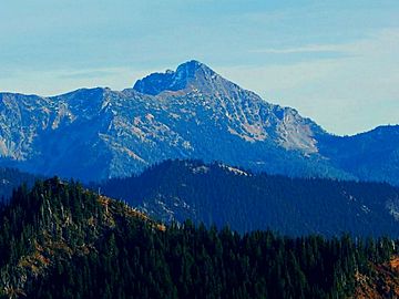
Bismarck Peak seen from northwest
|
|
| Highest point | |
| Elevation | 7,585 ft (2,312 m) |
| Prominence | 625 ft (191 m) |
| Geography | |
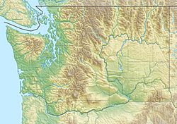
| Location | Yakima County Washington, U.S. |
| Parent range | Cascades |
| Topo map | USGS Bumping Lake |
| Climbing | |
| Easiest route | Scrambling class 2 |
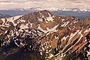
Bismarck Peak is a tall mountain in Washington state. It stands 7,585 feet (2,312 meters) high. This peak is found in the middle of the William O. Douglas Wilderness. This wilderness area is managed by the Wenatchee National Forest.
The mountain is about 24 miles east-southeast of Mount Rainier. It is located in Yakima County. Bismarck Peak is just east of the main Cascade Mountains. It is also southeast of Bumping Lake and northwest of Rimrock Lake. The closest higher mountain is Mount Aix, which is about 2.2 miles away to the north-northeast. Both Mount Aix and Bismarck Peak are very noticeable. They are the two highest peaks between Mount Rainier National Park and Yakima, Washington. Water from Bismarck Peak flows into the Yakima River. This river then joins the large Columbia River.
Weather at Bismarck Peak

Bismarck Peak is on the eastern side of the Cascade Mountains. Most weather systems come from the Pacific Ocean. They travel northeast towards the Cascades. When these weather systems reach the mountains, they are forced to rise. This process is called Orographic lift. As the air rises, it cools down and drops its moisture. This moisture falls as rain or snow on the mountains.
Because of this, the eastern side of the Cascades gets less rain and snow. This is compared to the western side. In winter, the weather is often cloudy. But in summer, high-pressure systems build up over the Pacific Ocean. This often means there are clear skies and little to no clouds.
More Information
- You can learn more about the William O. Douglas Wilderness on the National Forest Service website: William O Douglas Wilderness
 | Charles R. Drew |
 | Benjamin Banneker |
 | Jane C. Wright |
 | Roger Arliner Young |


