
Black Brook, New York facts for kids
Quick facts for kids
Black Brook, New York
|
|
|---|---|
 |
|

Black Brook, New York
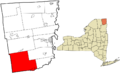
Location in New York
|
|
| Country | United States |
| State | New York |
| County | Clinton |
| Government | |
| • Type | Town Council |
| Area | |
| • Total | 134.33 sq mi (347.92 km2) |
| • Land | 129.98 sq mi (336.64 km2) |
| • Water | 4.36 sq mi (11.28 km2) |
| Elevation | 1,263 ft (385 m) |
| Population
(2010)
|
|
| • Total | 1,497 |
| • Estimate
(2016)
|
1,471 |
| • Density | 11.32/sq mi (4.37/km2) |
| Time zone | UTC-5 (Eastern (EST)) |
| • Summer (DST) | UTC-4 (EDT) |
| FIPS code | 36-019-06761 |
| GNIS feature ID | 0978736 |
| Website | https://www.townofblackbrook.org/ |
Black Brook is a small town located in Clinton County, New York. It's named after a stream that flows through the area. In 2010, about 1,497 people lived here.
This town is in the southwestern part of Clinton County, not far from Plattsburgh. It's also part of the beautiful Adirondack Park.
Contents
A Look Back: Black Brook's History
People first started settling in the Black Brook area around 1825. The town itself was officially formed in 1839. It was created from a part of the nearby town of Peru.
In its early days, Black Brook was known for different kinds of work. People mostly focused on farming, mining, and smelting iron. Smelting is a process where metal is taken out of its ore using heat.
Exploring Black Brook's Geography
Black Brook covers about 134 square miles (348 square kilometers). Most of this area is land, but about 4 square miles (11 square kilometers) is water.
Rivers and Streams
- The Au Sable River forms part of the town's southern border.
- The Saranac River flows through the northern part of Black Brook.
- The stream called Black Brook, which the town is named after, flows south through the middle of the town. It's a branch of the Au Sable River.
Lakes and Ponds
Black Brook is home to several large lakes:
- Silver Lake
- Taylor Pond
- Fern Lake
- The outlet of Union Falls Pond, a reservoir on the Saranac River, is also in the western part of the town.
Borders and Roads
The western edge of Black Brook borders Franklin County. The southern edge borders Essex County.
Two main roads pass through the town:
- New York State Route 9N goes through the southeastern part. It connects to Keeseville to the east and Jay to the southwest.
- New York State Route 3 crosses the northwestern corner. It leads to Plattsburgh to the northeast and Saranac Lake to the southwest.
People of Black Brook
The number of people living in Black Brook has changed over the years. Here's how the population has grown and shrunk:
| Historical population | |||
|---|---|---|---|
| Census | Pop. | %± | |
| 1840 | 1,064 | — | |
| 1850 | 2,525 | 137.3% | |
| 1860 | 3,452 | 36.7% | |
| 1870 | 3,561 | 3.2% | |
| 1880 | 3,365 | −5.5% | |
| 1890 | 2,256 | −33.0% | |
| 1900 | 1,933 | −14.3% | |
| 1910 | 1,959 | 1.3% | |
| 1920 | 1,822 | −7.0% | |
| 1930 | 1,692 | −7.1% | |
| 1940 | 1,806 | 6.7% | |
| 1950 | 1,611 | −10.8% | |
| 1960 | 1,595 | −1.0% | |
| 1970 | 1,484 | −7.0% | |
| 1980 | 1,505 | 1.4% | |
| 1990 | 1,556 | 3.4% | |
| 2000 | 1,660 | 6.7% | |
| 2010 | 1,497 | −9.8% | |
| 2020 | 1,453 | −2.9% | |
| U.S. Decennial Census | |||
In 2000, there were 1,660 people living in Black Brook. About one-quarter of the population was under 18 years old. The average age of people in the town was 38 years.
Places to Know in Black Brook
Here are some of the smaller communities and important locations you can find in Black Brook:
- Au Sable Forks – This is a small community on the southern border of the town, right by the Au Sable River. Part of it is also in the town of Jay.
- Black Brook – This is the main community, or hamlet, in the southern part of the town. It's northwest of Au Sable Forks.
- Clayburg – You can find this hamlet on the northern border of the town.
- Devins Corners – This hamlet is located in the northeastern part of Black Brook.
- East Kilns – A hamlet found northwest of Black Brook village, along Silver Lake Road.
- Fern Lake – A lake located north of Black Brook village.
- Hawkeye – This hamlet is at the eastern end of Silver Lake.
- Middle Kilns – A spot located between East Kilns and West Kilns on Forestdale Road.
- Riverview – A hamlet located on Route 3 in the northwestern corner of the town.
- Silver Lake – A beautiful lake in the western part of the town. It's about one mile wide and three miles long. Many homes around Silver Lake are used in the summer. A big part of the lake is owned by the state and kept "Forever Wild," meaning it won't be sold or developed.
- Swastika – A hamlet located north of Black Brook village.
- Taylor Pond – A lake in the southwestern part of the town, south of Silver Lake.
- Thomasville – A hamlet located on the town line in the southeastern part of the town.
- Union Falls – A hamlet located on the western town line.
- Union Falls Pond – A lake that is partly inside the western town line.
- West Kilns – A hamlet found in the southwestern corner of Black Brook.
Images for kids
-
Map showing Black Brook in Clinton County, New York.
See also
 In Spanish: Black Brook (Nueva York) para niños
