Black Mesa (Navajo County, Arizona) facts for kids
Quick facts for kids Black Mesa |
|
|---|---|
| Highest point | |
| Elevation | 6,120 ft (1,865 m) NAVD 88 |
| Prominence | 97 ft (30 m) |
| Geography | |
| Location | Navajo County, Arizona, U.S. |
| Parent range | White Mountains |
| Topo map | USGS Taylor |
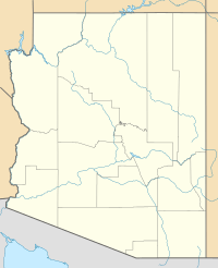
Black Mesa is a special kind of flat-topped hill called a mesa. It's located in the White Mountains area of Navajo County, Arizona. This mesa is also found within the lands of the Navajo Nation.
You can find Black Mesa just off State Route 77. This road runs between the towns of Snowflake and Show Low. Black Mesa stands about 6,120 feet (1,865 meters) tall.

All content from Kiddle encyclopedia articles (including the article images and facts) can be freely used under Attribution-ShareAlike license, unless stated otherwise. Cite this article:
Black Mesa (Navajo County, Arizona) Facts for Kids. Kiddle Encyclopedia.
