Black Mountains (Utah) facts for kids
Quick facts for kids Black Mountains |
|
|---|---|
| Highest point | |
| Peak | Mahogany Knoll ((northeastern east-west ridgeline)-Black Mountains) |
| Elevation | 6,729 ft (2,051 m) |
| Dimensions | |
| Length | 30 mi (48 km) (30 x 28 mi, ridgeline west, two ridgelines to southwest-w/Long Hollow) |
| Width | 28 mi (45 km) E-W |
| Geography | |
| Country | United States |
| Communities | Minersville, Enoch, Summit, Parowan, Paragonah, Greenville and Adamsville |
| Range coordinates | 38°05′21″N 112°50′04″W / 38.08914°N 112.83439°W |
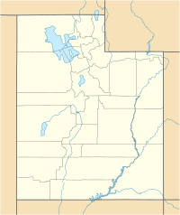
The Black Mountains are a mountain range in southwestern Utah, United States. They are about 30 miles (48 km) long. You can find them in parts of Iron County and Beaver County.
This mountain range is next to the Escalante Desert on its northeast side. On the southeast, it runs alongside the Hurricane Cliffs and the Parowan Valley. An important historical site, the Parowan Gap Petroglyphs, is located in the southern part of the range. Also, the Old Spanish National Historic Trail crosses near the Summit, Utah area, heading towards Cedar Valley and Cedar City.
Interstate 15 (I‑15) travels through the southeast part of the Black Mountains. It connects towns like Cedar City, Greenville, and Beaver.
What Makes the Black Mountains Special?
The Black Mountains have an interesting and varied shape. In the north, there's an east-west ridgeline. The Beaver River flows nearby to the west, and Minersville Reservoir is in the center. The northeastern hills are close to the towns of Beaver and Greenville.
The highest point in the range is called Mahogany Knoll. It stands at 7,976 feet (2,431 meters) tall. This peak is located in the northeast part of the range, right on the border between Iron and Beaver Counties. Another notable peak is Chipman Peak, which is 7,966 feet (2,428 meters) high.
From the northeast, a ridgeline stretches southwest towards Cedar Valley. This ridgeline forms the northwest edge of the Parowan Valley. The valley is quite narrow, with the Black Mountains on one side and the Hurricane Cliffs on the other.
Exploring the Area
The Old Spanish National Historic Trail used to follow a path through this area. It crossed a narrow pass, only about 1 mile (1.6 km) wide, between the Black Mountains and the Hurricane Cliffs. This trail then went west across the northern part of Cedar Valley, near the town of Enoch.
South of the Black Mountains, you'll find the Red Hills range. This is where the famous Parowan Gap Petroglyphs site is located. These ancient rock carvings are a fascinating glimpse into the past.
How to Get There
Several roads help people access the Black Mountains. Utah State Route 21 (SR‑21) runs along the northern edge of the range, following the Beaver River from Minersville Reservoir. It then turns northeast towards Beaver and Greenville.
Another important road is Utah State Route 130 (SR‑130). This road cuts through the western-central part of the range, going from Minersville in the northwest. SR‑130 travels south through Parowan Canyon. It then crosses an area called Long Hollow, which is a flat plain between two ridgelines. This route eventually reaches the northern part of Cedar Valley, near Rush Lake (which is usually dry). The road continues to Enoch and connects with I‑15 at Cedar City.
On the southeast side of the Black Mountains, I‑15 follows the Parowan Valley. It passes through towns like Enoch, Summit, and Parowan, before heading north towards Greenville and Beaver.
 | Emma Amos |
 | Edward Mitchell Bannister |
 | Larry D. Alexander |
 | Ernie Barnes |


