Blackhope Scar facts for kids
Quick facts for kids Blackhope Scar |
|
|---|---|
 |
|
| Highest point | |
| Elevation | 651 m (2,136 ft) |
| Prominence | 282 m (925 ft) |
| Listing | Ma,Hu,Tu,Sim, G, D,CoH,CoU,CoA,DN,Y) |
| Geography | |
| Location | Scottish Borders, Midlothian, Scotland |
| Parent range | Moorfoot Hills, Southern Uplands |
| OS grid | NT 31512 48324 |
| Topo map | OS Landranger 73 |
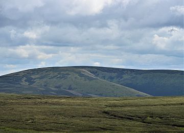
Blackhope Scar is a cool hill located in the Moorfoot Hills in Scotland. It's part of the wider Southern Uplands region. This hill is found northeast of the town of Peebles. It's pretty tall, being the second highest peak in the Moorfoot Hills, just a bit shorter than Windlestraw Law.
Contents
About Blackhope Scar
Blackhope Scar stands at 651 meters (about 2,136 feet) above sea level. This makes it a significant hill in the area. It's known for its wild, open moorland, which means it's covered in tough grasses and heather.
Where is Blackhope Scar?
You can find Blackhope Scar in the beautiful Scottish countryside. It sits right on the border between two areas: the Scottish Borders and Midlothian. Its location in the Moorfoot Hills makes it a great spot for outdoor adventures.
What's it Like to Visit?
If you decide to climb Blackhope Scar, you'll experience a real moorland adventure. The ground can be quite boggy, especially after rain, so good waterproof boots are a must! Despite being a bit rough, the climb is worth it for the amazing views.
Views from the Top
From the summit of Blackhope Scar, you can see far across the Scottish landscape. You'll get fantastic panoramic views of the surrounding hills and valleys. It's a perfect spot to take some cool photos and enjoy the peace and quiet of nature.
Climbing Blackhope Scar
Most people who climb Blackhope Scar start their journey from the Gladhouse Reservoir. This reservoir is a large body of water nearby, making it a convenient starting point for hikers. The path can be challenging, but it's a rewarding climb for those who love the outdoors.
Hill Classifications
Blackhope Scar is recognized as a "Marilyn," a "Graham," and a "Donald." These are special categories for hills in the UK based on their height and how much they rise above the surrounding land. Being on these lists means it's a notable hill for climbers and hikers.
 | James B. Knighten |
 | Azellia White |
 | Willa Brown |

