Bludenz (district) facts for kids
Quick facts for kids
Bezirk Bludenz
|
|
|---|---|
 |
|
| Country | Austria |
| State | Vorarlberg |
| Number of municipalities | 29 |
| Area | |
| • Total | 1,287.63 km2 (497.16 sq mi) |
| Population
(2012)
|
|
| • Total | 61,407 |
| • Density | 47.6899/km2 (123.5164/sq mi) |
| Time zone | UTC+1 (CET) |
| • Summer (DST) | UTC+2 (CEST) |
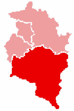
The Bludenz District (which is called German: Bezirk Bludenz in German) is an administrative area in the state of Vorarlberg, Austria. It's like a county or a region that helps organize things.
This district covers a large area of 1,287.63 square kilometers. In 2012, about 61,407 people lived there. The main town and administrative center of the district is Bludenz.
Contents
What Kinds of Places Are in Bludenz District?
The Bludenz District has 29 different communities. These are called municipalities. Among these, one is a bigger town, and two are special "market towns."
Which Is the Main Town?
- Bludenz is the biggest town and the center of the district.
What Are the Market Towns?
What Are the Other Communities (Municipalities)?
- Bartholomäberg
- Blons
- Bludesch
- Brand
- Bürs
- Bürserberg
- Dalaas
- Fontanella
- Gaschurn
- Innerbraz
- Klösterle
- Lech am Arlberg
- Lorüns
- Ludesch
- Nüziders
- Raggal
- Sankt Anton im Montafon
- Sankt Gallenkirch
- Sankt Gerold
- Silbertal
- Sonntag
- Stallehr
- Thüringen
- Thüringerberg
- Tschagguns
- Vandans
See also
- In Spanish: Distrito de Bludenz para niños

All content from Kiddle encyclopedia articles (including the article images and facts) can be freely used under Attribution-ShareAlike license, unless stated otherwise. Cite this article:
Bludenz (district) Facts for Kids. Kiddle Encyclopedia.
