Bowring, Oklahoma facts for kids
Quick facts for kids
Bowring
|
|
|---|---|
| Country | United States |
| State | Oklahoma |
| County | Osage |
| Area | |
| • Total | 0.20 sq mi (0.52 km2) |
| • Land | 0.20 sq mi (0.52 km2) |
| • Water | 0.00 sq mi (0.00 km2) |
| Elevation | 814 ft (248 m) |
| Population
(2020)
|
|
| • Total | 78 |
| • Density | 391.96/sq mi (151.27/km2) |
| Time zone | UTC-6 (Central (CST)) |
| • Summer (DST) | UTC-5 (CDT) |
| ZIP codes |
74056
|
| Area code(s) | 918 |
| FIPS code | 40-08000 |
| GNIS feature ID | 2804702 |
Bowring is a small, unincorporated community in Osage County, Oklahoma, United States. This means it's a community that isn't officially part of a city or town. It also counts as a "Census designated place," which is an area the government tracks for population numbers.
Bowring got its own post office on November 12, 1923. People say its name comes from two local ranchers, Mart Bowhan and Richard Woodring, whose names were combined.
Contents
Where is Bowring?
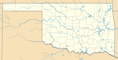
Bowring is located in northern Osage County. It's about 12 miles (19 km) northwest of the city of Bartlesville. It's also about 19 miles (31 km) northeast of Pawhuska, which is the main town of Osage County.
The community is also about 8.4 miles (13.5 km) south of the border with Kansas. You can reach Bowring using Oklahoma State Highway 10 (SH-10). This highway connects Bowring to the town of Copan to the east and a small area called Herd to the west.
How Many People Live in Bowring?
According to the 2020 census, 78 people live in Bowring.
Nearby Places to Explore
If you're near Bowring, here are some other small places:
- Whippoorwill Point (east of Bowring on SH-10)
- Hulah (mostly a ghost town east of Bowring on SH-10)
- Herd (mostly a ghost town west of Bowring on SH-10)
Bowring's Railroad History
Long ago, Bowring was an important stop for the Atchison, Topeka & Santa Fe Railroad. Ranchers used to bring their cattle to the west side of town. From there, the cattle were loaded onto special train cars. These trains would then take the cattle to markets all over the area.
The railroad line that went through Bowring started south of Caney, Kansas. It passed through what was once Hulah, then crossed the Caney River. After that, it went past Whippoorwill Point, through Bowring, and continued west to Pawhuska.
The old Hulah Depot, which was once near SH-10, has since been moved. You can now find it in Johnstone Park in the nearby city of Bartlesville.
Fun Things to Do: Lakes and Fishing
Bowring is close to two lakes on SH-10:
- Copan Lake and Dam: This lake is west of the town of Copan, on the Little Caney River.
- Hulah Lake and Dam: This lake is on the Caney River, near the small area called Whippoorwill Point.
Both of these lakes and dams are managed by the United States Army Corps of Engineers. They are very important because they help control floods for nearby cities like Dewey and Bartlesville.
The Caney River eventually joins the Verdigris River northeast of Claremore. Both the Little Caney and Caney rivers start in central Kansas.
Learning in Bowring
Students in Bowring attend schools in the Bowring Public School district.
 | Sharif Bey |
 | Hale Woodruff |
 | Richmond Barthé |
 | Purvis Young |


