Bradford (CDP), New Hampshire facts for kids
Quick facts for kids
Bradford, New Hampshire
|
|
|---|---|

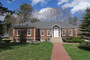
Bradford Public Library
|
|
| Country | United States |
| State | New Hampshire |
| County | Merrimack |
| Town | Bradford |
| Area | |
| • Total | 0.81 sq mi (2.10 km2) |
| • Land | 0.79 sq mi (2.06 km2) |
| • Water | 0.02 sq mi (0.04 km2) |
| Elevation | 685 ft (209 m) |
| Population
(2020)
|
|
| • Total | 372 |
| • Density | 468.51/sq mi (180.87/km2) |
| Time zone | UTC-5 (Eastern (EST)) |
| • Summer (DST) | UTC-4 (EDT) |
| ZIP code |
03221
|
| Area code(s) | 603 |
| FIPS code | 33-06900 |
| GNIS feature ID | 2629717 |
Bradford is a small community in New Hampshire, United States. It is also known as a "census-designated place" (CDP). This means it's a special area that the government counts for population information. Bradford is the main village within the larger town of Bradford. It is located in Merrimack County.
In 2020, about 372 people lived in the Bradford CDP. The entire town of Bradford had a population of 1,662 people.
Contents
Exploring Bradford's Location
The Bradford CDP is in the northeastern part of the town of Bradford. It is located near the outlet of Todd Lake.
The northern edge of Bradford CDP is next to the town of Newbury. To the south, its border follows the Warner River and its West Branch.
Roads and Travel
New Hampshire Route 114 runs along the eastern side of the CDP. This road can take you north about 12 miles (19 km) to New London. If you go southeast on Route 114, you will reach Henniker in about 9 miles (14 km).
Another important road, New Hampshire Route 103, goes right through the middle of Bradford CDP. Heading east on Route 103, you can reach Interstate 89 in Warner in about 7 miles (11 km). If you travel northwest on Route 103, you will arrive in Newport after about 13 miles (21 km).
Area Size
The Bradford CDP covers a total area of about 0.81 square miles (2.1 square kilometers). Most of this area is land, about 0.79 square miles (2.06 square kilometers). A small part, about 0.02 square miles (0.04 square kilometers), is water.
People of Bradford
The number of people living in Bradford has changed a little over time.
- In 2010, there were 356 people.
- In 2020, the population grew slightly to 372 people.
Who Lives Here?
In 2010, there were 144 households in Bradford. A household means all the people living in one home. Most of these households were families.
The people living in Bradford come from different backgrounds:
- About 95.2% were white.
- A small number were African American, Native American, or Asian.
- About 2.2% of the population were Hispanic or Latino.
Families and Age Groups
About 26.4% of the households had children under 18 years old living with them. Many households were made up of married couples.
The average household had about 2.47 people. The average family had about 2.88 people.
People of all ages live in Bradford:
- About 21.1% of residents were under 18 years old.
- About 11.5% were 65 years old or older.
- The average age of people in Bradford was about 43.4 years.
See also
 In Spanish: Bradford (condado de Merrimack) para niños
 | Lonnie Johnson |
 | Granville Woods |
 | Lewis Howard Latimer |
 | James West |


