Newport (CDP), New Hampshire facts for kids
Quick facts for kids
Newport, New Hampshire
|
|
|---|---|

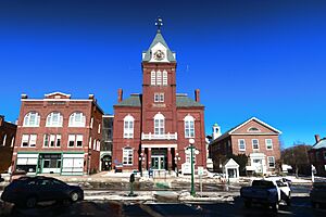
Newport Opera House
|
|
| Country | United States |
| State | New Hampshire |
| County | Sullivan |
| Town | Newport |
| Area | |
| • Total | 14.11 sq mi (36.54 km2) |
| • Land | 14.11 sq mi (36.54 km2) |
| • Water | 0.00 sq mi (0.00 km2) |
| Elevation | 817 ft (249 m) |
| Population
(2020)
|
|
| • Total | 4,735 |
| • Density | 335.63/sq mi (129.59/km2) |
| Time zone | UTC-5 (Eastern (EST)) |
| • Summer (DST) | UTC-4 (EDT) |
| ZIP code |
03773
|
| Area code(s) | 603 |
| FIPS code | 33-52500 |
| GNIS feature ID | 2378084 |
Newport is a special kind of community in New Hampshire, United States. It's called a census-designated place (CDP). This means it's an area that the government counts as a specific place for population studies, even though it's part of a larger town also named Newport.
The Newport CDP includes the main village and the countryside around it. It is located in Sullivan County. In 2020, about 4,735 people lived in the CDP. The entire town of Newport had a population of 6,299 people.
Contents
Exploring Newport's Location and Rivers
Newport CDP is found in the eastern part of the town of Newport. The main village is right where the Sugar River meets its South Branch.
Understanding Newport's Borders
The CDP stretches north all the way to the town line of Croydon. To the east, it reaches the border of Sunapee. In the south, it touches the town line of Unity.
The border of the CDP follows natural features like rivers and roads. For example, it follows the North Branch of the Sugar River. It also follows the main Sugar River southwest to where New Hampshire Routes 11 and 103 meet in a place called Kellyville.
Other parts of the border follow roads like Whitcher Road, Bascom Road, and Unity Road. It also follows Spring Brook and Coon Brook Road. The border even runs along an unnamed stream and then roads like East Mountain Road and Schoolhouse Road.
Major Roads and Travel Routes
New Hampshire Route 10 is the main street in Newport. If you go north on Route 10, you can travel about 10 miles to Interstate 89 in Grantham. Going south on Route 10 will take you about 35 miles to Keene.
Routes 11 and 103 travel together west from Newport for about 9 miles to Claremont. These two highways also go east out of town, known as Sunapee Street. They split about 3 miles east of Newport's center in a village called Wendell.
From Wendell, Route 11 goes northeast about 5.5 miles to the village of Sunapee. Route 103 heads southeast about 9.5 miles to Newbury Harbor, which is on Lake Sunapee.
Newport's Total Area
The U.S. Census Bureau states that the Newport CDP covers a total area of about 36.5 square kilometers (or about 14.1 square miles). All of this area is land.
Newport's Population and People
Let's look at how many people live in Newport and learn about them.
| Historical population | |||
|---|---|---|---|
| Census | Pop. | %± | |
| 1950 | 3,062 | — | |
| 1960 | 3,222 | 5.2% | |
| 1970 | 3,296 | 2.3% | |
| 1980 | 4,388 | 33.1% | |
| 1990 | 3,772 | −14.0% | |
| 2000 | 4,008 | 6.3% | |
| 2010 | 4,769 | 19.0% | |
| 2020 | 4,735 | −0.7% | |
| U.S. Decennial Census | |||
Population Changes Over Time
The population of Newport CDP has changed over the years. In 2010, there were 4,769 people living here. By 2020, the population was 4,735. This information comes from the official government count, called the census.
Who Lives in Newport?
In 2010, there were 1,954 households in the CDP. A household means all the people living together in one home. There were also 1,221 families.
Most people in Newport are white, making up about 96.9% of the population. Other groups include African Americans, Native Americans, and Asians. About 1.1% of the people were Hispanic or Latino.
Age and Family Life
About 30.2% of households had children under 18 living with them. Many households (44.1%) were married couples living together. About 12.5% of households were led by a single mother.
The average age of people in the CDP was 41.5 years old. About 22.6% of residents were under 18. About 17.4% were 65 years old or older.
Income and Financial Well-being
From 2011 to 2015, the average yearly income for a household in Newport was estimated to be about $49,486. For families, the average income was higher, around $62,163.
The average income per person was about $24,406. A small number of people and families lived below the poverty line. This included about 1.3% of people under 18 and 14.1% of people 65 or older.
See also
 In Spanish: Newport (condado de Sullivan) para niños
 | Charles R. Drew |
 | Benjamin Banneker |
 | Jane C. Wright |
 | Roger Arliner Young |


