
Saddle Hills County facts for kids
Saddle Hills County is a special area in northwest Alberta, Canada. It's a type of local government area called a municipal district. You can find it in the middle of the Peace Country region.
This county is about 450 kilometers (280 miles) northwest of Edmonton and 90 kilometers (56 miles) north of Grande Prairie. The main office for Saddle Hills County is located about 25 kilometers (16 miles) west of the Town of Spirit River, right where Highway 49 and Highway 725 meet.
Quick facts for kids
Saddle Hills County
|
||
|---|---|---|

Administration building
|
||
|
||
| Motto(s):
The Wilderness is our Back Yard
|
||

Location within Alberta
|
||
| Country | Canada | |
| Province | Alberta | |
| Region | Northern Alberta | |
| Census division | 19 | |
| Established | 1945 | |
| Incorporated | 1995 (Municipal district) | |
| 1999 (County) | ||
| Area
(2021)
|
||
| • Land | 5,827.7 km2 (2,250.1 sq mi) | |
| Population
(2021)
|
||
| • Total | 2,338 | |
| • Density | 0.4/km2 (1/sq mi) | |
| Time zone | UTC−7 (MST) | |
| • Summer (DST) | UTC−6 (MDT) | |

Contents
Geography of Saddle Hills County
Saddle Hills County is home to different types of communities. Some are small towns, while others are tiny settlements.
Communities and Localities
|
There are no big cities, towns, or villages directly inside Saddle Hills County. However, the county surrounds some of these places. The following small communities, called hamlets, are located within Saddle Hills County: |
Many smaller places, known as localities, are also found in Saddle Hills County. These are often very small settlements or areas with a few homes.
|
People of Saddle Hills County
Every few years, Statistics Canada counts how many people live in different areas. This is called a census.
In the 2021 Census, 2,338 people lived in Saddle Hills County. They lived in 880 homes. This was a small increase from the 2,225 people counted in 2016. The county is quite large, covering 5,827.7 square kilometers (2,250.1 square miles). This means there are only about 0.4 people per square kilometer, making it a very spread-out area.
Economy and Jobs
Saddle Hills County is located in the Central Peace Region of northwest Alberta. It sits along the southern banks of the Peace River. The county has a mix of farming and natural resources.
Natural Resources
The area has important deposits of natural gas and oil. These industries are a big part of the local economy. They help create jobs and support the county's growth.
Farming and Agriculture
Saddle Hills County is also known for its strong farming community. Farmers here grow many different crops, including:
- Pulses (like peas and lentils)
- Cereals (like wheat and barley)
- Canola
- Legumes
They also raise various animals, such as:
- Bison
- Elk
- Goats
- Sheep
The most common livestock in the county are cattle. There are an estimated 26,429 cattle in the area.
Transportation and Trade
The county has good connections for trade and travel. Rail service is available nearby in the Village of Rycroft, the Hamlet of Woking, and the City of Dawson Creek.
Two main highways, Highway 49 and Highway 2, run through the county. These roads provide important access to the Northwest Territories, British Columbia, and other parts of Alberta.
Economic Growth Areas
Saddle Hills County has identified three areas for future economic growth. These areas have special plans to help landowners, developers, and new residents understand how the county plans to develop.
In November 2019, the county faced a challenge. A very wet autumn and early snow meant that many crops could not be harvested. This led the Saddle Hills County Council to declare a municipal agricultural disaster. By late October 2019, only 59% of crops in the Peace Region had been harvested.
Gallery
-
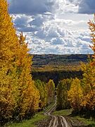
The beautiful Saddle Hills in autumn
-
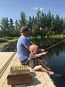
Moonshine Lake offers year-round fishing
-
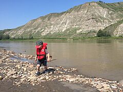
Canada's Mighty Peace River runs through Saddle Hills County
-
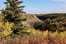
Autumn makes the hills and valley of Saddle Hills County stand out
-
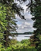
Moonshine Lake is one of the jewels of Saddle Hills County
-
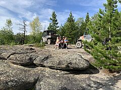
The Rim Rocks are a unique rock formation near Bay Tree in Saddle Hills County


