Brea Creek facts for kids
Quick facts for kids Brea Creek |
|
|---|---|
|
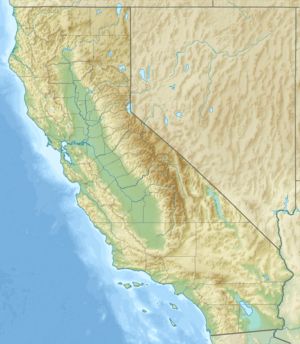
Location of the mouth of Brea Creek in California
|
|
| Country | United States |
| State | California |
| Counties | Orange County, San Bernardino, Los Angeles County |
| Cities | Brea, Fullerton, Whittier |
| Physical characteristics | |
| Main source | La Habra, Orange County, California 690 ft (210 m) 33°53′22″N 117°55′37″W / 33.88944°N 117.92694°W |
| River mouth | Coyote Creek Whittier, California 65 ft (20 m) 33°52′40″N 118°00′32″W / 33.87778°N 118.00889°W |
| Length | 11.7 mi (18.8 km) |
| Basin features | |
| Basin size | 23.6 sq mi (61 km2) |
Brea Creek is a stream in Southern California. It is one of the main streams that flows into Coyote Creek. Coyote Creek then joins the larger San Gabriel River. Brea Creek helps drain water from parts of Orange, Riverside, and San Bernardino counties.
The creek flows for about 11.7 miles (18.8 km). It starts near the cities of Brea and Anaheim. It ends in Whittier, where it meets Coyote Creek. The name Brea Creek likely comes from the city of Brea, or perhaps the city was named after the creek itself.
Contents
Brea Creek: A Look Back in Time
Ancient Times: The Tongva People
Long ago, Native American people called the Tongva lived in the La Habra valley for thousands of years. The Spanish later called them the Gabrieliño. These people likely used Brea Creek for their daily needs.
The Tongva had a village named Nacaunga. It was located right next to Brea Creek, at the entrance of Brea Canyon. This spot was important because it was close to water and offered a good place to live.
Colonial Times: Spanish Explorers Arrive
In 1769, a Spanish explorer named Don Gaspar de Portolá i Rovira traveled through California. On July 29, he and his group camped near Brea Creek. They were in a place the Spanish called ‘La Cañada de la Brea’, which means 'The Canyon of Tar'.
This journey was part of their famous march from San Diego to Monterrey. Many waterways in Orange County got their names from Spanish explorers during the 1700s.
Where Brea Creek Flows
Brea Creek starts in a mountain canyon called Brea Canyon. This is where Los Angeles County and San Bernardino County meet. The creek flows southwest, picking up water from more than ten smaller streams along the way.
It then crosses into Orange County. Here, another stream called Tonner Canyon joins it. The creek then turns northwest, then sharply southwest. It flows into the northern part of Brea Reservoir.
After leaving the Brea Reservoir dam, the creek flows west-northwest in a straight path. It is now a channel, meaning it has been shaped by people. It collects water from more small streams. Finally, it joins Coyote Creek, just before another major stream called Fullerton Creek.
How Much Water Flows in Brea Creek?
From 1932 to 1969, the USGS measured the water flow in Brea Creek. They had two measuring stations: one at the mouth of the creek and one at Brea Reservoir.
The highest water flow ever recorded was on March 14, 1941. At that time, 3,700 cubic feet per second (105 cubic meters per second) of water flowed through the creek. This shows that Brea Creek can have very strong flows, especially after heavy rains.
Changes to Brea Creek
People have made some changes to Brea Creek. There are four special structures called drop structures built along the lower part of the creek. These structures are made of strong concrete. They are part of what is known as the "Brea Canyon Channel." These structures help control the flow of water, especially during heavy rains.


