
Brea, California facts for kids
Quick facts for kids
Brea, California
|
|||||
|---|---|---|---|---|---|

Market City Cafe in Brea downtown
|
|||||
|
|||||

Location of Brea in Orange County, California.
|
|||||

Brea, California
Location in California

Brea, California
Location in the United States

Brea, California
Location in North America
|
|||||
| Country | United States | ||||
| State | California | ||||
| County | Orange | ||||
| Incorporated | February 23, 1917 | ||||
| Named for | Spanish for "natural asphalt" or "tar" | ||||
| Government | |||||
| • Type | Council-Manager | ||||
| Area | |||||
| • Total | 12.21 sq mi (31.61 km2) | ||||
| • Land | 12.17 sq mi (31.51 km2) | ||||
| • Water | 0.04 sq mi (0.10 km2) 0.26% | ||||
| Elevation | 361 ft (110 m) | ||||
| Population
(2020)
|
|||||
| • Total | 47,325 | ||||
| • Density | 3,889.30/sq mi (1,501.72/km2) | ||||
| Time zone | UTC−8 (PST) | ||||
| • Summer (DST) | UTC−7 (PDT) | ||||
| ZIP codes |
92821–92823
|
||||
| Area codes | 657/714, 562 | ||||
| FIPS code | 06-08100 | ||||
| GNIS feature IDs | 1660373, 2409897 | ||||


.jpg)
Brea (pronounced 'Bray-uh') is a city located in northern Orange County, California, in the United States. In 2020, about 47,325 people lived there. It's about 33 miles (53 km) southeast of Los Angeles and is part of the larger Los Angeles area.
Brea first became important for making oil. Later, it was known for growing citrus fruits like oranges and lemons. Today, it's a big shopping area, home to the Brea Mall and a lively downtown. The city also has a large public art program. This program started in 1975 and now features over 140 artworks placed all around the city.
Contents
History of Brea
Early Indigenous People
The land where Brea is now was once home to the Tongva people. They lived here for thousands of years before Europeans arrived. The Tongva tribe had many villages connected by trails. These trails were used for travel and trading with other Native American groups. The closest known village to modern Brea was called Hutuknga.
Spanish Exploration
On July 29, 1769, a Spanish group called the Portolá expedition explored the area. They were the first Europeans to see the inland parts of Alta California (which is now California). This group camped in Brea Canyon. They found a large native village and a small pool of clean water there. Today, a historical marker in Brea Canyon remembers their visit.

At the start of the 19th century, the village of Olinda was founded in Carbon Canyon. Many people came to the area looking for "black gold," which was another name for petroleum (oil).
Growth of Brea in America
In 1894, the landowner, Abel Stearns, sold 1,200 acres (4.9 km²) west of Olinda. He sold it to a new company called the Union Oil Company of California. By 1898, many hills nearby had wooden oil drilling towers. This was because the Brea-Olinda Oil Field had been discovered.
In 1908, a village named Randolph was started south of Brea Canyon. It was named after railway engineer Epes Randolph and was built for oil workers and their families. Famous baseball player Walter Johnson grew up in Olinda around this time. He worked in the oil fields when he was young.
_(cropped).jpg)
The villages of Olinda and Randolph grew and joined together as the oil business boomed. On January 19, 1911, the town's map was officially filed. It was given the new name Brea. This name comes from a Spanish word for natural asphalt, also called tar. With 752 people, Brea officially became a city on February 23, 1917. It was the eighth city to be formed in Orange County.
As oil production slowed down, people started growing more crops. Lemon and orange groves became very common. In the 1920s, the Brea Chamber of Commerce promoted the city with a slogan: "Oil, Oranges, and Opportunity."
By 1950, Brea had 3,208 people. The citrus groves slowly changed into areas for businesses and homes. In 1956, Carl N. Karcher opened the first two Carl's Jr. restaurants in Anaheim and Brea. The opening of the Orange Freeway (57) and the Brea Mall in the 1970s caused even more homes to be built. Large new neighborhoods were developed east of the 57 Freeway in the 1980s, 1990s, and 2000s.
In the late 1990s, a 50-acre (200,000 m²) part of downtown Brea was rebuilt. This area, known as Downtown Brea, became a popular spot for shopping and fun. It has movie theaters, outdoor cafes, a live comedy club, many shops and restaurants, and a weekly farmer's market. It officially opened in 2000.
In early 2006, Sunset magazine called Brea one of the five best suburbs to live in the Western United States.
Geography and Climate
Where is Brea Located?
The city of Brea covers an area of about 12.1 square miles (31.3 km²). Most of this area is land, with a small amount of water.
Brea is surrounded by other areas. To the north and east, it borders parts of Orange County and Los Angeles County that are not cities. To the west is La Habra, and to the southwest is Fullerton. Placentia is to the south, Chino Hills to the northwest, and Yorba Linda to the southeast.
Brea's Climate
Brea has a hot-summer Mediterranean climate. This means it has hot, dry summers and mild, wet winters.
| Climate data for Brea, California | |||||||||||||
|---|---|---|---|---|---|---|---|---|---|---|---|---|---|
| Month | Jan | Feb | Mar | Apr | May | Jun | Jul | Aug | Sep | Oct | Nov | Dec | Year |
| Mean daily maximum °C (°F) | 21 (69) |
21 (70) |
22 (72) |
23 (74) |
24 (76) |
27 (80) |
29 (85) |
30 (86) |
30 (86) |
27 (81) |
24 (75) |
21 (69) |
25 (77) |
| Mean daily minimum °C (°F) | 8 (47) |
9 (48) |
10 (50) |
11 (52) |
14 (57) |
16 (60) |
18 (64) |
18 (64) |
17 (62) |
14 (57) |
11 (51) |
8 (46) |
13 (55) |
| Average precipitation mm (inches) | 64 (2.5) |
79 (3.1) |
69 (2.7) |
28 (1.1) |
5.1 (0.2) |
0 (0) |
0 (0) |
10 (0.4) |
7.6 (0.3) |
7.6 (0.3) |
30 (1.2) |
61 (2.4) |
361.3 (14.2) |
Population and People
| Historical population | |||
|---|---|---|---|
| Census | Pop. | %± | |
| 1920 | 1,037 | — | |
| 1930 | 2,435 | 134.8% | |
| 1940 | 2,567 | 5.4% | |
| 1950 | 3,208 | 25.0% | |
| 1960 | 8,487 | 164.6% | |
| 1970 | 18,447 | 117.4% | |
| 1980 | 27,913 | 51.3% | |
| 1990 | 32,873 | 17.8% | |
| 2000 | 35,410 | 7.7% | |
| 2010 | 39,282 | 10.9% | |
| 2020 | 47,325 | 20.5% | |
| U.S. Decennial Census | |||
How Many People Live in Brea?
In 2010, Brea had a population of 39,282 people. The city was home to many different groups. About 67.1% of residents were White, 1.4% African American, 0.5% Native American, and 18.2% Asian. About 25.0% of the people were of Hispanic or Latino background.
Most people in Brea live in family homes. In 2010, there were 14,266 households. About 35.3% of these homes had children under 18 living there. The average household had about 2.75 people.
The population was spread out by age. About 23.1% of residents were under 18 years old. About 12.6% were 65 years or older. The average age in Brea was 38.7 years.
In 2010, the typical household income in Brea was $82,055 per year. This means that half of the households earned more than this amount, and half earned less.
Economy and Jobs
Top Employers in Brea
Brea has many businesses that provide jobs for its residents. Here are some of the biggest employers in the city, based on a 2023 report:
| # | Employer | # of employees |
|---|---|---|
| 1 | Albertsons | 1,206 |
| 2 | Beckman Coulter | 837 |
| 3 | Brea Olinda Unified School District | 621 |
| 4 | Nationwide | 460 |
| 5 | Service Champions Plumbing, HVAC | 406 |
| 6 | Bristol Industries | 405 |
| 7 | Nordstrom | 250 |
| 8 | 24 Hour Fitness | 201 |
| 9 | Acosta Sales & Marketing | 163 |
| 10 | The Olive Garden | 122 |
Education in Brea
Local Schools and Districts
Most students in Brea attend schools in the Brea Olinda Unified School District. This district has six elementary schools, one junior high school (Brea Junior High School), one high school (Brea Olinda High School), and one continuation high school (Brea Canyon High School).
A small part of Brea is also served by the Fullerton Joint Union High School District. Students in this area might go to Sonora High School in La Habra. They might also be part of the La Habra City School District. Students can also try to get into Troy High School in Fullerton by taking a special test.
Private Schools and Colleges
Brea also has several private schools. These include Brea Head Start (Pre-school), Brea Olinda Friends School (Pre-K to 6th grade), and St. Angela Merici Parish School (TK-8th grade).
For older students, Brea is home to the Southern California College of Business and Law. It also has a branch of the Golden Gate Baptist Theological Seminary.
Awards for Brea Schools
Many schools in Brea have won special awards for their achievements. Both Brea Olinda High School and Olinda Elementary School have been named Blue Ribbon Schools. This is a very high honor for schools in the United States.
Several other schools have been named California Distinguished Schools. These include Arovista Elementary, Country Hills Elementary, Fanning Elementary, Mariposa Elementary, Olinda Elementary, Brea Junior High, and Brea Olinda High schools. Laurel Elementary received a Title I Academic Achievement Award. Brea Junior High School and Brea Olinda High School have also been named California Gold Ribbon Schools.
Notable People from Brea
Many talented people have lived in Brea, including:
- Cody Fajardo – A quarterback for the Montreal Alouettes football team.
- Stephanie J. Block – A Broadway actress and singer.
- James Cameron – A famous film director, producer, and screenwriter.
- JoAnn Dean Killingsworth – An actress and dancer, known as the first person to play Snow White at Disneyland.
- Walter Johnson – A legendary Major League Baseball pitcher for the Washington Senators.
- Joe Maddon – A Major League Baseball manager, known for leading the Chicago Cubs.
- Mark Rober – A popular YouTuber and former engineer for NASA and Apple.
Sister Cities
Brea has special partnerships with cities in other countries. These are called "sister cities":
 Anseong, South Korea (since 2011)
 Hannō, Japan (since 1980)
 Lagos de Moreno, Mexico (since 1969)
Images for kids
-
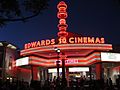
Edwards Cinemas movie theater in downtown Brea

See also
 In Spanish: Brea (California) para niños
