Breakneck Ridge facts for kids
Quick facts for kids Breakneck Ridge |
|
|---|---|

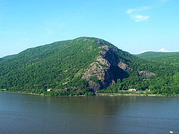
Breakneck Ridge from across the Hudson River
|
|
| Highest point | |
| Elevation | 1,260 ft (380 m) |
| Prominence | 527 ft (161 m) |
| Geography | |
| Location | Philipstown / Fishkill, New York, U.S. |
| Parent range | Hudson Highlands |
| Topo map | USGS West Point |
| Climbing | |
| Easiest route | Trail |
Breakneck Ridge is a cool mountain located along the Hudson River in New York State. It sits between the towns of Beacon and Cold Spring. This mountain is special because its rocky cliffs are easy to spot from far away, especially if you're coming from the south.
Together with Storm King Mountain on the other side of the river, Breakneck Ridge forms a beautiful spot called Wey-Gat, or "Wind Gate." This "gate" is like the northern entrance to the amazing Hudson Highlands area.
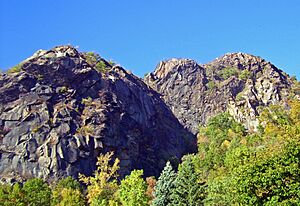
The highest point of Breakneck Ridge is about 1,260 feet (384 meters) above sea level. The southern side of the mountain has striking cliffs. These cliffs were formed because of quarrying, which is when people dig out rocks from the ground.
Breakneck Ridge is part of Hudson Highlands State Park. It offers incredible views of the Hudson River and the surrounding area. It's super popular with hikers! In fact, so many people visit that there's even a special train stop just for hikers on the Metro-North train line, right at the base of the mountain.
In the past, until the early 1900s, Breakneck Ridge was also known by other names like St. Anthony's Face or Turk's Face. This was because of a rock formation on the cliffs that looked like a face. Sadly, this formation was destroyed by quarry workers in 1846.
Hiking Breakneck Ridge
Breakneck Ridge is famous for its challenging but rewarding hiking trails. Many people come here to experience the steep climbs and amazing views.
Popular Trails and Views
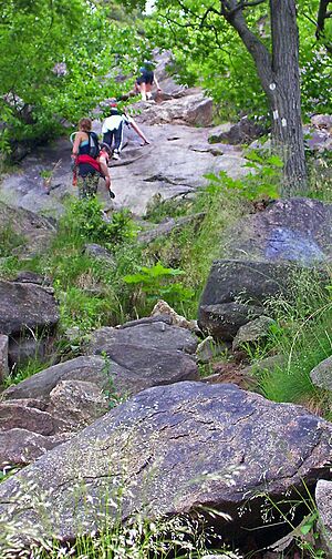
While there are a few ways to hike Breakneck Ridge, most hikers start with the white-blazed trail. This trail begins on the southbound side of Route 9D, near a tunnel.
The trail quickly becomes a steep and rocky climb. You'll work your way up to the first big bump on the mountain, which is about 720 feet (219 meters) above the river. From this spot, you get incredible, wide-open views of the Hudson River and the Highlands. It's a perfect place for photos!
The white trail continues over several other bumps and summits. As you go higher, you'll find even more fantastic viewpoints. There are also other trails, marked with blue, red, or green blazes, that branch off from the main white trail. These can be used as shortcuts to get back down to the base of the mountain.
Images for kids
 | Jessica Watkins |
 | Robert Henry Lawrence Jr. |
 | Mae Jemison |
 | Sian Proctor |
 | Guion Bluford |


